
Saturday 29 June 2013
Watershed Walk: Halfway
G
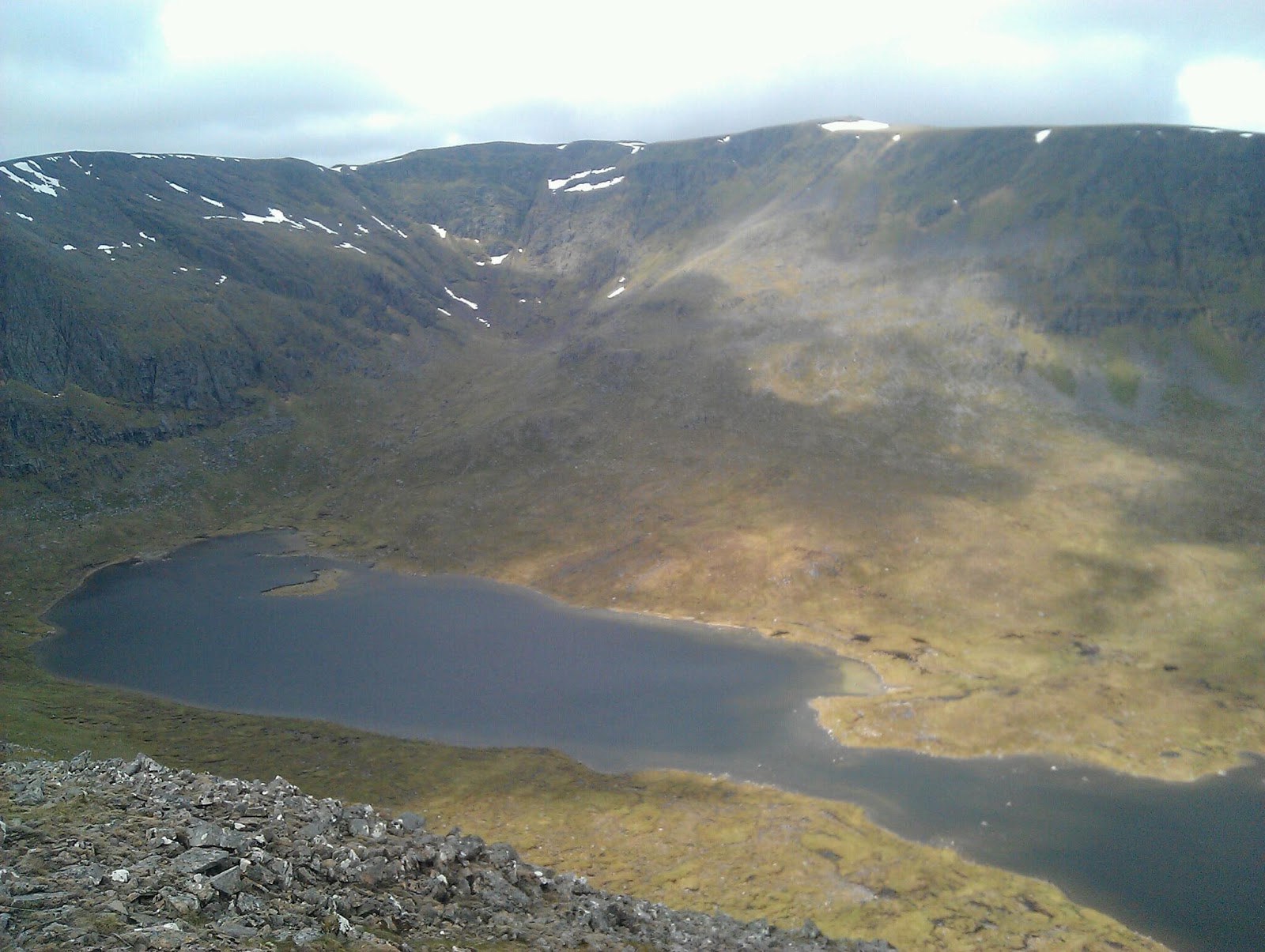
 Somewhere in the mist on Cairn Liath, east of Creag Meagaidh, I reached halfway on the Scottish Watershed. Since Ben Lui the weather has been mostly wet and windy with low cloud on the tops. Only occasionally has the sky cleared, as on Beinn Bheoil, from where I took the photo of Ben Alder above. The wind has been northerly and cold too. In the mist my compass has seen much use. A bonus though has been a lack of midges. I expect this will change! I'm now in the Great Glen preparing to head west into Knoydart. The next four days are forecast to be stormy after which calmer, very warm conditions are meant to prevail.
Sunday 23 June 2013
And The Storm Came: Scottish Watershed
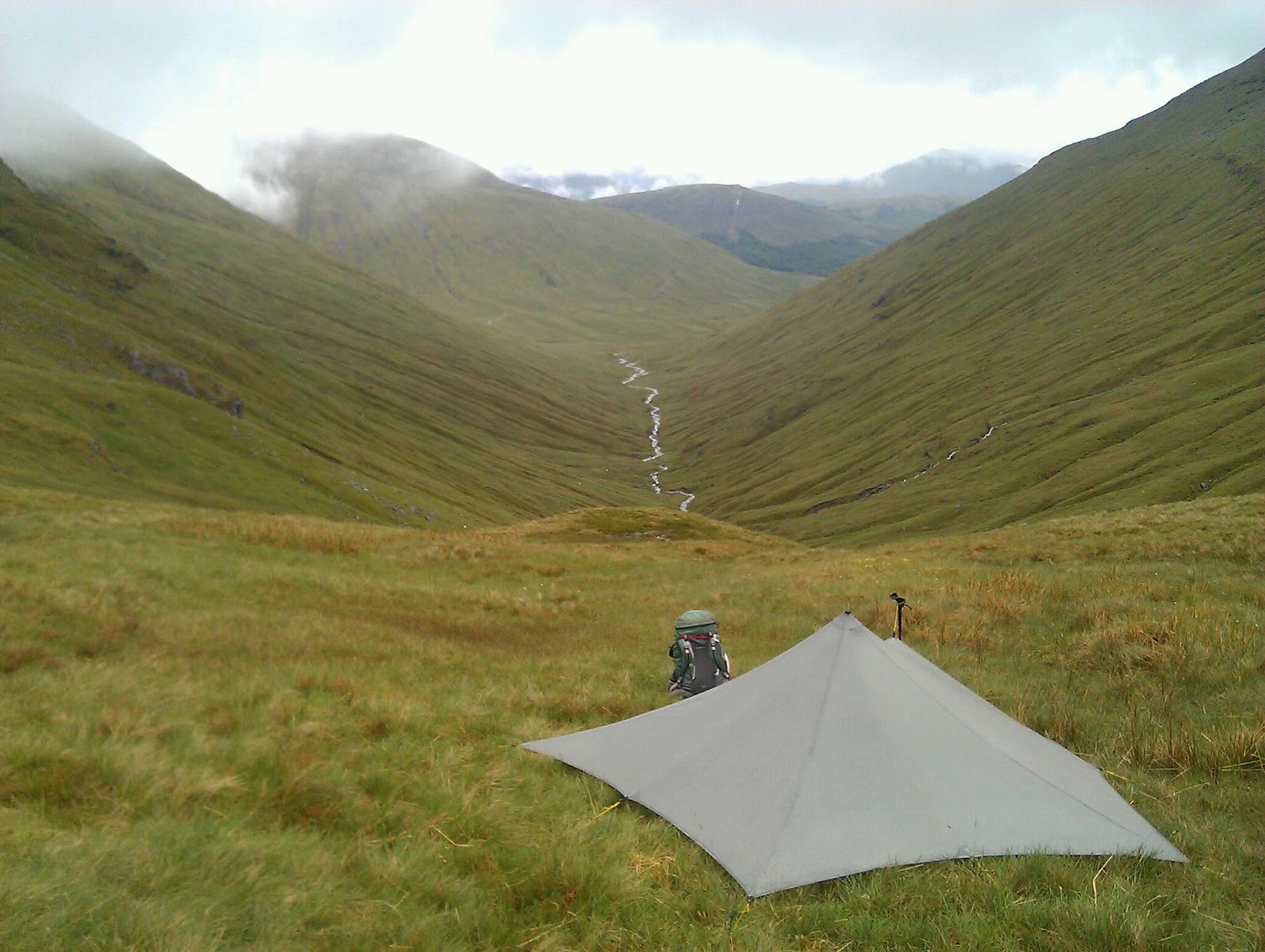
The pitch looked good, just below the lip of the col, sheltered, I thought, from the wind. Dinner over I settled down to sleep listening to the light patter of drizzle on the nylon just above my head. Then the wind started, roaring down on me, shaking my shelter. The rain was now hard and loud, bouncing off the fabric. As the wind grew I realized I wouldn't sleep so midnight saw me out in the storm moving camp. Just 50 metres further downhill and I was out of the worst of it. A bumpier site but at least I could sleep. I woke to thick mist and continuing rain. A slog up a greasy path and I was on Ben Lui, shared with four others who loomed up out of the cloud, the only other walkers I saw in three days. The Watershed ran down the north side of the mountain. Steep and craggy, this is not a good way to descend in mist and rain. Picking a safe route down ledges, shelves and gullies wasn't easy but it was an intense experience, requiring concentration. Easier, grassier hills followed and then another wet and windy camp. The winds are supposed to ease tomorrow.
The picture shows my first camp on the col below Ben Lui.
Thursday 20 June 2013
Into the Highlands: Scottish Watershed
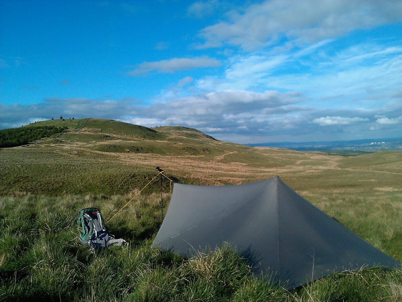
The rise from the Lowlands to the Highlands is very noticeable, especially on foot. Suddenly the hills are bigger, steeper, rougher and feel like real mountains. At the same time, oddly, the walking is actually easier. That's because up high, above around 600 metres, the ground is drier and firmer and the vegetation much shorter. Gone is most of the bog hopping. Tussocks are now rare. And on the highest hills, the Munros, there are even paths, something so far rare on the Watershed. There is more water too and more choice of dry, flat camp sites. Then of course there is the land itself, far grander, wilder and impressive than anything to the south. From the summit of Ben Lomond I has a glorious vista of the mountains and lochs of the Loch Lomond and the Trossachs National Park. Two more camps saw me over a fine Corbett, Beinn a'Choin, and another four Munros before a long descent to Crianlarich. I am now in the heart of the hills.
The picture shows An Caisteal, one of the Munros above Crianlarich.


Saturday 15 June 2013
Across the Central Lowlands
Following the Watershed across Central Scotland has proved to be more hilly, wild and remote than I expected. Of course there have been roads, railways, farms,industry, and even one town but overall developments are usually some distance away. Wild camping wasn't a problem and I was always hidden from roads and houses. The Watershed twists and turns, touching the south-east corner of the Pentland Hills and doubling back on itself twice in the Campsie Fells. Only around Cumbernauld, the only town on the Watershed, did it feel like I was really in the Lowlands. My main memories though are of the wildlife and the flowers and trees - a roe deer grazing in a forest glade, a badger foraging in an overgrown field, a wonderful dawn chorus, the wild whistle of curlews over rough pastures, fields of yellow buttercups, hills white with cotton grass, lanes lined with hawthorn blossom, the young trees of the new Central Scotland Forest. Nature is thriving in the Central Lowlands. But now it's into the Highlands with Ben Lomond the first Munro on the walk.
Friday 7 June 2013
Across the Southern Uplands: Scottish Watershed

Monday 3 June 2013
Scottish Watershed Walk: The Beginning.
After five days I feel this walk has really begun. Already I've had dense mist, heavy rain, knock-you-over winds, hot sunshine, incredibly arduous walking in boggy forest rides, splendid walking on rolling grassy hills, camps in the mist, sunshine, rain and thick forest. Ahead lies the Moffatdale Horseshoe, which should be a fine walk.
The picture of Pikehaw Fell was taken on day three, not long before plunging back into the forest.
Subscribe to:
Posts (Atom)