Saturday 30 April 2022

An Unusual Press Trip: Taking A Stretcher Up Stac Pollaidh


On the way up Stac Pollaidh, Suilven in the background

Outdoor company press trips can vary from exciting to mundane, depending on how much time is spent in the hills and how much on indoor product promotions and factory visits. Recently I went on one for Helly Hansen that definitely fell into the exciting category. It was also interesting and informative, not to say unusual, as it wasn’t just about gear or, indeed, even mainly about gear. Instead “the aim was to raise awareness of the incredible work the Mountain Rescue Teams do across the UK to keep everyone else safe in the mountains and enjoying the outdoors.” To that end myself and other outdoor writers were invited to spend a day on Stac Pollaidh in the NW Highlands with members of Assynt Mountain Rescue, one of five mountain rescue teams sponsored by Helly Hansen, and learn a bit about their work.

Stac Pollaidh

After a night at the excellent Summer Isles Hotel we met the mountain rescuers at the foot of Stac Pollaidh, which is only a little hill (it’s just 612 metres high) but one that bristles with dramatic rock pinnacles and crags along its long narrow ridge. Here we discovered we were to carry a stretcher up the mountain and we soon learnt just how tiring this is as we all – writers, mountain rescuers, members of Helly Hansen’s PR team – took turns. 

Getting steeper

The weather was just about perfect, with high clouds, bursts of sunshine, and an occasional cool breeze. The latter meant the Helly Hansen jackets provided were needed at times. It wasn’t tee-shirt weather. The air was clear and the views spectacular with Suilven, Cul Mor, and Cul Beag standing out above the lochan-spattered lower ground. This landscape never fails to impress.

Cul Beag

Once on the ridge the mountain rescuers decided we should practise taking the stretcher up steep rocky terrain with someone in it. Firstly, a volunteer was strapped in and the casualty bag inflated around them so they were really secure then we learnt how to move the stretcher up a rocky gully hand over hand, a slow but efficient method that meant you were only holding the stretcher when your feet were secure and stationary. Each time the stretcher had moved up along the four pairs of us holding it the rear pair would move to the front and the exercise was repeated. Once we reached the top of the gully we then reversed the process and took the stretcher back down. It was hard work. There was a top rope so the stretcher couldn’t go anywhere if we proved incompetent. 

Ed Smith at work, Cul Mor in the background

As I was moving the stretcher I have no photos of taking the stretcher up and down the gully. However, there will be some as we had a professional photographer along with us, Ed Smith, whose website is well worth a look. I’m looking forward to seeing his pictures of this episode. 

Steeper still

Leaving the stretcher behind we then clambered along the narrower, rockier ridge towards the summit. I opted out of the more difficult scrambling to the actual summit as my hands were aching after the stretcher carrying and the easier scrambling as they haven’t fully recovered from the operations of last year. And I hadn’t done so much with them since before those operations. Once I’d grasped a few holds and my hand had instinctively recoiled due to soreness I lost any confidence I had and preferred to sit and watch the hills and the view. It was a great day for just sitting and contemplating.

The drone inspecting gullies

Once the others returned from the top and we were back at the stretcher the mountain rescuers deployed their drone and showed us how it could be used. Tim Hamlet, the team leader and a mountain guide (Hamlet Mountaineering) , disappeared round a corner to hide in a gully. The drone was then used to scan the hillside in infra-red mode and quickly picked up the heat from Tim’s body. Using the drone rescuers could scan a hillside riven with gullies quickly and without risk to themselves. Without the drone they would have to rope down each gully, which would take time and involve risk. There was also a Virtual Reality headset, which gave a much bigger and clearer image of the view the drone had than the small screen on the control panel. It was also somewhat unnerving to use! When the drone raced away from the ridge so the people on it shrank into the distance I really felt as though I was being projected out into the air beyond the mountain. 

Drone control

The drone exercise over there was just carrying the stretcher back down the mountain and the day was over. For me anyway. The others were going on a paddle in canoes on a nearby loch. I don’t do water stuff!

View from Stac Pollaidh    


This was a very enjoyable day, and my knowledge of mountain rescue increased greatly. This is how to organise a press trip! The weather helped too. The Helly Hansen clothing didn’t get much of a test but I will be trying items for review for The Great Outdoors in the weeks to come. I’m particularly interested in finding out how the good-looking Odin 1 World Infinity waterproof jacket performs.

Helly Hansen is also working with mountain rescue teams to “build a connection between the end-user and Helly Hansen’s professionals” by way of a website called Trail Finder which will have recommended trails from Mountain Rescuers both in the UK and around the world.

In Conversation With Tony Hobbs - Sunday 8pm Live


Tony Hobbs on the TGO Challenge

 Tomorrow, May 1, I'm having a livestream conversation with Tony Hobbs at 8pm. Here's the link

 We'll be discussing a variety of outdoor topics. I don't know what they'll be!

Pacific Crest Trail Podcast on Just Up The Trail


A few weeks ago I recorded a podcast about the Pacific Crest Trail with Rob Jones of Just Up The Trail. This is his first podcast and it'll be launched this Sunday, May 1.

And on the PCT itself on this day in 1982 I reached the little town of Acton. Ahead lay the Mohave Desert and then the High Sierra. I spent May 1 visiting four outdoor stores in Los Angeles, courtesy of a lift from someone in Acton, where I purchased snowshoes, crampons, gaiters, and insulated bootees in preparation for the snowbound High Sierra, all of which I would haul across the desert for the next week.

Joshua Tree shade. Mohave Desert

Friday 22 April 2022

Woods, Winds, & Water: A First Spring Overnight Trip That Didn't Go Quite According To Plan

Shelter at last

Sometimes trips don’t go quite according to plan, and sometimes trips give rewards that weren’t expected. My first spring trip of the year was both those. With warm weather forecast and most of the snow below 1000 metres gone a trip with a lighter pack without the ice axe, crampons, snowshoes, and winter camping gear I’d been carrying since November appealed. I wanted the freedom of not feeling burdened down.

View across Rothiemurchus Forest to the Lairig Ghru

Not wanting to drive far for an overnight trip I decided on the northerly extension of Braeriach, a big wedge of ground between Gleann Einich and the Lairig Ghru in the Cairngorms that’s mostly between 600 and 700 metres high. This is little-frequented pathless country so once away from the main track in Gleann Einich I didn’t expect to see anyone else. 

In Gleann Einich

The air was warm, the sky bright, and the mountains shining as I set off. There was a strong breeze though, even down here in the forest. The woods were still peaceful and the walk to Gleann Einich relaxing. I appreciated the lighter load too.

Once I left the last trees the wind was fierce, roaring straight down the glen into my face. Dark ragged clouds ripped across the mountains. Two mountain bikers with skis on their packs passed me cycling out. They’d gone to ski a line called The Escalator on Braeriach but had only skied part of it as the wind was just too strong high up. I was glad I wasn’t going that high.

Once I turned off the track the going became tough, the terrain all tussocks and bogs. Having been here before I knew it was like this and didn’t expect to make fast progress. The wind hindered me too, strong enough to knock me sideways occasionally. I’d planned on camping near a lochan on this open moorland and then going up the tops not far away, perhaps watching the sunset from one of them. The wind ended that idea. I could find nowhere sheltered and didn’t fancy a night in a shaking noisy shelter. The wind was coming from the south. On the far side of the hills just above the lochan was a shallow glen running north-east. Maybe there would be more shelter in it. 

Old tree, young trees

There wasn’t. The wind was funnelling straight down the glen. I went right up to its head. Here I found the remains of a long-abandoned shieling. No-one came here often now but once they did. I guessed there was a path long ago. Turning away I followed the burn gently downwards. There were stumps of long-dead trees in the peat, A lonely pine appeared, a surviving remnant of the forest that was once here. No, not lonely. As I neared I could see a scattering of little pines, no more than a metre or so high, around the old tree. As always, seeing the forest returning was uplifting.

The glen steepens

Still battered by the wind I continued past the pines and into the narrower lower glen. The terrain became stony, scoured by floods and snowmelt. The banks either side grew steeper. I decided I should climb up to the moorland above while I could before I reached a drop I couldn’t descend and had to retreat. The scramble up steep slopes of heather and rock was hard work. Knees and elbows came into play at times, and I was glad of the strength of some of the heather.

Once up and on flatter ground I realised to camp anywhere sheltered I would have to go down again, down to the Allt Druidh, which drains the north side of the Lairig Ghru. The descent was down even rougher slopes than those I’d just climbed with big boulders hidden in the heather, some covered with slippery moss. 

Creag an Leth-choin at dusk

Once down the terrain was no easier. The river was a raging torrent. The Lairig Ghru path lay not far up the other side but there was no way I could ford safely. I went downstream into the first trees, searching for a camp site. After climbing another steep rough bank and descending again to avoid a crag I found a lovely spot beside some old birches. With relief I made camp. I’d now been searching for a camp site for several hours and was far from where I’d planned to be. There’d be no hills this evening. Sunset came with a touch of colour amongst the racing clouds.

A peaceful camp

The night was warm, especially after the wind died down. I could hear the river roaring but even so this was a peaceful place. I lingered in the morning, admiring the old trees. And because I knew there was hard work to come. To cross the river I needed to go back upstream, beyond some feeder streams to where the Lairig Ghru path crossed it on steeping stones. To get there meant climbing back up the steep banks above camp and then crossing rough undulating moorland. Then I’d be on the path that lay just a few hundred metres away across the river from camp.

Allt Druidh

The ascent required more use of knees and elbows and more pulling on heather stems. Once out of the trees the wind was blasting against me again. I was now heading into it, across heather and boggy moorland that seemed even rougher than the day before. There were many little young pines to keep my spirits up. I weaved in and out of little stream gullies, trying to contour and not lose or gain much height. The river became a shallower stream and much less powerful as it flowed over flatter ground. I forded it before I reached the path at a wide pebbly stretch. The water was ankle deep and cold. My boots were sodden from all the bogs anyway.

Clouds over the Lairig Ghru

Once across I soon reached the path and could stride out, for the first time since I’d left Gleann Einich. Back in the trees I paused and gazed across the white thrashing river far below. There on the far side was the campsite I’d left three hours earlier. Now the hard work was over there was just the pleasant walk back through the forest to my car. 

Looking back across the river to my campsite

 
No summits were reached, and only short distances walked yet this was an arduous trip due to the wind and the terrain. The joy was in the regenerating forest and in the lovely camp site. A good start to spring.


Tuesday 19 April 2022

A Look At The May Issue Of The Great Outdoors


The May issue of The Great Outdoors is out now. In it I have a piece I loved writing about some of my most memorable camps on long walks over the decades. I also review nine solo tents, a Finisterre insulated smock, EDZ waterproof socks, and a big pack from Osprey.

Other big features in this issue see Ursula Martin undertake a 3700 mile walk in Wales, Stacey McGowan Holloway on a music-inspired backpack of the Hebridean Way, and Rudolf Abraham hiking the Alpe Adria Trail from the Alps to the Adriatic.

Shorter pieces cover Robin Wallace's excellent Walk With Wallace YouTube channel, Vivienne Crow touring Skiddaw, Russ Moorhouse camping on every Wainwright, Fiona Russell on her first solo wild camp, how the outdoor community is supporting Ukraine, and Jim Perrin on Slieve Donard in the Mountains of Mourne.

Alex Roddie gives tips on how and where to pitch a tent in the Skills section while in the Gear pages David Lintern looks at kid's waterproofs. In Books Alan Rowan reviews The Peatlands of Britain and Ireland: A Traveller's Guide by Clifton Bain, and Alex Roddie reviews Tales from the Big Trails by Martyn Howe.

In Wild Walks Alan Rowan climbs Ben Stack in the Northern Highlands, Stefan Durkacz finds solitude in the Pentland Hills, Vivienne Crow visits Pike O'Blisco and Wet Side Edge in the Lake District, Roger Butler is high above the River Wye on Drum Ddu and Y Gamriw in the Cambrian Mountains, and Fiona Barltrop has a springtime walk on the South Downs.


Monday 11 April 2022

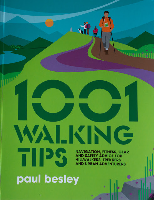
Book Review: 1001 Walking Tips by Paul Besley


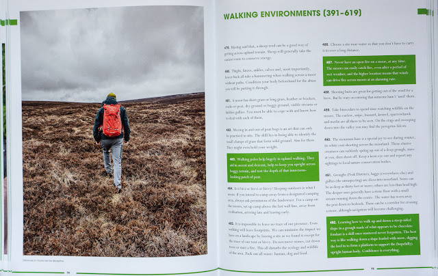
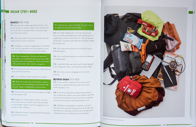
1001 Tips is a guide to walking with a difference. Rather than a conventional manual format it consists of succinct tips grouped under various subjects. The tips are very short, few running longer than three or four lines. Every type of walking is covered – urban walking, hillwalking, long-distance walking, winter walking and more. Every walking related topic is here too, everything from fitness and training to winter safety.

Some tips are practical dos and don’ts, some instructional, some informative, some light-hearted (such as have a snowball fight or build a snowman during a winter walk). There’s a huge mix here. Novices can learn much, those with more experience will learn something too – and probably disagree with some of the advice! It’s a good book for arguing over. I’m pleased too to see that there are tips on conservation and taking care of the countryside. This isn’t just a how-to book. 

 
You could read this book straight through, cover to cover, but it’s not really designed for that. I think it’s a book to dip into, to browse, to use for reference, to refresh your knowledge. Going winter walking for the first time (or the first time in a while)? Read the 80 tips in that section. Thinking of long-distance walking. There are 113 tips for that.

The author is well qualified to write the book. He’s a writer on landscape and walking and a walking guide with a particular interest in the Peak District and South Pennines. He’s written four walks guides to the area and is a volunteer ranger for the Peak District National Park and a member of Woodhead Mountain Rescue.  He’s also a good photographer and the book is illustrated with his photographs.

Entertaining, informative, and well-presented this is a book that deserves a place on every walker’s bookshelf. It's published by Vertebrate and costs £25.