
 |
| Carn a' Ghille Chearr |
Carn Bad na Caorach. Carn a’ Ghille Chearr. Not names familiar to most hillwalkers. They are walking distance from my home though and so receive the occasional visit. The boundary of the Cairngorms National Park separates the two hills though this area is the southern edge of the Dava Moor rather than actually in the Cairngorms.
Carn a’ Ghille Chearr shares its name with one of the summits in the Cromdale Hills just across Strathspey. It means Hill of the Unlucky Boy. Maybe the same boy? The Cromdale one is 710 metres high, my local one just 420 metres. As far as I know it doesn’t appear in any hill lists. Carn Bad na Caorach does though.
 |
| Carn Bad na Caorach |
According to The Mountain Guide in the somewhat arcane world of minor hill lists 477 metre Carn Bad na Caorach is both a Tump and subHump. Further research with the Relative Hills Society reveals that a Tump is a British hill with more than 30 metres of prominence while Hill Bagging tells me that a subHump is a hill that fails by ten metres or less to meet the definition of a Hump, a hill with 100 metres prominence. I never knew this lowly gentle moorland hill appeared in any lists at all. I also learnt, from The Mountain Guide again, that Carn Bad na Caorach is the 6649th highest peak in the British Isles and the 4618th tallest in Scotland.
 |
| Gorse & rowan |
I set off to climb these two little hills through a mix of ageing plantations slowly reverting to more natural forest and boggy moorland dotted with sheep and grouse butts. There was a cool breeze and shifting clouds. Occasionally the sun shone. At times spots of rain fell. In early May spring is just beginning here. The gorse was coming into bloom, birch and rowan leaves were just beginning to unfurl. The first wheatears, back from Africa, darted amongst the heather. A cuckoo called from the woods. Overhead a buzzard was harried by a much smaller bird, maybe a crow, too far away to be sure.
 |
| The slopes of Carn a' Ghille Chear |
A scattering of pine and larch that had managed to escape browsing dotted the rough, rocky slopes of Carn a’ Ghille Chearr. The slopes aren’t steep but the walking is rough, the only paths being the occasional sheep track. The summit is a curve of rock protruding from the moorland, just about enough for the ‘carn’ in the name – it means pile of stones or stony hill.
Carn Bad na Caorach has no such justification. There are few rocks here, just a gentle moorland swelling. No trees either, though the name means hill of the thicket of rowan berries. Just rough boggy tussocks that make for tough walking. Far to the south the high Cairngorms rose.
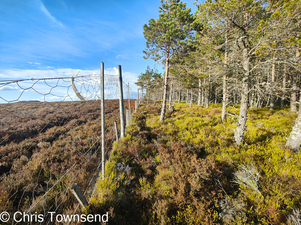 |
| Forest fence |
Bits of old tracks in the bogs led me to the top of Tombain Plantation, which again is reverting to more natural woodland. A high fence ran along the top edge of the forest. Inside the first bright green of bilberry leaves glowed amongst the pines. Outside was dark heather. No trees here. The sheep and muirburn see to that.
 |
| In the woods |
Inside the forest, accessed through a partly collapsed section of the old fence, the world changed. I could hear bird song. Pines, birch and rowan grew all around. A pool shone like a jewel. The stark monotony of the moors was gone and so was the sense of vast space. I’d been able to see the Moray Firth and the Cairngorms. Now the world felt intimate, closed-in.
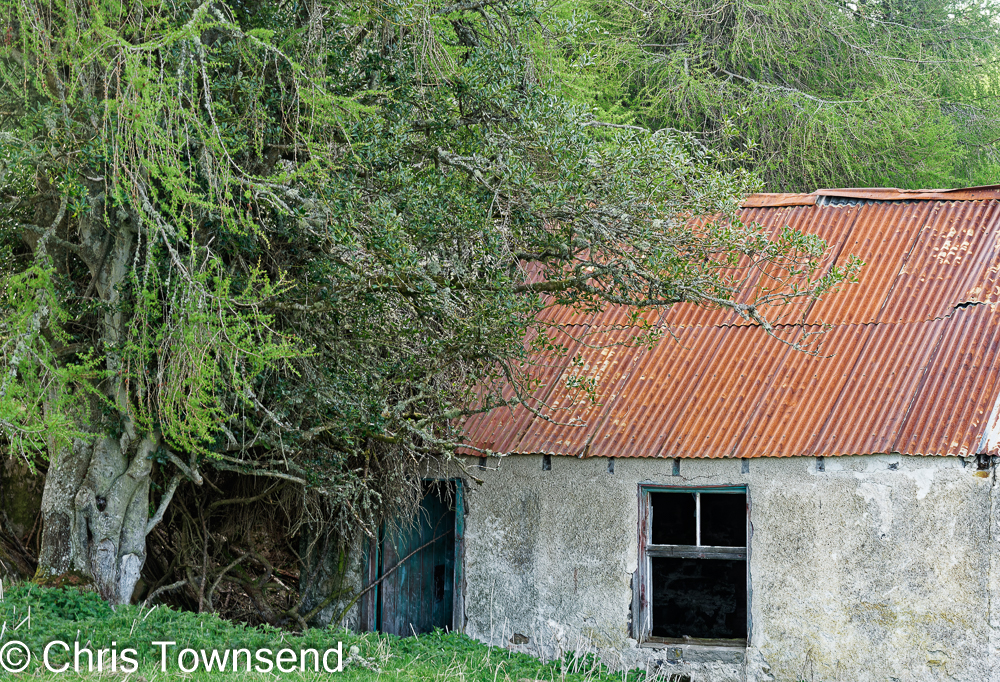 |
| Wester Kichanroy |
A few more fences crossed and I left the trees at the ruined house of Wester Kichanroy, one end over shadowed by huge larch and holly trees. Not far to home now.
No comments:
Post a Comment