
Showing posts with label conservation. Show all posts
Showing posts with label conservation. Show all posts
Friday, 25 July 2025

Tuesday, 15 July 2025
A Heatwave Walk In A Doomed Landscape
 |
| Lochan na h-Earba |
Hillwalking in a heatwave is hard work, especially carrying camping gear. The forecast was for a few days of clear skies and light winds when I planned the trip. After became a forecast for a heatwave I decided to go anyway and modify my plans if necessary.
I’d been planning to visit the Ardverikie area south of Loch
Laggan since March when the Scottish Government granted permission (see here)
for a huge pumped storage scheme that will drastically change this wild area. I
wanted to see it again before it became a different and diminished place.
 |
| Foxgloves & the Abhainn Ghuibinn |
I set off late, hoping to avoid the hottest part of the day. I don’t know if I did but it was certainly very hot, the air still and heavy. The land looked lush and green. Lines of red and white foxgloves edged the track. As long as I kept my place slow it was lovely walking.
Soon I reached Lochan na h-Earba under the walls of craggy
Binnein Shuas, only 747 metres high but a rugged hill with a classic rock climb,
Ardverikie Wall, on its cliffs. At the southern end of the lochan is a golden
sandy beach, a lovely spot. A few tents dotted the grass at the sand’s edge. It
is a grand place for wild camping.
 |
| Lochan na h-Earba |
Lochan na h-Earba is a double lochan as the same name applies to the next lochan in this narrow glen between steep hills with just a half kilometre of flat land, Am Magh, between them. When the hydro comes this will disappear under the waters of a reservoir as the twin lochans become one with dams at both ends. That will be a sad day.
I considered joining the campers by the beach but there were
still several hours of daylight left so I pushed on up a steepening stony path into
Coire Pitridh and then to the Bealach Leamhain at almost 750 metres. Here I
pitched my tent on rough ground that was probably boggy in wet weather. This
night it was dry enough.
 |
| Loch a' Bhealaich Leamhain evening |
Just beyond my camp I could look down on Loch a’ Bhealaich Leamhain, a jewel set between the steep rugged walls of two Munros, Beinn a’ Clachair and Geal Charn. This will be the upper loch of the hydro scheme, with a large dam at one end. Low sunlight lit the grasses on the bealach. The waters of the loch shimmered in the breeze. The sky and the hillsides glowed. A wild peaceful place. For now.
 |
| Bealach camp |
I settled into my tent. The light wind kept off the midges for a while but died away as it grew dark. A few bites and I had the doors zipped shut, even though it was quite stuffy inside. The air did cool in the darkness though, dropping to 12°C, and I was able to sleep for several hours, until the rising sun woke me with brightness and a rapidly rising temperature.
 |
| Loch a; Bhealaich Leamhain morning |
I wandered over to look at the loch again. The water was a deeper blue, undisturbed except for one little whisper of wind. The grasses glowing in the sunshine again but the slopes either side were shadowed. It felt an enchanted place.
By the time I set off the heat was building rapidly. A rough
path took me up to the col between Creag Pitridh and Geal Charn. I had intended
on climbing the former, another Munro, as it’s less than 100 metres above the
col and just half a kilometre away before heading up Geal Charn but I was
already feeling the effects of the heat and not quite enough sleep. A rest
seemed much more attractive, especially as I found a shaded spot behind a boulder.
It’s not often conditions are right for a nap outside during a summer’s day
high in the Scottish hills, midges or the weather usually moving me on quickly.
I was glad to take advantage of the opportunity.
 |
| Creag Pitridh |
The rest lasted two hours, at least half of which I spent asleep. I felt rested and relaxed. So relaxed I could have stayed there all day. I wanted to climb Geal Charn though, or rather I wanted to descend Geal Charn. On the map I’d noticed a path marked on the north side of the hill that eventually curved down to Am Magh. I’d found no mention of it in any guidebook. Did it still exist? I wanted to find out. The situation looked excellent as it traversed across steep slopes high on side of remote Coire an Iubhair Mor.
 |
| Geal Charn |
A steep stony path led up to the extensive plateau-like Geal Charn, a path not marked on the map, though it is well-used and described in every guidebook. As the path levels out the distinctive summit cone appears, its sides strewn with the pale stones that give the hill its name – Geal Charn meaning white hill. On some maps it also has the alternative name Mullach Coire an Iubhair, the top of the corrie of the yew tree. I could see no trees in the corrie below nor did it seem likely that yew trees ever grew this high. There’s a big well-built cairn and a circular trig point on the top. I rested here a while, enjoying the extensive view. In the sun my thermometer read 42°C. There was a breeze though, which took the edge off the heat.
 |
| Summit cairn and trig point |
A short descent led to the steep edge of Coire an Iubhair Mor. I could see the path not far below and follow its snaking line across the corrie wall. It looked even better than on the map, and better still when walked. It’s well-constructed and wider than a walker’s path, made, I think, for ponies. In places it’s fading away, in other crumbling and narrow, but still easy to follow. The only tracks I saw were those of deer. Not far below a little lochan lay in the heart of the corrie.
 |
| Marvellous & neglected |
I thought this path lovely and easily the best way up Geal Charn, which is an underrated hill. But I could see why the path was neglected. It’s on the wrong side of the hill for combining Geal Charn with Creag Pitridh and Beinn a ‘Clachair, the round of these three Munros being a standard route and recommended in every guidebook.
 |
| Looking back up the path to the rim of Coire an Iubhair Mor |
Leaving the corrie rim the path ran down to the Allt a’ Mhaigh (Moy Burn). As I descended the breeze dropped away and the air became stifling. The clegs (horseflies) came out and I wasted precious energy slapping them away. Despite this and adding insect repellent to the sunscreen and sweat I was still bitten painfully a few times, smears of blood decorating my arms and legs.
 |
| Loch na h-Earba & Binnein Shios |
Lower down the path faded away into boggy ground. I could see the north-easterly Lochan na h-Earba and craggy Binnein Shios, a companion to Binnein Shuas. Soon I was down on Am Magh and the estate track that runs along this long glen.
 |
| Am Magh & Lochan na h-Earba |
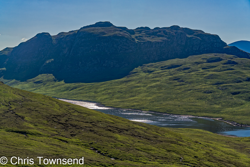
Am Magh is another lovely peaceful place. There are a few trees here and many more on the flanks of the hills either side of the north-easterly lochan. If I’d been out for a second night I’d have camped here. As it was I tramped the track alongside the other lochan back to the golden beach and on to my car and the main road. The heat didn’t relent and I stopped regularly for water and a rest. I probably drank five times as much as usual on a day out. On the way home I heard that the temperature reached a record 32.2°C in Aviemore, which wasn’t far away.
 |
| Binnein Shuas & Loch na h-Earba |
I’m glad I visited this area again. It’s how I shall remember it. If the hydro is constructed I doubt I’ll return.
There was a campaign against the hydro scheme. Parkswatch
Scotland ran several excellent piece such as Free
market landscape destruction by Nick Kempe and Shafting
Ardverikie – the fate awaiting its lochs, corries, bens and fine old hill paths
by David Jarmin. The last, which I only read after my walk, describes the Coire
an Iubhair path. The John Muir Trust made
a formal
objection too but all the campaigning was to no avail. A beautiful area of
wild land is to be lost.
Saturday, 25 November 2023
Wild land in Scotland threatened by a blight of communications masts
 |
| The wild north side of Liathach. A mast is proposed for this area. |
The latest threat to our mountains comes from communication masts, many of which are planned for remote areas in the Scottish hills where there are no communities or houses for them to service, just wild land to sully and spoil.
Why does this crazy scheme exist? Why is time and money being spent to build masts where they will benefit nobody?
The reason is that the UK government has a set a target to bring 4G mobile network coverage to 95% of the geographical UK. Not 95% of people, 95% of land, even if there are no people there.
As concerns for the effects of this on our wild land grow a
coalition of Mountaineering Scotland, the John Muir Trust and the Knoydart
Foundation has written to Ofcom Scotland and the UK Government’s Minister for
Data and Digital Infrastructure. The coalition asks anyone concerned to write
to the Minister too. (Sir John
Whittingdale – john.whittingdale.mp@parliament.uk).
There is more information about the coalition and its campaign on the Mountaineering
Scotland website and on the John Muir Trust website.
I think it’s also worthwhile writing to MPs for the areas concerned whether you are their constituent or not, but especially if one is your MP (MPs not MSPs as this is a UK scheme, not one devolved to Scotland). My MP is Drew Hendry, MP for inverness, Nairn, Badenoch and Strathspey. He will be getting a letter!
The coalition members make it clear that they support digital connectivity for people and communities but for that the masts needs to be in the right places. David Black, Mountaineering Scotland’s Access and Conservation Officer, says “We want to ensure digital connectivity is achieved while protecting Scotland’s last wild landscapes”. Mike Daniels, Head of Policy at the John Muir Trust, says “We want 100% digital connectivity for people and communities in rural Scotland, rather than 95% coverage on a map. That is why we are asking the UK Government, Ofcom and the operators to prioritise proposals where the mast signal would provide coverage and associated connectivity benefits for rural residents’ homes and business premises, and gaps along the road network.”
Nick Kempe and George Allan have looked at many of the proposals and reveal just how intrusive they will be in a series of posts on Parkswatch Scotland.
In two posts they give details of specific schemes which really show how bad and ill-thought-out they are. The first is in the heart of Torridon, in the remote area between Liathach and Beinn Dearg. This is National Trust for Scotland land and also a National Scenic Area and a Wild Land Area. The magnificent walk round the back of Liathach goes right past the proposed site. A mast here is completely inappropriate and unacceptable. It would not serve any local people.
 |
| Luibeg Bridge |
The second scheme is in the Cairngorms by the Luibeg Bridge in the area between the Lairig Ghru and Glen Derry. This is deep in the hills and again would not serve anybody. Thankfully it has been called in by the Cairngorms National Park Authority.
In these cases the authors suggest objecting to the plans and give details how to do so. However whilst it doesn’t take long to do so there are so many other mast applications it could take a while to cover them all. What’s needed is an organised campaign against the proposals in general. The coalition mentioned above is a start but other organisations like the National Trust for Scotland need to be involved and there needs to be far more publicity (hence this post). We need to shout about this on social media and in emails and letters to MPs and the Minister.
Sunday, 21 August 2022
BrewDog’s “Lost Forest” A Year On: Fencing Begins
 |
| The Burma Road |
A year ago I wandered up the Burma Road in the Monadh Liath hills just outside Aviemore (see this post) to have a look at the Kinrara estate which BrewDog had recently bought with a view to restoring a “lost forest”. Nothing had happened then of course, the land looking much as it had for many years with lovely woodland lower down and a degraded grouse moor higher up. I did though notice some small pines and other trees poking up through the heather and commented that the forest would return on its own if deer numbers were reduced to stop overgrazing.
 |
| The Burma Road |
BrewDog however plan to plant over a million native trees in fenced areas and recently obtained planning permission for this plus a grant of over a million pounds from Scottish Forestry. BrewDog CEO James Watt defended the project in this post, with a letter from noted environmentalist Mike Berners-Lee backing him up. However there is no mention of regeneration and Berner-Lees says that the aim is to create a “bio-diverse broadleaf woodland”. Given that there is relict Caledonian Pine forest here surely it is this that needs restoring, as Dave Morris pointed out in an excellent letter to the Herald newspaper quoted in this informative post by Nick Kempe on Parkswatch Scotland.
 |
| A lone pine along the Burma Road. Seed source for the future? |
As I climbed above the lower woodland I could see a digger high on the hillside and soon some massive fence posts running across the hillside. Piles of wire netting lay nearby. From an aesthetic point of view this fence will be an intrusion into an open landscape. I also wonder how many access points there will be – it will certainly be a barrier to wandering down anywhere from Geal Charn as I’ve done many times.
 |
| The fence line marching across the hillside. |
More significantly it will result in a forest one side and bare moorland the other, an unnatural straight line separating healthy and unhealthy ecosystems. I also wonder how the planting will be done. In an area close to my home planting involved digging with heavy machinery that destroyed many of the regenerating pines.
 |
| Beside the Burma Road. |
The views over Strathspey were dramatic with bands of cloud and rain sweeping across the land and bursts of sunshine lighting up different spots. Over there Wildland is allowing the forest to return naturally, making Glen Feshie an inspiring place, Now Wildland is extending this to the Glen Tromie and Gaick estates, supported by Forestry Scotland. It’s a shame Forestry Scotland didn’t advise BrewDog to do the same and that BrewDog didn’t ask Wildland for advice.
 |
| Lairig Ghru from the Burma Road |
Leaving aside the big important question of estate ownership, which is covered well on Andy Wightman’s blog, I’d rather see a planted forest on the Kinrara estate than have it continue as a grouse moor. Such a forest will be better for biodiversity. I’d rather see natural regeneration than planting though and whether that or planting I'd rather see a reduction in deer numbers than fencing.

I’ll be going back up the Burma Road to see how the work progresses and posting about this again.
 |
| The Cairngorms from the Burma Road |
Note: all photographs taken August 19, 2022
Sunday, 22 August 2021
A Visit to BrewDog's 'Lost Forest'
 |
| There is much woodland on the lower part of the estate |
Earlier this year it was widely reported that brewing giant BrewDog had bought the Kinrara estate in the Monadh Liath hills just outside Aviemore with the intention of restoring a ‘lost forest’. This being a fairly local place and one where I’ve walked many times I decided to go and have a look at it with thoughts of a ‘lost forest’ in mind.
An estate track known as the Burma Road runs up the centre of the estate over the watershed between the rivers Spey and Dulnain. The smaller southern section is in the Cairngorms National Park and this is where I went, adding the short ascent of Geal Charn Mor to my walk and descending the same way.
I was just about to leave the parking area when a walker greeted me. It was Gary Hodgson of Tarmachan Mountaineering. He’d been up the hills photographing mountain hares, something he does regularly here. He posts great photos of these lovely animals on social media and on his blog, They’re well worth a look.

After we’d chatted about the future of the estate and more, I set off, noting that under the old Scottish Rights of Society sign a smaller one had been added with a link to find out more about the proposed new native forest. At least the proposals aren’t being kept secret.
 |
| A fenced forest along the Burma Road |
Initially the Burma Road runs through healthy-looking birch and pine forest – no lost forest here. A network of fencing protects the trees, looking as though it’s been erected at different times over the years. In places one of the problems with this approach can be seen. Young trees crowd against the fence while on the other side is open treeless moorland.
 |
| A lone pine on the hillside above the Burma Road. The pale area is old muirburn. |
As the track climbs higher a pattern found in too many damaged Highland glens can be seen. Strips of woodland run down the sides of burns where the steepness of the slopes protects them from grazing. On the hillsides above a few old pines are all that’s left of what must once have been a magnificent forest.
 | |
| Young pines, old pines |
There are signs though that the forest could return. All the way up I saw tiny pines, birches, willows, and rowans poking up through the heather and grass. Not many, but they were there. The forest is trying to return, and maybe is returning, albeit slowly. Even at the top of the road at nearly 700 metres there were a few little pines. Remove enough deer to stop overgrazing and cease heather burning – areas of dead white heather show this has taken place not so long ago – and the trees will return. The forest isn’t lost. It’s just waiting to come back.
 |
| How big will these little pines be able to grow? |
It’s a steady pull up the Burma Road and it’s a favourite test piece for mountain bikers. Not for the cyclist who passed me though. He wasn’t pedalling, just sitting there letting his electric bike do the work. I plodded on, very briefly envious but not really. I prefer the world at walking pace. And I do wonder when an electric bike becomes motorised transport rather than an aid to cycling.
 |
| A tiny pine at almost 700 metres |
From the top of the road I took the eroded path over the moorland to the summit of Geal Charn Mor. This is a splendid viewpoint for the Cairngorms but today clouds hung low over the tops, those over the Glen Feshie hills looking quite ominous. Rather here than there, I thought.
 |
| View to the Glen Feshie hills from Geal Charn Mor |
Walking back down I pondered the future of the estate. Just what will BrewDog do with it? Whatever it is it’ll almost certainly be better than keeping it as a shooting estate. The potential for rewilding is exciting.
 |
| This forest could expand. Looking back down to Strathspey from the Burma Road |
Back home I had a look at the proposals on the link from the notice and also read Parkwatch Scotland’s detailed posts on the subject. The first thing I noted is that the plans have been drawn up by Scottish Woodlands, which is basically a commercial forestry management company. As Parkwatch Scotland says BrewDog would have done better to talk to those with expertise in native forest regeneration and restoration such as Wild Land Ltd, who own the neighbouring Glen Feshie estate. As it is, the proposals do talk about encouraging natural regeneration and also about ‘expansion of ancient woodland sites through creation of appropriate woodland types and species mixtures’. However, Parkwatch Scotland has looked at the detailed proposals, not just those in the graphic from the link on the notice, and says the plan is for mass planting and fencing. This might do something quickly – look at all our new trees! But it’s not the best way to restore a natural forest. Regeneration may be slower but as the seed source and even some infant trees are there it might surprise BrewDog at how effective it is. A forest requires space to spread naturally too and not be confined inside a fence.
To really allow the forest to return deer numbers need to be reduced and heather burning and grouse shooting stopped. Then patience is needed. Just wait. The forest will emerge.
Monday, 21 June 2021
Thoughts After Six Years As A Trustee Of The John Muir Trust

At the John Muir Trust AGM last weekend I ended my six year stint as a Trustee (two three-year terms are the maximum at any one time) and I've been thinking back over this time.
Being a Trustee involves half a dozen or more meetings to attend each year and many, many papers and emails to read and respond to. The Board of Trustees is the governing body of the Trust and has many responsibilities. It's not the details of the meetings or the paperwork that I remember though, it's the dedication and hard work of the Trustees and the staff. As a member for many years I was a firm believer in the aims of the Trust but I have to admit that until I became a Trustee I had no idea of how much work it did or how many people were committed to seeing those aims become reality.

Whilst much Trustee work is in indoor meetings and sitting at a computer once a year Trustees do visit one of the Trust's propeties each year along with members of staff to see the work of the Trust on the ground. I have great memories of visits to Skye, Quinag, Ben Nevis, and, especially, Helvellyn. I say especially as the decision to take over the management of the Glenridding Estate, which includes the whole eastern side of Helvellyn, was, I think the major one made while I was a Trustee. It was the Trust's first venture into land south of Scotland and thus very significant. I was very much in favour and I'm glad to see that it is working out well - mainly due to the excellent staff the Trust has there. The visit there was to let Trustees see the place for themselves before we took the decision to take it over.

I end my time as a Trustee very impressed with everyone involved in its running and their commitment. I hope I have contributed a little. I am very aware that many have contributed far more. This leaves me hopeful about the future of wild land. I think the Trust is a very important organisation and one I would encourage everyone who loves wild land to join. It's very much needed.
You can see join and support the John Muir Trust here.

The photos show Trustee and staff on visits to Skye, Quinag, Helvellyn and Ben Nevis.
Wednesday, 3 March 2021
Muirburn Is Back: The Environmental Cost
 |
| Muirburn, Cromdale Hills, February 25 |
Just a few days after the thaw clouds of smoke on the Cromdale Hills showed that muirburn - the burning of heather to improve habitat for red grouse so there are more of them to shoot - has started again. Banned during the first lockdown because of the danger to fire crews and others if a fire got out of control it wasn't banned during the current one. In my opinion it should be banned full stop.
Muirburn damages deep peat, a carbon dioxide store, and thus contributes to climate change when it occurs on peat moorlands. Revive: the Coalition for Grouse Moor Reform (a group well worth supporting) says "independent research commissioned by Revive has shown that 4% of Scotland's landmass is regularly burned on for grouse moor management while around 40% of land used for burning overlies deep peat". Revive quotes Richard Dixon, Director of Friends of the Earth Scotland, as saying "the Scottish Government is spending millions to restore damaged peatlands in some parts of Scotland so it is clearly ridiculous to allow muirburn to threaten the peat stored on grouse moors. Muirburn is a nineteenth century practice that has no place in the twenty-first century.”
Muirburn is also bad for biodiversity. Apart from the creatures and plants that die in the fires the resulting habitat is impoverished. Muirburn is intended to benefit just one plant - heather - and one bird - red grouse. And just so people can enjoy killing the latter.
Peat damage and poor biodiversity are both important reasons to oppose muirburn. I think appearance matters too. The pattern of burnt strips on grouse moors is ugly and shows that this is an unnatural environment. Let's do away with heavily managed grouse moors and let nature take over, protecting deep peat, increasing biodiversity, and restoring beauty. It's time for a change.
Subscribe to:
Posts (Atom)