Showing posts with label smartphones. Show all posts

Wednesday, 21 August 2024

How Satellites Have Changed My Hiking Life: A Look At Tech & Backpacking Part 1

Igloo Ed Huesers using a handheld GPS device in Yellowstone National Park in 2009

Working on the forthcoming republication of High Summer, the story of my walk the length of the Canadian Rockies in 1988, I’ve been struck by one huge difference between then and now, the rise of electronic and digital tech. Whilst all the backpacking clothing and equipment I used wouldn’t look too out of place now and its functions haven’t changed at all I now carry items that were the stuff of science fiction back then (which is appropriate as many of them require satellites in space to operate). I’ve written about this in general in a new introduction to the book but I thought it would be interesting to look at the timeline of the changes and how and when new items were added and the effect they had.

Satellites are the key to these changes, satellites for navigation and for communication. So they come first. This is the space age!

Satellite Navigation

Silva Multi Navigator

Magellan launched the first consumer Global Positioning System device that used a satellite array to calculate its location on the ground just a year after my walk and similar ones soon appeared during the 1990s. I tested a few for The Great Outdoors magazine. One of the earliest was the Silva Multi Navigator which I tried in 1995*. This was a bulky device weighing 227g that ran on 2 AA batteries. Like other GPS devices it gave your position in Lat/Lon or grid numbers which you could then find on a map. You could record tracks so you could retrace your route and it had an electronic compass and a barometer/altimeter. It sounds very basic now but seemed like magic at the time. You could stand on a featureless hillside in thick mist, press a button and a grid reference appeared. Plot that on the map and you knew where you were to within maybe ten metres. Amazing!

I wasn’t though convinced enough of the value of GPS devices to take one on my round of the Munros and Tops in 1996. With 512 summits to climb I wanted to keep the weight of my load down and decided GPS was something I could do without. In retrospect there were a couple of times it would have been useful but mostly it would have just sat in the pack.

SatMap

The next development was GPS mapping and a decade after using the Multi Navigator I was using a SatMap device with maps on it. Now I could see where I was without having to read the grid reference on a map. Amazing again and, I thought, much more useful.

My first smartphone in use on the Pacific Northwest Trail in 2010

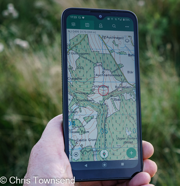
In 2007 Apple launched the iPhone and the smartphone revolution began. I could immediately see the advantages of these tiny computers for long-distance walks. They could take pictures, carry books to read, show your position on a map, link to the internet, and even be used for phone calls. In 2010 I bought one, the HTC Desire, and took it on the Pacific Northwest Trail with all the maps downloaded on to it. Long before I finished the trail I was hooked. I’ve never been backpacking without a smartphone since. I’ve never carried a standalone GPS device again either. There seems no need. I do still carry printed maps though. I like the overview a big map sheet gives and anyway I think I’d feel underequipped without one plus a magnetic compass. Twenty-five plus years of using them on hundreds of days has left the need for them ingrained. I do virtually all my navigation with the smartphone however.

For communication with the outside world the first smartphones were only useful when there was a signal though, which was hardly ever in wild places. On the Pacific Northwest Trail I was just as out of touch most of the time as I had been on earlier walks. I was just less likely to get lost, which would have made a huge difference on the Canadian Rockies walk where I spent around a week somewhat unsure of my whereabouts. That part of the walk would have been unrecognisable if I’d had GPS mapping.

Satellite Communication

SPOT & Garmin InReach

With satellite navigation established satellite communication soon followed and being in touch without a phone signal became possible. I’ve been using a GPS** satellite communicator the last thirteen years (I was surprised to discover it was so long but my first gear list with one is dated January 2011). Until two years ago this was a SPOT unit which I just used to send an ‘I’m OK’ message from camp each evening. It had no screen so ironically it didn’t show my position, though it did to the recipients of the message. Still, I had my smartphone to show where I was in case I didn’t know.

It wasn’t long before satellite communicators with screens and two-way messaging became available. I was happy enough with the basic SPOT for a while but then I was sent a Garmin InReach Mini 2 to test in 2022. As with my first smartphone I was quickly hooked. Especially as it linked with my phone so I could use its much bigger screen for sending and reading texts and emails. I still send the basic OK message each day but when needed I send more info such as when I expect to finish a walk and I can also receive messages and news from home.You can read my full review of the InReach Mini 2 here.

Satellite communicators are key safety devices of course and can be used to call for help just by pressing a button. I’ve never had to do this and obviously hope I never will but having it is a reassurance, as much to my family as to me, as is being able to let them know I’m OK every day. Before this was possible they were used to me disappearing for weeks at a time but now I suspect they’d think that irresponsible.

GPS has changed navigation and communication in the outdoors greatly, making the first much easier and the second possible. Whether this is good or bad or a mix of both is another matter. Whatever anyone thinks the change has happened.

There are other electronic and tech devices that didn’t exist for the first half of my backpacking life too – e-readers, weather trackers, portable battery packs. I’ll go into these and what they added to my backpacking in terms of utility and weight (or reduction in it) in Part Two of these all-things techy posts.

*I can’t remember all the dates I started using stuff of course. I consult a Word document containing lists of the gear I’ve used on just about every overnight or longer trip since 1993. It now runs to 490 pages! Luckily Word’s search engine works well.

** Now there are several global navigation satellite systems they should correctly be referred to as GNSS. However GPS was first and is established as the generic term so I’ve stuck with that.

Saturday, 10 September 2022

Thoughts on Smartphones & Photography

Oppo Find X5 Pro main lens (25mm full frame equivalent), ISO 135, 1/150 @ f2.2

On a summit recently I was asked to take a couple’s photograph and handed a smartphone. I took the photo and looked round. There were several other people there, all taking photographs with smartphones. No one except me had a standalone camera. Over the last few years I’ve observed this many times. Cameras have become rare, smartphones ubiquitous. The latter are now the choice of most people for outdoor photography. They’ve replaced compact digital cameras, which were common a decade ago and which themselves replaced compact film cameras a decade before that.

How good smartphones are for photography is something I’ve been considering over the last few months after being sent an Oppo Find X5 Pro to test which I’ve now reviewed for The Great Outdoors.  This is the first smartphone I’ve had supplied for review as a camera rather than for other features. Previously I’d had a couple of smartphones to test for suitability for the hills because of their ruggedness but without any emphasis on the camera.  With the Find X5 Pro nothing else was mentioned by the PR company who supplied it. 

Oppo Find X5 telephoto lens (52mm full frame equivalent) ISO 100, 1/720 @ f2.4

The Fine X5 Pro does have an astonishingly sophisticated camera with four lenses, two of them 50mp and one with five-axis stabilisation, which the video camera also has. There’s a pro mode with manual controls, a histogram, and the option to shoot raw files and many other features, more in fact than on my cameras. This is not a phone with a camera tacked on. In fact it’s more of a camera with additional phone functions. It’s the first smartphone I’ve used which I’ve started to take seriously for photography.

Oppo Find X5 Pro Xpan mode ISO 100, 1/9300 @ f1.7

The Find X5 Pro is a far cry from my first smartphone, a top model back in 2010, which had a 5mp camera with a single lens and hardly any features. I bought it for communication and navigation not photography. I did take pictures for social media and on a long walk sent a few back to The Great Outdoors which were used quarter page size. They were just about good enough for this. Looking at them on the computer screen now even the best aren’t sharp, there’s quite a bit of noise, and details are smeared. I wasn’t surprised at the low quality. The phone has a tiny sensor and a tiny lens.

Photographs taken with my 12mp camera at the same time are fine and not far off those from my current 24mp cameras. Indeed, these cameras are themselves now six and ten years old respectively and there have been five subsequent models. Whilst these have added and improved features the 24mp sensor has remained the same because the image quality is fine.

In the same period of time smartphone cameras have improved amazingly as companies realised that photography was becoming a main usage and people were looking for better quality pictures and more lens options. As smartphone sales soared companies invested heavily in camera development in order to compete.

Oppo Find X5 Pro main lens, ISO 1686, 1/35 @ f1.7

Images from the Find X5 Pro are vastly superior to those from my 2010 smartphone and more like those from my camera. Even images from the far less sophisticated and much less expensive rugged phones are better. Yet whilst smartphone sensor sizes have increased a little they’re still tiny compared to the APS-C sensors on my cameras. So how this increase in quality been achieved? The answer lies in the huge increase in smartphone processing power which allows for computational imaging using algorithms and sophisticated software to stack multiple images to create sharper images with less noise. There’s much more technical detail on this in this fascinating article on DXOMark.

The latest smartphones can take great photos. But the process is mostly automated and sometimes the camera gets it wrong, just as the old fully automatic point-and-shoot cameras used to, both film and digital. Most of the time, in good light, the smartphone images will be fine. Most of the time. One way to have some control over the images is to use pro modes that allow you to adjust the exposure settings manually and shoot raw images that can be processed in software like Lightroom. Not all smartphones have this option. The Find X5 Pro does have, and I’ve used it occasionally and found it can work well though images often require more processing than ones from my camera. If the Find X5 Pro was my main camera I’d use it much more.


The two pictures above were taken at the same time with the Find X5 Pro and the Sony a6000. I printed both at A4 size and showed them to several people. No one could tell which was the smartphone image. Looking at them again a few months later and I can’t tell either. Would larger prints bring out differences? Maybe. Something to find out.

Could a smartphone like the Find X5 Pro replace my cameras? Not yet. I’d love it if it could as it would cut the weight and size of my camera gear drastically. As it is I think a smartphone like this could be my second camera, given that I usually carry two, both in case of failure and for use with different lenses. In fact, during my testing of the Find X5 Pro I have just carried one of my cameras. However if I wasn’t taking photos for publication I think I’d be quite happy with a smartphone. And maybe I’m being cautious and conservative. I’m very familiar with my cameras and lenses. I know how they perform and how to use them. Taking a smartphone camera seriously has meant a new learning curve, one I haven’t anywhere near completed. 

Update: after I shared this on Facebook a commentator, Mike Reid, posted a link to a video by photographer Sean Tucker called Getting Better Photographs from your Phone Camera. It's very interesting and informative.  

Friday, 8 April 2022

Thoughts On Smartphone Navigation In The Hills & A Review Of Three Outdoor Phones


The issue of smartphones for navigation in the hills has reared its controversial head again following a BBC website piece with the title "Hillwalkers warned more than a phone needed to navigate mountains" and containing the statement "Some people do not realise phones will just switch off at cold temperatures, leaving them stranded", which is simply untrue. More sensible was the advice from Mountaineering Scotland safety advisor Ben Gibson recommending not just relying on a phone and advising carrying a map and compass as well plus a power bank.

I've written about navigating with phones a few times before but thought I'd expand my thoughts a little here and also post a review of three smartphones designed for outdoor use that recently appeared in The Great Outdoors magazine.

Perhaps the most important point to make is that smartphones, maps, compasses, and GPS units are just tools and to be useful you need to know how to use them and what their limitations are. They're not magic. Map reading is a skill needed whether your map is on a screen or printed.

Now I've been around so long that when I began hillwalking mobile phones and GPS satellites were the stuff of science fiction. Map and compass were the only options. I learnt to use them and couldn't imagine ever not having them. However those much younger have grown up with mobiles and GPS and undoubtedly can't imagine not having them. Suggesting that the tools they are familiar with shouldn't be used or don't work in the hills and they should stick to the old ones is futile and I suspect makes it likely that all the advice of people who say this will be rejected. I know that's what I would have done. If you know someone is wrong about something why trust them on anything else?

That said, having options is wise. Phones can fail or break, though it's never happened to me and I've been using them for navigation for well over a decade. Printed maps can blow away or tear and if paper can get soaked (I prefer ones on plastic). Both have happened to me in the past. Compasses are not infallible either as I discovered many decades ago, long before GPS let alone smartphones, when I walked off the wrong side of Ben More on the island of Mull, following a compass bearing, and discovered that if there are magnetic rocks around compasses can be 180º out. Much more recently I had a compass suffer reverse polarity so the needle pointed south not north, though not accurately enough to use it safely. Whether you use GPS or map and compass as your main navigation tool if you have both you have a backup in case of failure. Or of course two phone. Or two compasses. 


Teaching people how to use a phone for navigation is the way forward, not telling them it won't work. Often problems with using phones for navigation comes down to a lack of skill and knowledge not the failure of the phone. If all you have on the phone is Google maps you'll probably get lost, as you will if all you have is a printed road map. If you're reliant on a preset route, whether downloaded to a phone or in a printed guidebook, and can't map read then you may have problems if you lose the route. Tools have to be the right ones and you need to know how to use them. 

There are many mapping and hiking apps. I currently use OS Maps. Alex Roddie wrote a useful review of apps for The Great Outdoors recently.

"The battery will run out", is often given as a reason for not using a phone for navigation. If you know how to maximise battery life this should not be so (put it in airplane mode most of the time). Carrying a battery charger is wise too. Also, consider a phone with a big battery or one with a replaceable battery (see my reviews below). 

A myth is that phones won't work for navigation without a phone signal. This isn't true as the phone uses GPS satellite signals to show your position not wifi or 4G/5G. You do need to download the maps so they can be used offline - you probably won't be able to do that in the hills.

Whether printed or digital a map for the hills should have contours and other symbols that, when you know how to read them, shows what the terrain is like. In Britain that means the Ordnance Survey or Harvey maps. I do nearly all my navigation with a map. These days it's usually one on my smartphone, though I do carry a printed one as backup and to look at in camp. 

For planning I use a mixture of screen maps and printed maps. On screen I can draw routes and let the software workout distance and ascents. Printed maps I can spread out over the floor and visualise routes over huge areas, a great way to dream. I  love maps. I can spend hours poring over them, studying landscapes and planning routes. 

I still always carry a compass though it may not be used most days. Because I'm so familiar with using one in poor visibility I sometimes get my position on the phone, note the direction I want to take, and then transfer it to the compass as a bearing. I do keep the compass and phone apart though - close together the phone may cause reverse polarity in the compass. Don't carry them in the same pocket!


Summing up: good navigational skills are essential in the hills. And the key one is being able to read a map, whether it’s on paper or on a screen. The latest smartphones are efficient GPS units and with good downloaded maps can be used for navigation. Indeed, being able to pinpoint your position on a map on the screen should make it harder to get lost. A battery pack or spare battery should ensure you don't run out of power. And just in case something does goes wrong, carrying a paper map and a compass or a second phone as a back up is wise..

 
Review of Three Rugged Smartphones
 
From the left: Samsung Galaxy XCover Pro, Land Rover Explore R, Motorola Defy 


Smartphones are generally fairly fragile creatures, needing care, especially when taken into the hills. For years I kept mine in a protective case, handled it carefully, and kept it away from rain, snow, dust and mud. A cracked screen after I dropped my phone on a long walk – not enough to stop it working but I had to baby it the rest of the walk – had me looking at rugged phones designed for construction sites and other outdoor workplaces. I found plenty of big, heavy, chunky, rubberised clumsy-looking phones. They didn’t look very comfortable to carry or use and the specs were minimal. I didn’t think any could replace my phone for all uses.

Then in 2018 Land Rover launched a phone designed for hillwalking and the outdoors. The Explore looked like a slightly bigger standard phone and had all the features of the rugged phones plus much better specs. I took it on the GR5 trail through the Alps and enjoyed having a phone I didn’t have to treat carefully. When I went back to my standard phone I found I resented needing a case so when I replaced it I looked for a rugged phone and was pleased to discover there were now a number of options as well as the Explore.

Having now been using rugged phones for the last year and a half I can’t imagine going back to a standard one. I love having a phone that doesn’t require looking after. I’m now used to ignoring rain, putting my phone down on snow and mud, and slipping it into a pack or jacket pocket knowing it won’t come to harm if I bang it on something. Dropping it isn’t a worry either, though ironically rugged phones are designed to be non-slip. I like not needing a case too. Without one the rugged phones reviewed here are only slightly heavier and barely any bigger than a standard equivalent phone with one. And if the phone gets dirty you can easily wipe it clean.

There are now quite a few rugged smartphones suited to outdoor use. I’ve compared three that I’ve used extensively here. All of them have excellent waterproof, dustproof, and drop specifications. The cameras are all adequate but no more. The other specs are fine for most uses but they’re not as fast as top-end smartphones (or anything like as expensive). However, for the hills they are superb.


Land Rover Explore R    225 grams        £249.      ***1/2


Pros                   customisable dashboard, cost

Cons                  battery life, screen colour

Size                   160 x 76 x11mm

Weight               225 grams

Operating system Android 9/10

Battery              3100mAh

Memory             64GB, micro-SD slot

Cameras            12 MP f1.8 rear, 8MP front

Rather than an update to 2018’s Land Rover Explore this is a new phone with a different design and software. The durability aspects remain though, and it works in temperatures between -30°C and +65°. The screen is protected by Corning Gorilla glass and can be used with gloves or wet fingers. It’s recessed to give extra protection if dropped. The battery is 3,100 mAh, which Land Rover says is enough for 1.5 days with “medium-to-heavy” use.

Although the Explore R is the same size as the Samsung XCover Pro the display is smaller. It also has a slight yellowish colour tinge. However, I soon forgot about this in use. The display is bright and easily visible in sunshine. The screen works with gloves and wet fingers

For mapping the Explore R comes with the OS Maps app and a free 12-month premium subscription.

Like the first Explore the Explore R has a customisable Dashboard page that can give useful information such as sunrise and sunset times, altitude, and compass direction. Some of the information can only be updated with a phone signal though. Other information uses GPS.

I’ve used the Explore R for over a year in every type of weather without any extra protection and it’s always worked fine. There’s a dull finish to the sides and a rough textured back so it can safely be held in one hand.

I think the big drawback of the Explore R is the battery. It will last the 1.5 days claimed, though it’s easy to shorten that if you’re not careful. For a trip longer than a day a battery pack is essential.

https://landroverexplore.co.uk


Motorola Defy         235g   £279      ****1/2        £279       Best Buy


Overall Rating       ****1/2

Likes                       large screen, powerful battery life, cost

Dislikes                   nothing

Size                        170 x 78 x 11mm

Weight                     235 grams

Operating system     Android 10

Battery                    5000 mAh

Memory                   64GB, micro SD slot

Cameras                  48MP f1.8 main, 8MP front

Cost                        £279

The Defy is the biggest phone reviewed yet only weighs a few grams more than the others. The sides and back have a raised, ribbed pattern for a secure grip that’s the best of the three phones. The temperature operating range is -25° to 55°C. The recessed screen is Corning Gorilla glass for protection.

Other than the standard Google apps there’s no preinstalled software so you need to download mapping and other outdoor apps.

The big plus of the Defy is the massive 5000 mAh battery. Using the phone to record my route, check my position on the map occasionally, take a dozen and more photos, send a few texts, and even upload images to social media when there’s a signal the battery lasts two days. With careful use I can make that three.

The Defy arrived for testing at the end of last summer and I’ve used it through the autumn and winter without any problems and without treating it carefully. It’s worked fine in rain and in snow and in temperatures well below freezing. The screen is bright in any light and works with wet fingers and gloves. I like the large size but those with smaller hands may find it a bit more difficult to hold.

The big battery and large screen make this my Best Buy of the three phones, especially as the cost is quite low.

 www.motorolarugged.com


Samsung Galaxy XCover Pro     232g    £469  ****     Recommended


Overall Rating       ****

Likes                       replaceable battery

Dislikes                   quite expensive

Size                        160 x 76 x 10mm

Weight                     232 grams

Operating system     Android 10

Battery                   4050 mAh

Memory                  64GB, micro SD slot

Cameras                 25mp f1.7 wide angle & 8mp ultra-wide angle rear, 13mp front  

The Samsung Galaxy XCover Pro is the most expensive phone reviewed. It does have a better camera than the others and a fairly powerful battery that lasts well. The big plus point though is that the battery is replaceable. This has two advantages. The first is that a spare battery only weighs 76 grams, far less than a battery pack of the same capacity. The second is that if the battery runs out you can just replace it and continue using the phone straight away rather than having to attach it to a battery pack. The battery itself lasts me two days with reasonably careful use.

To change the battery the rear of the phone has to be removed. I was concerned this might be a weak point but after over a year’s use it’s as waterproof and dustproof as ever.

The XCover Pro is designed for construction sites and dusty and dirty workplaces rather than the hills and there are no mapping or other apps and a few features that aren’t really relevant for the outdoors. However, it is very tough and comes with three years guaranteed software and security updates (the other phones have two years).

The phone has a roughened back and matt finish rather than shiny sides to give a secure grip. The size is just right for me to use comfortably in one hand. The screen is only slightly recessed and fills more of the front of the phone than the screens on the other phones. Again, I thought this might be a weak point but so far it’s been fine.

https://www.samsung.com

Tuesday, 31 March 2015

Smartphones & Distractions In The Hills


It’s two and a half years ago since I last wrote about using smartphones in the hills in one of my most popular posts. Then my aim was to counter the arguments against using smartphones and tablets as GPS units. The same arguments still surface today and I think my piece is still valid. I’m not returning to that here however but to the question of how appropriate such technology is in the hills and whether it can be a distraction.  I’ve been thinking about this since reading a fascinating blog piece by author Alex Roddie entitled Ditching the infinity machine– five months later in which he describes swapping his smartphone for a basic phone after becoming concerned that the former was spoiling his enjoyment of the wilds. After this experiment Alex has returned to his smartphone but he now uses it in a different way so it’s far less intrusive.

Most of my walking having been done before smartphones existed (and much of it before mobile phones) the options for distraction from the wilds came down to just one – a book. And I carried plenty, often several at a time. Mostly I read in camp in the evening, especially when the weather meant staying in my tent was wise, (and I sometimes left rather late in the morning because I spent too long reading over breakfast). But sometimes a book gripped me enough that reading it became more important than where I was and I read while walking, my mind far away from my surroundings. Often though I was reading because where I was walking wasn’t that wild or interesting. I was still cut off from the world around me though and probably missed much. Alex Roddie in his earlier piece on smartphones describes the problem of battery failure with smartphones. Books don’t run out of power. Instead they run out of words. I can remember hoarding the last pages of a book, only reading a few at a time, because I was so concerned about finishing it before I reached somewhere I could buy another. Occasionally I’ve arrived in a town with finding books my main concern above food, showers, resupply or somewhere to stay. I couldn’t imagine doing a long walk or even an overnight trip without something to read. I still can’t but now I take a Kindle loaded with dozens of books for the same weight as one small paperback. Of course the Kindle can run out of power too but it’s not happened yet, even when I’ve been out for a week at a time. In fact I’ve not yet needed to recharge it from my back-up battery. And with the Kindle in a waterproof case I can read in the rain, as I did on a crossing of the Coirrieyairick Pass on a TGO Challenge walk. That’s the roughest terrain I’ve read myself across. Some people go further. Hamish Brown describes reading a paperback along the South Glen Shiel Ridge in Hamish’s Mountain Walk. 
Reading my way along a Mohave Desert road on the Pacific Crest Trail

Alex Roddie mentions using his smartphone as an e-reader, saving the weight of a Kindle. I did this on the Pacific Northwest Trail, before I had a Kindle, but found that it drained the battery too quickly. Given the weights of back-up batteries I reckon it’s lighter to carry the Kindle. Reading on a Kindle is a much more pleasant experience too as the screen is larger and there’s no glare.

My main use of my smartphone – currently a mid-range Sony Xperia SP, which does everything I need, is quite light (174 grams with protective rear case) and is still small enough to be used comfortably for actual phone calls – is for navigation with ViewRanger. Usually this just means locating my position and maybe walking a short distance to check I’m going the right way so the phone doesn’t need to be on all the time. A secondary use is for photos that I can send to social media before I get home and can download the images from my cameras onto the PC (I don’t have one of the latest cameras that links easily to a smartphone). I also send texts to my partner sometimes during a trip and always as soon as I’ve finished for the day. As I’m usually in places where a phone signal is a rarity (still the case in much of the Scottish Highlands) I’ll upload a photo or send a text and then put the phone back in the pack still switched on, as long as I have enough power. Generally at some point over the next few hours it’ll pick up enough of a signal to send the text and, less often, the photo. I don’t have any notifications or sound switched on so I don’t hear any bings or beeps and can forget about the phone. 

In camp I rarely look at the phone except to locate exactly where I am if I’ve camped after dark and am uncertain. The Kindle books and writing in my journal are enough distractions if needed. If I've enough power and there's a connection I might check the weather forecast. Occasionally I'll listen to the radio. However on long walks the phone always comes into use anytime I reach a town as then I can update my blog, answer emails, check social media and even submit reports to The Great Outdoors, something I did on both my Pacific Northwest Trail and Scottish Watershed walks. 

How communication technology is used in the hills is up to the individual of course. There are no rights or wrongs. I see no reason not to check emails and social media or even make phone calls if you find it satisfying any more than I can see a reason not to read in the hills (and I have been told at times that it’s ‘wrong’ to carry a book). The key is for you to control it and not the other way round. If it becomes intrusive and you think it’s spoiling your enjoyment the answer is simple. Switch the damn thing off!