Friday, 22 April 2022

Woods, Winds, & Water: A First Spring Overnight Trip That Didn't Go Quite According To Plan

Shelter at last

Sometimes trips don’t go quite according to plan, and sometimes trips give rewards that weren’t expected. My first spring trip of the year was both those. With warm weather forecast and most of the snow below 1000 metres gone a trip with a lighter pack without the ice axe, crampons, snowshoes, and winter camping gear I’d been carrying since November appealed. I wanted the freedom of not feeling burdened down.

View across Rothiemurchus Forest to the Lairig Ghru

Not wanting to drive far for an overnight trip I decided on the northerly extension of Braeriach, a big wedge of ground between Gleann Einich and the Lairig Ghru in the Cairngorms that’s mostly between 600 and 700 metres high. This is little-frequented pathless country so once away from the main track in Gleann Einich I didn’t expect to see anyone else. 

In Gleann Einich

The air was warm, the sky bright, and the mountains shining as I set off. There was a strong breeze though, even down here in the forest. The woods were still peaceful and the walk to Gleann Einich relaxing. I appreciated the lighter load too.

Once I left the last trees the wind was fierce, roaring straight down the glen into my face. Dark ragged clouds ripped across the mountains. Two mountain bikers with skis on their packs passed me cycling out. They’d gone to ski a line called The Escalator on Braeriach but had only skied part of it as the wind was just too strong high up. I was glad I wasn’t going that high.

Once I turned off the track the going became tough, the terrain all tussocks and bogs. Having been here before I knew it was like this and didn’t expect to make fast progress. The wind hindered me too, strong enough to knock me sideways occasionally. I’d planned on camping near a lochan on this open moorland and then going up the tops not far away, perhaps watching the sunset from one of them. The wind ended that idea. I could find nowhere sheltered and didn’t fancy a night in a shaking noisy shelter. The wind was coming from the south. On the far side of the hills just above the lochan was a shallow glen running north-east. Maybe there would be more shelter in it. 

Old tree, young trees

There wasn’t. The wind was funnelling straight down the glen. I went right up to its head. Here I found the remains of a long-abandoned shieling. No-one came here often now but once they did. I guessed there was a path long ago. Turning away I followed the burn gently downwards. There were stumps of long-dead trees in the peat, A lonely pine appeared, a surviving remnant of the forest that was once here. No, not lonely. As I neared I could see a scattering of little pines, no more than a metre or so high, around the old tree. As always, seeing the forest returning was uplifting.

The glen steepens

Still battered by the wind I continued past the pines and into the narrower lower glen. The terrain became stony, scoured by floods and snowmelt. The banks either side grew steeper. I decided I should climb up to the moorland above while I could before I reached a drop I couldn’t descend and had to retreat. The scramble up steep slopes of heather and rock was hard work. Knees and elbows came into play at times, and I was glad of the strength of some of the heather.

Once up and on flatter ground I realised to camp anywhere sheltered I would have to go down again, down to the Allt Druidh, which drains the north side of the Lairig Ghru. The descent was down even rougher slopes than those I’d just climbed with big boulders hidden in the heather, some covered with slippery moss. 

Creag an Leth-choin at dusk

Once down the terrain was no easier. The river was a raging torrent. The Lairig Ghru path lay not far up the other side but there was no way I could ford safely. I went downstream into the first trees, searching for a camp site. After climbing another steep rough bank and descending again to avoid a crag I found a lovely spot beside some old birches. With relief I made camp. I’d now been searching for a camp site for several hours and was far from where I’d planned to be. There’d be no hills this evening. Sunset came with a touch of colour amongst the racing clouds.

A peaceful camp

The night was warm, especially after the wind died down. I could hear the river roaring but even so this was a peaceful place. I lingered in the morning, admiring the old trees. And because I knew there was hard work to come. To cross the river I needed to go back upstream, beyond some feeder streams to where the Lairig Ghru path crossed it on steeping stones. To get there meant climbing back up the steep banks above camp and then crossing rough undulating moorland. Then I’d be on the path that lay just a few hundred metres away across the river from camp.

Allt Druidh

The ascent required more use of knees and elbows and more pulling on heather stems. Once out of the trees the wind was blasting against me again. I was now heading into it, across heather and boggy moorland that seemed even rougher than the day before. There were many little young pines to keep my spirits up. I weaved in and out of little stream gullies, trying to contour and not lose or gain much height. The river became a shallower stream and much less powerful as it flowed over flatter ground. I forded it before I reached the path at a wide pebbly stretch. The water was ankle deep and cold. My boots were sodden from all the bogs anyway.

Clouds over the Lairig Ghru

Once across I soon reached the path and could stride out, for the first time since I’d left Gleann Einich. Back in the trees I paused and gazed across the white thrashing river far below. There on the far side was the campsite I’d left three hours earlier. Now the hard work was over there was just the pleasant walk back through the forest to my car. 

Looking back across the river to my campsite

 
No summits were reached, and only short distances walked yet this was an arduous trip due to the wind and the terrain. The joy was in the regenerating forest and in the lovely camp site. A good start to spring.


Tuesday, 19 April 2022

A Look At The May Issue Of The Great Outdoors


The May issue of The Great Outdoors is out now. In it I have a piece I loved writing about some of my most memorable camps on long walks over the decades. I also review nine solo tents, a Finisterre insulated smock, EDZ waterproof socks, and a big pack from Osprey.

Other big features in this issue see Ursula Martin undertake a 3700 mile walk in Wales, Stacey McGowan Holloway on a music-inspired backpack of the Hebridean Way, and Rudolf Abraham hiking the Alpe Adria Trail from the Alps to the Adriatic.

Shorter pieces cover Robin Wallace's excellent Walk With Wallace YouTube channel, Vivienne Crow touring Skiddaw, Russ Moorhouse camping on every Wainwright, Fiona Russell on her first solo wild camp, how the outdoor community is supporting Ukraine, and Jim Perrin on Slieve Donard in the Mountains of Mourne.

Alex Roddie gives tips on how and where to pitch a tent in the Skills section while in the Gear pages David Lintern looks at kid's waterproofs. In Books Alan Rowan reviews The Peatlands of Britain and Ireland: A Traveller's Guide by Clifton Bain, and Alex Roddie reviews Tales from the Big Trails by Martyn Howe.

In Wild Walks Alan Rowan climbs Ben Stack in the Northern Highlands, Stefan Durkacz finds solitude in the Pentland Hills, Vivienne Crow visits Pike O'Blisco and Wet Side Edge in the Lake District, Roger Butler is high above the River Wye on Drum Ddu and Y Gamriw in the Cambrian Mountains, and Fiona Barltrop has a springtime walk on the South Downs.


Monday, 11 April 2022

Book Review: 1001 Walking Tips by Paul Besley


1001 Tips is a guide to walking with a difference. Rather than a conventional manual format it consists of succinct tips grouped under various subjects. The tips are very short, few running longer than three or four lines. Every type of walking is covered – urban walking, hillwalking, long-distance walking, winter walking and more. Every walking related topic is here too, everything from fitness and training to winter safety.

Some tips are practical dos and don’ts, some instructional, some informative, some light-hearted (such as have a snowball fight or build a snowman during a winter walk). There’s a huge mix here. Novices can learn much, those with more experience will learn something too – and probably disagree with some of the advice! It’s a good book for arguing over. I’m pleased too to see that there are tips on conservation and taking care of the countryside. This isn’t just a how-to book. 

 
You could read this book straight through, cover to cover, but it’s not really designed for that. I think it’s a book to dip into, to browse, to use for reference, to refresh your knowledge. Going winter walking for the first time (or the first time in a while)? Read the 80 tips in that section. Thinking of long-distance walking. There are 113 tips for that.

The author is well qualified to write the book. He’s a writer on landscape and walking and a walking guide with a particular interest in the Peak District and South Pennines. He’s written four walks guides to the area and is a volunteer ranger for the Peak District National Park and a member of Woodhead Mountain Rescue.  He’s also a good photographer and the book is illustrated with his photographs.

Entertaining, informative, and well-presented this is a book that deserves a place on every walker’s bookshelf. It's published by Vertebrate and costs £25.


Friday, 8 April 2022

Thoughts On Smartphone Navigation In The Hills & A Review Of Three Outdoor Phones


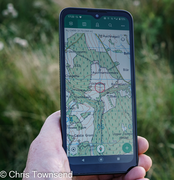
The issue of smartphones for navigation in the hills has reared its controversial head again following a BBC website piece with the title "Hillwalkers warned more than a phone needed to navigate mountains" and containing the statement "Some people do not realise phones will just switch off at cold temperatures, leaving them stranded", which is simply untrue. More sensible was the advice from Mountaineering Scotland safety advisor Ben Gibson recommending not just relying on a phone and advising carrying a map and compass as well plus a power bank.

I've written about navigating with phones a few times before but thought I'd expand my thoughts a little here and also post a review of three smartphones designed for outdoor use that recently appeared in The Great Outdoors magazine.

Perhaps the most important point to make is that smartphones, maps, compasses, and GPS units are just tools and to be useful you need to know how to use them and what their limitations are. They're not magic. Map reading is a skill needed whether your map is on a screen or printed.

Now I've been around so long that when I began hillwalking mobile phones and GPS satellites were the stuff of science fiction. Map and compass were the only options. I learnt to use them and couldn't imagine ever not having them. However those much younger have grown up with mobiles and GPS and undoubtedly can't imagine not having them. Suggesting that the tools they are familiar with shouldn't be used or don't work in the hills and they should stick to the old ones is futile and I suspect makes it likely that all the advice of people who say this will be rejected. I know that's what I would have done. If you know someone is wrong about something why trust them on anything else?

That said, having options is wise. Phones can fail or break, though it's never happened to me and I've been using them for navigation for well over a decade. Printed maps can blow away or tear and if paper can get soaked (I prefer ones on plastic). Both have happened to me in the past. Compasses are not infallible either as I discovered many decades ago, long before GPS let alone smartphones, when I walked off the wrong side of Ben More on the island of Mull, following a compass bearing, and discovered that if there are magnetic rocks around compasses can be 180º out. Much more recently I had a compass suffer reverse polarity so the needle pointed south not north, though not accurately enough to use it safely. Whether you use GPS or map and compass as your main navigation tool if you have both you have a backup in case of failure. Or of course two phone. Or two compasses. 


Teaching people how to use a phone for navigation is the way forward, not telling them it won't work. Often problems with using phones for navigation comes down to a lack of skill and knowledge not the failure of the phone. If all you have on the phone is Google maps you'll probably get lost, as you will if all you have is a printed road map. If you're reliant on a preset route, whether downloaded to a phone or in a printed guidebook, and can't map read then you may have problems if you lose the route. Tools have to be the right ones and you need to know how to use them. 

There are many mapping and hiking apps. I currently use OS Maps. Alex Roddie wrote a useful review of apps for The Great Outdoors recently.

"The battery will run out", is often given as a reason for not using a phone for navigation. If you know how to maximise battery life this should not be so (put it in airplane mode most of the time). Carrying a battery charger is wise too. Also, consider a phone with a big battery or one with a replaceable battery (see my reviews below). 

A myth is that phones won't work for navigation without a phone signal. This isn't true as the phone uses GPS satellite signals to show your position not wifi or 4G/5G. You do need to download the maps so they can be used offline - you probably won't be able to do that in the hills.

Whether printed or digital a map for the hills should have contours and other symbols that, when you know how to read them, shows what the terrain is like. In Britain that means the Ordnance Survey or Harvey maps. I do nearly all my navigation with a map. These days it's usually one on my smartphone, though I do carry a printed one as backup and to look at in camp. 

For planning I use a mixture of screen maps and printed maps. On screen I can draw routes and let the software workout distance and ascents. Printed maps I can spread out over the floor and visualise routes over huge areas, a great way to dream. I  love maps. I can spend hours poring over them, studying landscapes and planning routes. 

I still always carry a compass though it may not be used most days. Because I'm so familiar with using one in poor visibility I sometimes get my position on the phone, note the direction I want to take, and then transfer it to the compass as a bearing. I do keep the compass and phone apart though - close together the phone may cause reverse polarity in the compass. Don't carry them in the same pocket!


Summing up: good navigational skills are essential in the hills. And the key one is being able to read a map, whether it’s on paper or on a screen. The latest smartphones are efficient GPS units and with good downloaded maps can be used for navigation. Indeed, being able to pinpoint your position on a map on the screen should make it harder to get lost. A battery pack or spare battery should ensure you don't run out of power. And just in case something does goes wrong, carrying a paper map and a compass or a second phone as a back up is wise..

 
Review of Three Rugged Smartphones
 
From the left: Samsung Galaxy XCover Pro, Land Rover Explore R, Motorola Defy 


Smartphones are generally fairly fragile creatures, needing care, especially when taken into the hills. For years I kept mine in a protective case, handled it carefully, and kept it away from rain, snow, dust and mud. A cracked screen after I dropped my phone on a long walk – not enough to stop it working but I had to baby it the rest of the walk – had me looking at rugged phones designed for construction sites and other outdoor workplaces. I found plenty of big, heavy, chunky, rubberised clumsy-looking phones. They didn’t look very comfortable to carry or use and the specs were minimal. I didn’t think any could replace my phone for all uses.

Then in 2018 Land Rover launched a phone designed for hillwalking and the outdoors. The Explore looked like a slightly bigger standard phone and had all the features of the rugged phones plus much better specs. I took it on the GR5 trail through the Alps and enjoyed having a phone I didn’t have to treat carefully. When I went back to my standard phone I found I resented needing a case so when I replaced it I looked for a rugged phone and was pleased to discover there were now a number of options as well as the Explore.

Having now been using rugged phones for the last year and a half I can’t imagine going back to a standard one. I love having a phone that doesn’t require looking after. I’m now used to ignoring rain, putting my phone down on snow and mud, and slipping it into a pack or jacket pocket knowing it won’t come to harm if I bang it on something. Dropping it isn’t a worry either, though ironically rugged phones are designed to be non-slip. I like not needing a case too. Without one the rugged phones reviewed here are only slightly heavier and barely any bigger than a standard equivalent phone with one. And if the phone gets dirty you can easily wipe it clean.

There are now quite a few rugged smartphones suited to outdoor use. I’ve compared three that I’ve used extensively here. All of them have excellent waterproof, dustproof, and drop specifications. The cameras are all adequate but no more. The other specs are fine for most uses but they’re not as fast as top-end smartphones (or anything like as expensive). However, for the hills they are superb.


Land Rover Explore R    225 grams        £249.      ***1/2


Pros                   customisable dashboard, cost

Cons                  battery life, screen colour

Size                   160 x 76 x11mm

Weight               225 grams

Operating system Android 9/10

Battery              3100mAh

Memory             64GB, micro-SD slot

Cameras            12 MP f1.8 rear, 8MP front

Rather than an update to 2018’s Land Rover Explore this is a new phone with a different design and software. The durability aspects remain though, and it works in temperatures between -30°C and +65°. The screen is protected by Corning Gorilla glass and can be used with gloves or wet fingers. It’s recessed to give extra protection if dropped. The battery is 3,100 mAh, which Land Rover says is enough for 1.5 days with “medium-to-heavy” use.

Although the Explore R is the same size as the Samsung XCover Pro the display is smaller. It also has a slight yellowish colour tinge. However, I soon forgot about this in use. The display is bright and easily visible in sunshine. The screen works with gloves and wet fingers

For mapping the Explore R comes with the OS Maps app and a free 12-month premium subscription.

Like the first Explore the Explore R has a customisable Dashboard page that can give useful information such as sunrise and sunset times, altitude, and compass direction. Some of the information can only be updated with a phone signal though. Other information uses GPS.

I’ve used the Explore R for over a year in every type of weather without any extra protection and it’s always worked fine. There’s a dull finish to the sides and a rough textured back so it can safely be held in one hand.

I think the big drawback of the Explore R is the battery. It will last the 1.5 days claimed, though it’s easy to shorten that if you’re not careful. For a trip longer than a day a battery pack is essential.

https://landroverexplore.co.uk


Motorola Defy         235g   £279      ****1/2        £279       Best Buy


Overall Rating       ****1/2

Likes                       large screen, powerful battery life, cost

Dislikes                   nothing

Size                        170 x 78 x 11mm

Weight                     235 grams

Operating system     Android 10

Battery                    5000 mAh

Memory                   64GB, micro SD slot

Cameras                  48MP f1.8 main, 8MP front

Cost                        £279

The Defy is the biggest phone reviewed yet only weighs a few grams more than the others. The sides and back have a raised, ribbed pattern for a secure grip that’s the best of the three phones. The temperature operating range is -25° to 55°C. The recessed screen is Corning Gorilla glass for protection.

Other than the standard Google apps there’s no preinstalled software so you need to download mapping and other outdoor apps.

The big plus of the Defy is the massive 5000 mAh battery. Using the phone to record my route, check my position on the map occasionally, take a dozen and more photos, send a few texts, and even upload images to social media when there’s a signal the battery lasts two days. With careful use I can make that three.

The Defy arrived for testing at the end of last summer and I’ve used it through the autumn and winter without any problems and without treating it carefully. It’s worked fine in rain and in snow and in temperatures well below freezing. The screen is bright in any light and works with wet fingers and gloves. I like the large size but those with smaller hands may find it a bit more difficult to hold.

The big battery and large screen make this my Best Buy of the three phones, especially as the cost is quite low.

 www.motorolarugged.com


Samsung Galaxy XCover Pro     232g    £469  ****     Recommended


Overall Rating       ****

Likes                       replaceable battery

Dislikes                   quite expensive

Size                        160 x 76 x 10mm

Weight                     232 grams

Operating system     Android 10

Battery                   4050 mAh

Memory                  64GB, micro SD slot

Cameras                 25mp f1.7 wide angle & 8mp ultra-wide angle rear, 13mp front  

The Samsung Galaxy XCover Pro is the most expensive phone reviewed. It does have a better camera than the others and a fairly powerful battery that lasts well. The big plus point though is that the battery is replaceable. This has two advantages. The first is that a spare battery only weighs 76 grams, far less than a battery pack of the same capacity. The second is that if the battery runs out you can just replace it and continue using the phone straight away rather than having to attach it to a battery pack. The battery itself lasts me two days with reasonably careful use.

To change the battery the rear of the phone has to be removed. I was concerned this might be a weak point but after over a year’s use it’s as waterproof and dustproof as ever.

The XCover Pro is designed for construction sites and dusty and dirty workplaces rather than the hills and there are no mapping or other apps and a few features that aren’t really relevant for the outdoors. However, it is very tough and comes with three years guaranteed software and security updates (the other phones have two years).

The phone has a roughened back and matt finish rather than shiny sides to give a secure grip. The size is just right for me to use comfortably in one hand. The screen is only slightly recessed and fills more of the front of the phone than the screens on the other phones. Again, I thought this might be a weak point but so far it’s been fine.

https://www.samsung.com

Sunday, 3 April 2022

On This Day 40 Years Ago I Began The Pacific Crest Trail.

At the Mexican border. No mention of the PCT there back then.

On the 3rd April 1982 I set off from the Mexican border to walk to Canada on the Pacific Crest Trail. It was to be the defining walk of my life. 

It was a different world then. A larger world. The communications and digital revolutions were a long way in the future. There were no mobile phones, no GPS, no Internet, no social media, no digital cameras. I communicated with home by postcard. No one knew where I was from one week to the next. I took photographs on film and sent batches back from post offices. I wouldn't see my pictures until I returned home. 

My pack at the start

My equipment wouldn't look that unusual now, though it was heavier than I'd take today. The biggest visual difference is that no one used trekking poles then. 

PCT Gear List. Some still familiar names.

There were guidebooks to the trail. As these were heavy and bulky I tore them up and sent sections ahead in supply boxes, as I did with paper maps.

Guidebook sections

The landscape in Southern California was strange. I'd never experienced hot and dusty desert hills full of spiky plants and with little water before. I had to learn a great deal in the first few days. 

Southern California scenery

The PCT was little-known and little-hiked in 1982. That year just 120 thru-hiker permits were issued and only 11 of us completed the trail. In 2019 5,441 permits were issued and 988 finished. (Information from the Pacific Crest Trail Association). Hiking the trail must be a different experience now, though the landscape is still glorious.

Ten years ago I dug out my trail journals and my Kodachrome transparencies and wrote a book about my PCT hike, which was published in 2014 by Sandstone Press. Writing the book brought back to me what a wonderful adventure it had been and reinforced my feeling of the walk's importance to my life. It was intensely fulfilling.