Sunday 28 August 2022

An Atmospheric Day In The Cairngorms

Swirling clouds in the Lairig Ghru

The forecast of clearing clouds and touches of sunshine for the evening suggested a late walk on the Cairngorm Plateau, especially as winds were forecast to be light so midges were very likely lower down. The heavy rain and the thick clouds blanketing the hills when I arrived in Coire Cas weren’t so encouraging. I checked the forecast for Cairn Gorm again. The sunshine and evaporating clouds had vanished, replaced by rain and drizzle. Wandering round in mist and wetness didn’t appeal – I’ve done that too many times. A change of plan then. 

Creag an Leth-choin during a brief clearance

Creag an Leth-choin (Lurcher’s Crag), that rugged peak dramatically overhanging the mouth of the Lairig Ghru pass, was just brushed by the clouds. It’s 200 metres lower than the Plateau and so more likely to stay clear. I decided to head that way. I remembered a path up Lurcher’s Gully below the peak, though I hadn’t been that way except when it was snow covered (it’s a great downhill ski run) for many years. This path isn’t shown on the OS 1:50,000 map but is on the 1:25,000. Was it still there? Finding out would be interesting.

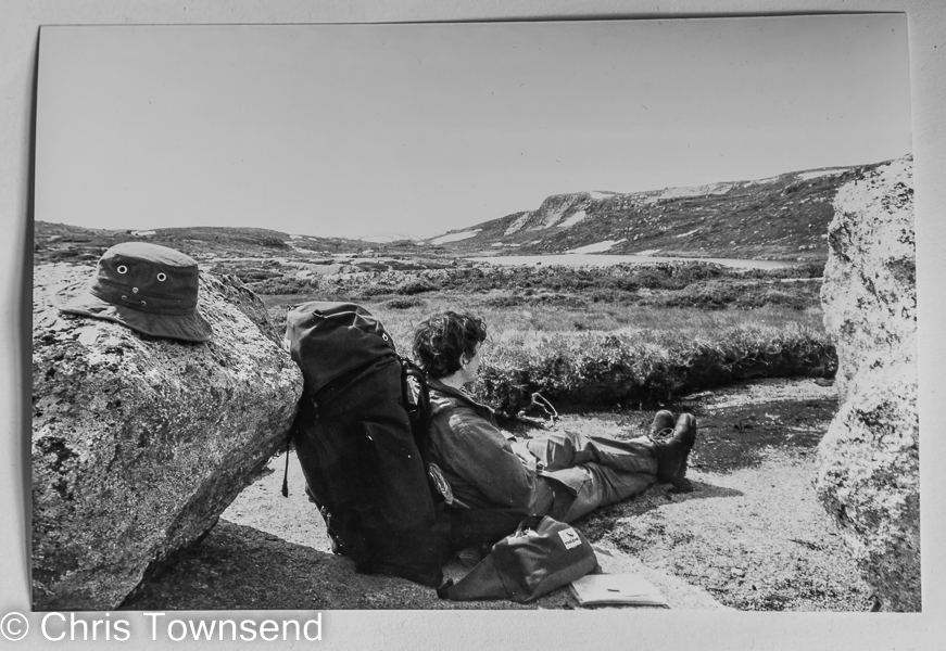
Buachaille Etive Mor & Creagan Gorm

Exiting the car I was instantly assailed by midges. A man in a t-shirt passed by flapping his arms. “The midges are terrible”. I set off briskly, the rain having given away to gentle drizzle. Across Glenmore the heather was purple on Buachaille Etive Mor and Creagan Gorm, until they disappeared into rain and cloud.

The line of the path up Lurcher's Gully just visinle

The start of the Lurcher’s Gully path where it left the main path up to the Plateau wasn’t clear. When I found it the path was narrow and overgrown. In places it was barely visible. I lost it several times soon picked it up again. The walking was no easier on the path than off but trying to find the line was an intriguing game.

Springs in Lurcher's Gully

The fading path suggests not many people come this way, which is a shame as the wide gully is lovely and colourful in summer with masses of flowers – mainly heather and bog asphodel, in places bog cotton, tormentil, common butterwort, harebells, and even some hawkweed. Higher up a series of springs and wet flushes glowed bright green, yellow and red. A covey of grouse, maybe a dozen, exploded from the heather noisily.

Rainbow

A squall swirled over Glenmore, hiding the hills, then swept on over Cairn Gorm, leaving a bit of rainbow in its wake. 

View over the Lairig Ghru

The gully gradually ended on flatter ground which I wandered across to the edge of the Lairig Ghru. Across the deep cleft of the pass clouds and rain squalls drifted over Strathspey. Looking back there was a similar scene over Cairn Gorm. Some of the clouds were below me. 

On the summit

Rocky slopes led to the short summit ridge of Creag an Leth-choin. The clouds thickened and the Lairig Ghru became a seething mass of vapours. All around the summit the swirling mass continued, a very mobile atmosphere. Ring ousels flitted and called in the rocks.

The Lairig Ghru

Mist came and went as I rested on the summit. The air was damp and chilly. On the descent the cloud lifted at first, giving a good view along the curves of the Lairig Ghru and out to hazy hills split by shafts of sunlight. Then the mist enveloped me and stayed most of the way down, creating a silent vague world. 

Sunset

I was almost back at Coire Cas when a line of red appeared under the clouds far to the north-west. The sun was setting. Soon the clouds flared up, startlingly bright and fiery, a stunning finish to the rather atmospheric day. 

Coire Cas Glowsticks

Not quite the finish though. After the sunset had faded I could see two glowing lurid green columns rising into the air, the raised Coire Cas car park barriers. Why they have to look like giant glowsticks I can’t imagine. I’d rather they didn’t. 


Thursday 25 August 2022

Images of my Scandinavian Mountain walk 30 years ago in B&W

Lakavatnet, Central Norway. August 12

As promised in my last post here are some B&W images from my walk the length of the mountains of Norway and Sweden in 1992. These were taken on B&W film from which I had 15 x 10cm prints made. I could probably get better results from the negatives but I haven't yet located them so these are photographs of the prints. 

Setadalsheiene, Southern Norway. Late June.

Pieljekaisestugan, Northern Sweden. August 29.

As I noted in my last post I don't have details of where and when all the pictures were taken. Some of the prints have captions on the back. Many don't. I curse my old self again! Here are a couple of camp shots that could be anywhere along the route.


The next two images were taken in the long Tjaktavagge valley on the Kungsleden long-distance path in Northern Sweden on the 9th September. 


My last picture is captioned "Dusk in Arctic Norway", which means it was taken in the last week of  the walk, between the 12th and 17th September.


Wednesday 24 August 2022

Thirty years ago, a walk along the mountains of Norway and Sweden, plus a brief initial look at Andrew Terrill's On Sacred Ground


I'm currently reading the second volume of Andrew Terrill's account of his extraordinary walk from the toe of Italy to the Arctic Ocean, having been granted a prepublication review copy. On Sacred Ground covers the journey from the Alps through Germany and Denmark to Norway and the North Cape.Like the first book, The Earth Beneath My Feet (which I reviewed here and here), it's enthralling and life-affirming, a great adventure story with more depth than most such books. I'll be reviewing it for The Great Outdoors. The publication date is October 1 and it can be ordered from Amazon.

One of the finest camps on my walk. In the Jotunheimen, Norway

I'm just over half way through On Sacred Ground and Andrew has just started up Norway, in mid-April when there is still much snow, the thaw is underway, and the going, to put it midly, is difficult. This is the first section of his long walk when Andrew is in an area I know, and indeed on a walk similar to one I had undertaken six years earlier than his. In 1992 I walked south to north through the mountains of Norway and Sweden, a journey of 2200km (1400 miles) that took me four and a half months. Andrew took a much more meandering route, staying in Norway throughout, and walked over 4,000km (2500 miles), taking six months to do so. He began at the end of one winter and finished as the next one began. My walk was in summer and so much easier.

Another fine camp. Lakavatnet, Central Norway

Reading Andrerw's story had me thinking about my walk and how much I want to return to the Scandinavian Mountains, especially in the north. There are plans! I only ever wrote one article about that walk - there was little interest in the area, something I've never understood - and so far I've failed to find a copy. I have however some photos of the walk, both colour and B&W. My filing system, if it can be graced with that name, was awful and many of the pictures are not captioned or dated. I curse myself! It's so much easier with digital but this of course was in film days. 

Somewhere on the Hardangervidda, Norway. I think!

My next post will feature some of the B&W images from the walk.

This is somewhere along the Kungsleden long-distance path in Sweden

Photographic note: My camera equipment consisted of two Nikon SLR bodies, 24mm, 28-70mm and 70-210mm Nikon lenses, and a tripod. With cases it weighed 3.9kg/8.6lbs, which seems an awful lot today. My films were Fujichrome 50 & 100 colour transparency and Ilford FP4 B&W. The transparancies were photographed with my Sony NEX 7 and Sony 35mm F1.8 lens and the raw files processed in DxO PureRaw and Lightroom. 

In the Jotuheimen, Norway. I think.


Sunday 21 August 2022

BrewDog’s “Lost Forest” A Year On: Fencing Begins

The Burma Road

A year ago I wandered up the Burma Road in the Monadh Liath hills just outside Aviemore (see this post) to have a look at the Kinrara estate which BrewDog had recently bought with a view to restoring a “lost forest”. Nothing had happened then of course, the land looking much as it had for many years with lovely woodland lower down and a degraded grouse moor higher up. I did though notice some small pines and other trees poking up through the heather and commented that the forest would return on its own if deer numbers were reduced to stop overgrazing. 

The Burma Road

BrewDog however plan to plant over a million native trees in fenced areas and recently obtained planning permission for this plus a grant of over a million pounds from Scottish Forestry. BrewDog CEO James Watt defended the project in this post, with a letter from noted environmentalist Mike Berners-Lee backing him up.  However there is no mention of regeneration and Berner-Lees says that the aim is to create a “bio-diverse broadleaf woodland”. Given that there is relict Caledonian Pine forest here surely it is this that needs restoring, as Dave Morris pointed out in an excellent letter to the Herald newspaper quoted in this informative post by Nick Kempe on Parkswatch Scotland.  

A lone pine along the Burma Road. Seed source for the future?

As I climbed above the lower woodland I could see a digger high on the hillside and soon some massive fence posts running across the hillside. Piles of wire netting lay nearby. From an aesthetic point of view this fence will be an intrusion into an open landscape. I also wonder how many access points there will be – it will certainly be a barrier to wandering down anywhere from Geal Charn as I’ve done many times. 

The fence line marching across the hillside.

More significantly it will result in a forest one side and bare moorland the other, an unnatural straight line separating healthy and unhealthy ecosystems. I also wonder how the planting will be done. In an area close to my home planting involved digging with heavy machinery that destroyed many of the regenerating pines. 

Beside the Burma Road.

The views over Strathspey were dramatic with bands of cloud and rain sweeping across the land and bursts of sunshine lighting up different spots. Over there Wildland is allowing the forest to return naturally, making Glen Feshie an inspiring place, Now Wildland is extending this to the Glen Tromie and Gaick estates, supported by Forestry Scotland. It’s a shame Forestry Scotland didn’t advise BrewDog to do the same and that BrewDog didn’t ask Wildland for advice. 

Lairig Ghru from the Burma Road

Leaving aside the big important question of estate ownership, which is covered well on Andy Wightman’s blog, I’d rather see a planted forest on the Kinrara estate than have it continue as a grouse moor. Such a forest will be better for biodiversity. I’d rather see natural regeneration than planting though and whether that or planting I'd rather see a reduction in deer numbers than fencing.


I’ll be going back up the Burma Road to see how the work progresses and posting about this again.

The Cairngorms from the Burma Road

 Note: all photographs taken August 19, 2022