Showing posts with label long distance hiking. Show all posts

Sunday, 27 July 2025

40 years ago on the Continental Divide Trail, 15 years ago on the Pacific Northwest Trail

The Highline Trail, Pacific Northwest Trail

On July 27 1985 I reached Macks Inn close to the boundary of Yellowstone National Park and completed the first 815 miles of the Continental Divide Trail. It was day 59 on the trail. I posted a piece on the walk here

On July 27 2010 I camped by Sinclair Creek in the Whitefish Divide region after the first 118 miles of the Pacific Northwest Trail. It was day 8 on the trail. 

Stahl Peak. PNT.

At this point both trails were in the Rocky Mountains but the PNT would soon leave them on its journey east to the Pacific Ocean. The CDT of course stays in the Rockies until they fade away in northern New Mexico.

There were mosquitoes! PNT

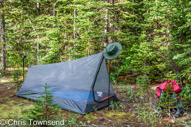
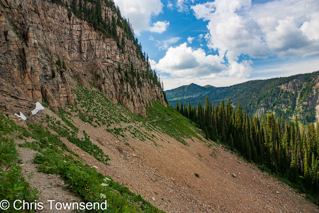
On the PNT the walking was becoming tougher as I'd left the prepared trails of Glacier National Park behind. It was to become much more difficult, both with the terrain and navigation. On this day I still had trails to follow. It began at a mosquito-infested site where I just slept in the inner mesh tent and finished with thunderstorms and rain. Along the way the scenery was superb and the final section on the Highline Trail wonderful.

There was rain! PNT

On the CDT the walking was already tough, the hardest in fact of the whole walk as there was much bushwhacking and steep rocky slopes and navigation was often just continue south by the easiest way I could find. I wrote in my journal that the ten days I spent in the Beaverhead Mountains were the "toughest walking I've ever done". I did also note that the rewards were "pristine cirques ... no campsites, no trails, no fire rings, no cut trees ... immaculate scenery". 

Immaculate scenery. CDT

On the PNT I was half a day's walk from my first rest stop in the little town of Eureka. On the CDT I hadn't had a break for seventeen days when I reached Macks Inn, a small fishing resort. I needed one! In fact I took two.

Ahead the terrain on the CDT would be much easier though as I crossed Yellowstone National Park with its signed maintained trails and backcountry campsites. 

Whitefish Divide scenery. PNT

A big difference on the walks was my camera gear. 1985 was still film. I haven't yet scanned many of the thousands of images I took. I must do so! 2010 was digital. The images from that walk posted here are ones that didn't appear in my PNT book. All of those with this piece were taken on July 27.

Fire Lookout on 2205m/7235ft Mount Wam. PNT

I 've never written a book about my CDT hike but there is a long chapter about it in my first book The Great Backpacking Adventure (long out of print). The cover of that book is of my friend Scott Steiner who accompanied me on the first 500 miles at a camp below the Chinese Wall in Montana.


Saturday, 14 September 2024

High Summer Update: New Edition Almost Ready!

The Rockwall, Kootenay National Park, July 

The new edition of High Summer, the story of my walk along the length of the Canadian Rockies in 1988, is almost ready for publication. Andrew Terrill of Enchanted Rock Press has just sent me the typeset proofs of the print edition to check, which is exciting! 

As I mentioned in previous posts the new edition will have far more photographs than the first one. Indeed, my main work has been selecting and scanning slides to send to Andrew for him to process for publication. I've also written a new introduction looking back at the walk. The original text hasn't been altered though, I've just added a few footnotes. 

In the snow near the finish, October 

Now to check the proofs!

Sunday, 16 June 2024

My Cape Wrath Trail walk

Along the Allt Grannda

My Cape Wrath Trail walk started in sunshine and ended in rain, wind and cold that had me stopping three or four days from the end. There’s no set route. Start in Fort William and walk to Cape Wrath by whichever way you choose. There are suggested routes though, on websites, maps and in a guidebook, all giving various alternatives.

Start in Fort William

From Fort William there are western and eastern options. Having walked much of the western one in Knoydart last year (see this post) I decided to start with the eastern one which initially follows the Great Glen Way. This makes for easy walking and a waymarked path for the first day or so.

Mist rising from Loch Lochy. Early morning at my first camp.

I began at the end of the long hot dry spell in May and was in shorts and t-shirt for the first five days, which took me from Fort William to Morvich and Glen Shiel. After that those garments disappeared into the depths of my pack never to emerge again.

Loch Lochy in the Great Glen

The first section along the Caledonian Canal also provides many places for food and drink and I barely touched my supplies until the evening of the second day. The easy walking continues after the Great Glen Way is left and the route turns west along forest roads above Loch Garry. Once these roads run out at the end of the loch everything changes. An intermittent narrow and hard-to-follow boggy path runs through tussocks and heather. The going is arduous and it took me a while to find anywhere to camp. The landscape improves dramatically however, with a feeling of entering the mountains.

Waterfall on the Allt Grannda

The three days from Glen Garry north over the eastern edge of the Glen Shiel hills to the western end of Glen Affric and then west along the Allt Grannda were a delight with fine views, sunshine, and mostly good paths and tracks. The highlight was the narrow gorge of the Allt Grannda where the path winds across the steep hillside high above the river which crashes down in waterfalls and cascades. This section has been a favourite for many years and I was happy to return after too long away.

The excellent path above the Allt Grannda

At Morvich I ate some fresh food and came down with a stomach bug, which was ironic. I know exactly what it was! I spent a day feeling weak and unwell as the clouds rolled in and rain fell. The dry spell was over.

The Falls of Glomach

I left Morvich for a mostly wet walk to Strathcarron via the Falls of Glomach – as spectacular as ever -, Iron Lodge, Maol Buidhe bothy, and Bendronaig Lodge, a meandering route that would be excellent in good weather. As it was the clouds stayed low on the hills and rain fell frequently.

Much of the time after Morvich was like this

The wet cloudy weather continued as I walked through the Torridon hills and past An Teallach to Inverlael at the head of Loch Broom. However the clouds were often were broken and more interesting visually and there were occasional clearances and bursts of sunshine, especially in the evening. This is an area I know well so I could imagine the big hills that lay hidden all around.

Cloud fill Coire Mhic Fhearchair on Beinn Eighe in Torridon

An Teallach did appear though. An overcast sky made for dull, flat light but the mountain looked as splendid as ever. It was the first hill I’d seen clearly since leaving Morvich.

An Teallach

At Inverlael I had arranged to meet my friend Tony Hobbs who was joining me for the next section to Inchnadamph. I had planned on a day off in Ullapool, which is not far from Inverlael, and Tony had said he’d book somewhere. He had, forty miles away in Lochinver! Everywhere in or near Ullapool was fully booked. So we had a pleasant two nights in the Culag Hotel in Lochinver where we met another CWT walker, also here because everywhere else was booked. In Lochinver we heard the first forecast for the much colder, stormier weather to come.

Waterfall in Glen Douchary

Back on the walk we had good weather for our first camp in Glen Douchary though and for a splendid walk along the lovely gorge in the glen and another camp in the sun by Rappach Water.

Tony Hobbs and his dog Lassie in Glen Douchary

The stormy weather began the next day with heavy showers and an increasingly strong wind as we headed up Glen Oykel. Loch Ailsh was in the mist. The forest was dripping. We did find a small open area in the trees for a sheltered camp. No views, just big Sitka spruce, but we were out of the wind.

Tony and Lassie above the River Traligill after we'd come through the bealach 

Back in the full force of it the next day we continued up the glen and then up to the narrow Bealach Trallgil at just over 500 metres. As we came through the pass the wind was ferocious, blasting right in our faces, which at least meant it was unlikely to knock us off the narrow path into the rocky gorge below. Again that evening we were able to find a sheltered site. Here I began to have doubts about going on. The strong NW wind was meant to continue for many more days, bringing colder air down from the Arctic with snow on the tops.

Walking out to Inchnadamph on the last day

By morning my mind was made up. I didn’t want to struggle into this weather just to reach Cape Wrath. I’d stop at Inchnadamph and come back later for the final few days. I’d walked this section before, indeed I’d walked most of the whole route before, and I am in a position to return at almost any time. If this had been a one-off trip far from home I would have continued despite the weather, as I have done on other long walks. But here, only a few hours from where I live, there was no need.

I enjoyed the Cape Wrath Trail as I always enjoy backpacking, moving on each day, camping each night. It was interesting to do a mostly low level walk through the mountains rather than go over them. I’ll write another piece about my thoughts on the environment along the way soon.

I posted some pictures of my camps on the trail here and some pictures of clouds and mist along the way here.
Saturday, 24 September 2022

40 Years Ago I Finished My Pacific Crest Trail Thru-Hike

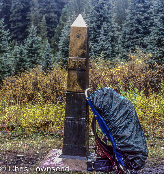
Monument 78, September 24

On the 24th September 1982 I finished my walk along the Pacific Crest Trail at Monument 48 on the USA/Canada border. It was pouring with rain. I didn't mind. I'd just had the greatest adventure of my life. My only regret was that it was ending. 

View from Fire Creek Pass, September 17

The last two weeks of the walk were spectacular as the trail passed through the dramatic alpine mountains of the North Cascades. They were tough weeks too as over and over again the trail climbed to high passes, descended into deep valleys, then climbed straight back up to another high pass. But after over 2000 miles (3200km) of backpacking I was very fit and found the walking easier than back in the much gentler terrain at the start in faraway Southern California. 

Autumn larches at one of my last camps

After the touch of winter at Snoqualmie Pass (see this post) I felt the need to hurry even though I would have liked to draw out these last weeks, stretching every last minute in the mountains and on the trail. But winter was coming. The autumn colours were increasing by the day, the ground a swathe of red. Golden larches shimmering in the forests. Nights were chilly, the ground often white with frost at dawn. Days were hot in the sun but cool in the shade.

Mount Hardy from Methow Pass, September 22

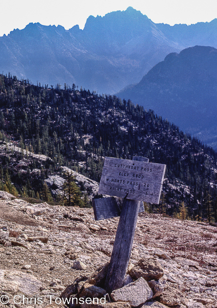
But the weather held until the very last day and the mountains were glorious. This was the most dramatic landscape since the High Sierra. I had wondered if I would be tired of the trail and eager to finish after so many months walking. Not here, not in this magnificent landscape. I felt I could have walked here forever.

Cutthroat Pass, September 22

I couldn't of course. In two days I would be back home. The PCT would live with me forever though and my appreciation and joy in the walk would deepen over the years. 

The full story of my PCT hike is told in my book.


Saturday, 18 June 2022

Forty Years Ago On The Pacific Crest Trail: River Crossings

Larry Lake fording Tilden Creek, June 17, 1982

In my last post on my 1982 Pacific Crest Trail thru-hike I wrote that the spring thaw was underway and that "the most dangerous part of the whole walk was about to start". This was due to the rapidity of the thaw, which meant we had many raging torrents to cross every day for six days in the Yosemite backcountry. Guessing this might be the case I'd bought a 60 foot length of 7mm climbing rope in Mammoth Lakes. We used this frequently. It was just long enough. 

Larry Lake in the Yosemite backcountry

The four of us who'd gone through the High Sierra together decided to split into two pairs at Tuolumne Meadows. I've long forgotten the reason but it was unwise. A group of four would have been much safer and more reassuring through this difficult section. As we were on the same route we did meet up occasionally but mostly I was just with Larry Lake, who like me had set off solo at the Mexican border. 

Crawling across logs over McCabe Creek, June 13, 1982

Where we could we crossed creeks on fallen trees, a slow process as the logs were wet and slippery. The roaring water just below was deafening and disorientating and the whole procedure unpleasant.

Crossing Kerrick Creek, June 16, 1982

The going away from the creeks was arduous too. The trail was rarely visible, still snow covered in places or else under water in a flooded forest. In meadows the snow was a mass of suncups - hard edged hollows that were difficult to cross.

Flooded Yosemite forest

The landscape was spectacular and I did at times enjoy it but overall this wasn't my favourite part of the trail. There were just too many creek crossings and the feeling of contant danger was wearing. I was glad when it was over and I could go back to trail hiking. Looking at my photos and reading my journals now I'm thankful and surprised that we survived. I think it's the most continuously dangerous period of hiking I've ever done.

Yosemite mountains

The full story is told in my book.


Sunday, 12 June 2022

Forty Years Ago On The Pacific Crest Trail: The Thaw Starts

The Tuolumne River

On the 12th June 1982 I arrived in Tuolumne Meadows after a 29 day crossing of the snowbound High Sierra. The first 23 days had taken me and my three companions to Mammoth Lakes, where we sent home our snowshoes, skis and crampons as the snow was softening and the spring thaw starting. After two days in Mammoth Lakes, mostly spent eating, we spent four days walking to Tuolumne Meadows and encountered a taste of what was to come with a thigh-deep ford of Rush Creek.

Soft snow between Reds Meadow and Tuolumne Meadows

At Tuolumne Meadows we found the store had opened two days previously. As no-one in Mammoth Lakes was sure when it would open we'd left with 17 days food so our packs were still heavy despite ditching the snow and ice gear. I was shocked on weighing mine at a store - 92lbs/42kg! How I carried it I now have no idea. It had weighed even more for the 23 days to Mammoth Lakes.

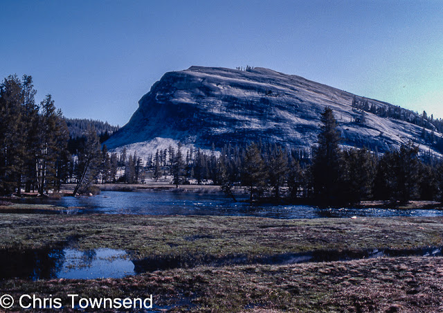
Lembert Dome & the Tuolumne River

Crossing the High Sierra to Mammoth Lakes had been an exciting big adventure. I'd never done anything like it before. Now, I thought, I could start to relax and return to trail hiking. In fact the most dangerous part of the whole walk was about to start. 

I'll tell some tales of the next section soon. The full story is told in my book.


Sunday, 22 May 2022

Forty years ago on Mount Whitney on the Pacific Crest Trail, and a more recent ascent

On the ascent

Forty years ago on May 22, 1982, I climbed 4.421 metre Mount Whitney, the highest peak in the 48 contiguous states in the USA, as a side trip from my Pacific Crest Trail hike. The High Sierra was snowbound, so this was a crampons and ice axe ascent. With my three companions I camped at Crabtree Meadows, a superb site where we were pleased to be able to pitch our tent on dry ground rather than snow.

Camp at Crabtree Meadows

The ascent was exciting and, in a few places, quite scary as we edged round bulging rock buttresses on steep snow with dizzying drops under our feet. The views from the summit were vast, with mountains disappearing into the distance on three sides and to the east the shimmering pale slash of semi-desert Owens Valley far, far below.

On the summit

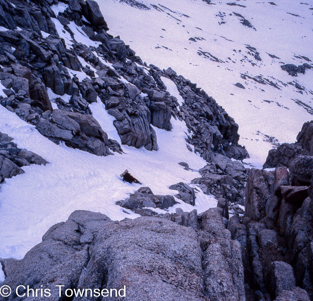
Not wanting to traverse the crest round those buttresses again we decided to glissade down one of the many snow-filled gullies on the west face of the mountain. This proved equally exciting, especially when Larry lost his ice axe at a narrow stony section of the gully and ended up spreadeagled on his back out in the middle of the slope, held there by the crampons on the back of his pack. I climbed down to him, retrieving his axe along the way, and we then kicked steps down to gentler snow.

Glissade

I didn’t take many photos on the climb, it was too intense, and we didn’t linger, not knowing how long it would take or if the weather would change. As it was the day took thirteen hours. I was the only one with a camera, which I handed to Larry to take pictures of me at times.

On the summit in 2016

Thirty-four years later I climbed Mount Whitney again in very different conditions. This was on my walk from Yosemite Valley to Death Valley and I made the ascent in mid-October after a long dry summer. This time I camped a little nearer the mountain at Guitar Lake, another spectacular site, and descended the far side. Free of snow the ascent was much easier though it was actually colder on the summit due to a strong wind.

Camp at Guitar Lake, 2016

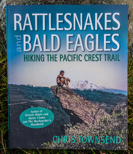
You can read the full story of my first ascent of Mount Whitney and the rest of my Pacific Crest Trail thru-hike in my book Rattlesnakes and Bald Eagles.


Tuesday, 8 September 2020

Into the Arctic and the Winter: The Final Stage of My Yukon Walk, September 1- September 8, 1990


When I left the Eagle Plains Hotel (see my last Yukon post) I knew I was on the last part of the walk but I didn't know exactly where I would finish or how long it would take me to get there, wherever it was, so I set off with two weeks supplies and the heaviest pack of the trip. I was pretty fit of course and the load was not the burden it would have been at the start of the walk.

My plan was to follow the remote Richardson Mountains north at least as far as the pass where the Dempster Highway crossed them into the Northwest Territories. Autumn colours and cold temperatures showed that summer was over. Chilly rain fell frequently and I was glad of the tarp I'd brought as a cooking shelter.

After crossing the Arctic Circle I climbed up into the Richardson Mountains. These are built of sedimentary rocks and form long undulating ridges that make for superb walking and I had one of the best days of the whole trip striding along the crest.

The weather however did not let me stay on the crest for long. Snow began to fall and soon a blizzard was raging. I was blown off my feet once and could then only progress by almost crawling. This, I realised, was crazy so I descended cautiously down steep and slippery moss and boulders to easier terrain. I camped in heavy rain and strong winds on open ground with little shelter. The storm battered the tent, easing towards dawn as the rain turned to snow.

I left that camp in a white-out and slogged through soft deep snow to a final camp. Somewhere during the day I left the Yukon Territory. Another desperate day in driving snow and hail staggering through ankle- to thigh-deep snow led to the Dempster Highway. A truck slowed and stopped. The walk was over.

The walk had taken 83 days and I reckoned I'd walked well over 1,000 miles, though as I couldn't trace some of my route exactly on the map I didn't know for certain. The distance didn't matter though. It had been a great adventure.

I wrote a book about the walk. It’s long out of print but I expect there are second-hand copies around.


Photographic Note: I carried two SLRs, the Nikon F801 and FM2, with Nikkor 35-70, Nikkor 24mm,and Sigma 70-210 lenses, plus a Cullman tripod. Films were Fujichrome 50 and 100 slide ones. The total weight with padded cases was 4kg. To digitise the slides I photographed them on a lightbox with my Sony a6000 with a Sony E 30mm macro lens.