Monday 31 July 2023

Musings on Tools for Writing, Photography and More


The point of tools is to do a job. The right tools do the job well, the wrong ones don’t.  What constitutes right and wrong depends on several factors, including how you and the tool interact. The right tool for one person may be wrong for someone else. For me the tools I use for writing and recording are important. I want them to be ones I can use without thinking. If the process interferes with my thoughts then I want a different tool.


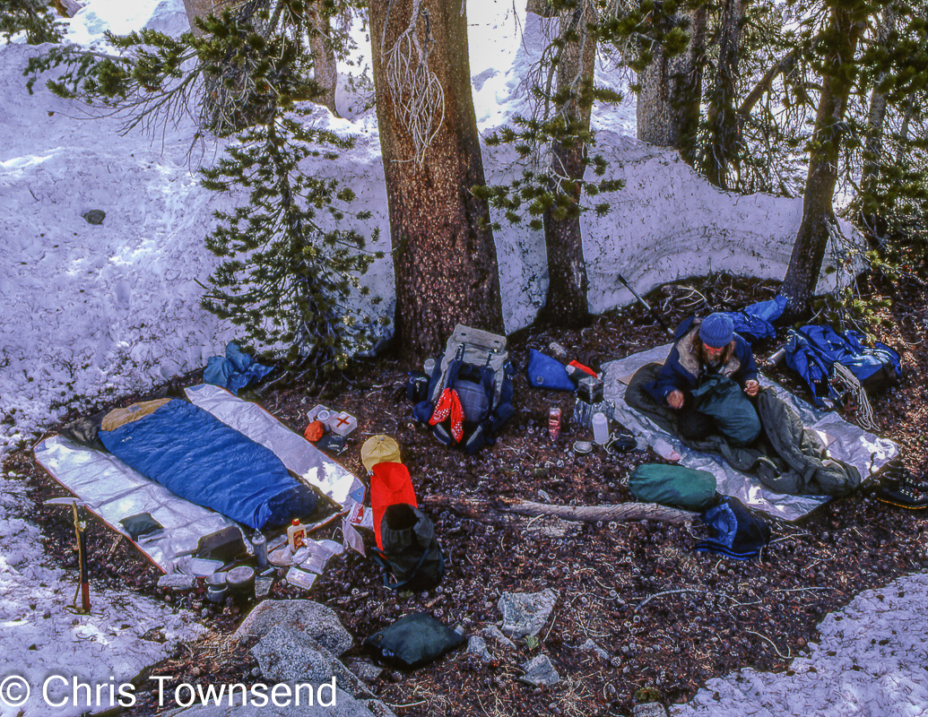
I was thinking about this after reading a comment on Threads by Alex Roddie (he’s alex_roddie on that site, I’m christownsendoutdoors) about note-taking and journaling tools in which he agreed with another poster that the best app for journaling was a notebook. I agree, to some extent. When camping I use a notebook. I’ve tried making notes on various digital devices (smartphone, tablet, and before them a Psion handheld computer – still in a drawer somewhere I think) and it’s just too difficult by headlamp in a tent or even just sitting outside on a log or rock. Pen and paper is far easier, even if I sometimes have difficulty reading my scrawl months or years later. Currently I used the excellent Thrunotes notebooks. (If you want one you’ll have to wait until next spring or summer though as they’re not available again until then).


At home I do all my writing on a PC. I like the full-size keyboard and the large screen. However brief notes and lists go on paper. I use the back of sheets that have arrived with magazines or products for this and have a pile of them on my desk right next to the keyboard. I have a notebook too but only write stuff I want to keep and can’t be bothered typing out in this. Ephemeral stuff on bits of paper gets chucked away eventually.

Dates I need to remember or be reminded about go in a desk diary and an online calendar. I look at the former more often but the advantage of the latter is that I can enter a reminder for a day or two before that pops up on my PC or phone. The desk diary can’t do that! I have a wall planner too. It used to be on the wall behind my PC so I could look up from the screen and see it. This year I moved it to a different wall where it’s more accessible and so easier to write on. I’ve hardly used it though as I can’t see it without turning round. I need to move it back! Office organisation matters.

This system, if it can be glorified with that term, works for me. Others may do everything using digital tech or by traditional means. Outdoor writer Hamish Brown writes his books and articles longhand, Paddy Dillon writes his guidebooks on a handheld computer during his long walks. Neither method would work for me. We’re all difficult. The key is finding what works for you not for anybody else.

In finding the right tools I’ve never bothered whether something is old tech or new tech, low tech or high tech. I use a mixture, as with the pen and paper and PC on my desk. In the hills I have a smartphone and an e-reader along with my notebook and pen. They’re all tools.


The e-reader is one of my favourite digital products as it saves me lots of weight and vastly increases my choice of reading. I used to carry a paperback on overnight trips and several on multi-day trips, including nature and route guides. I now have a library on a device that’s smaller and lighter than a paperback. I love it!


The smartphone is mostly for navigation in the hills. I carry a printed map as well though. Not just as a backup but because I can spread it out in the tent and get an overview of the area and maybe consider options for the next day. If it’s not too windy I can open it on a high point and identify distant features and get a general view of the landscape around me too.

My 2010 smartphone on the Pacific Northwest Trail

If I do any typing on the smartphone it’s usually just short texts. My fingers just aren’t made for tiny virtual keyboards. I don’t like writing anything much longer than a few sentences on a phone. The exception is on multi-day walks when I want to write blog posts or send updates to The Great Outdoors. Then I have no choice but to use my smartphone. It’s hard work! I’ve been doing this since my Pacific Northwest Trail thru-hike in 2010, the first walk on which I took a smartphone (here’s an example) and it hasn’t become any easier even though smartphones are quite a bit bigger now.

My main photography is done with a mirrorless camera with the smartphone as a backup. This is another area where I love digital. Having discovered a few unused rolls of film last year and still having some film cameras I tried film photography again for a while and was reminded why I really like digital and was very happy to stop using film. (See this post). Alex Roddie however has fallen in love with film and old film cameras and is producing some lovely photos.


Since 2010 I’ve used Sony APS-C mirrorless cameras. The basic design hasn’t changed much, which is good as it means that when I get a new one, as I did earlier this year (see this post), it’s familiar and I can quickly learn how to use it. There may be better cameras. I don’t know. And really I don’t care. My cameras do the job I require and that’s what’s important. They’re a means to an end and as long as the results are fine and I can achieve them easily then they’re doing their job, just like the notebook and pen, and the PC, and the sheets of paper. Just tools.

Thursday 27 July 2023

A Visit To Brew Dog's "Lost Forest" - not much change!

A brief break in the rain

I didn’t see what I was expecting to see and this was good. For once. What wasn’t there was any tree planting or sign of tree planting on Brew Dog’s Kinrara estate which straddles the border of the Cairngorms National Park and includes Geal-charn Mor, a Corbett.

When I went there last summer I found long lines of fencing being constructed across the hillsides (see here). By this February the fencing was complete (see here) but nothing else had changed as far as I could see, though the land was snow-covered so I thought I might have missed something.

Trees returning

Late July and I did expect to see some signs of forestry activity but no, it looked much the same as last summer. Looking closely regenerating trees – pine, birch, rowan – were coming along nicely and a bit bigger than last year. Brew Dog’s “Lost Forest” is returning without any need for planting.

I walked up to the top of the estate track known as the Burma Road that runs from Strathspey to the River Dulnain. The top of Geal-charn Mor lies some 130 metres higher and a little over a kilometre away, an easy walk over mostly boggy heather moorland. The rain was beating down and cloud covered the top so on this occasion I didn’t go the top though. Instead I wandered a little way down towards the Dulnain to see if there was any sign of planting here. There wasn’t. Maybe there is lower down.

Purple time

Despite the rain and the lack of the forecast evening clearance (instead the rain got heavier) this was an enjoyable walk. Seeing young trees poking through the heather is always heartening. And the heather itself was turning purple and shining in the sombre light. There were other flowers too with bright blue Scottish bluebells standing out.

Scottish bluebells

Occasionally there were hazy views of the hills. Once or twice the sun broke through briefly, lighting up the land before the clouds closed in again. Lower down the birches, rich in their summer finery, looked glorious.

There are hills in the cloud

Will planting start soon? I hope not but probably. It’s unnecessary. The forest is coming back and should be left to do so. 

It rained


Wednesday 26 July 2023

Mountain Paths: My Thoughts


Following my post on the new It's Up To Us campaign from Mountaineering Scotland and the Outdoor Access Trust for Scotland about upland path maintenance I've written a longer piece with some stronger views  for The Great Outdoors which has just appeared online - https://www.thegreatoutdoorsmag.com/opinion/fund-mountain-path-repairs/

Tuesday 18 July 2023

Strange hours, dawn light, a little-visited Cairngorms ridge


The heavy rain was easing as I set off. It was already 8.30 in the evening. The forecast was for a short break in a week of rain and thunderstorms. Threatened thunderstorms anyway. Every day. Having been out in exposed places in thunderstorms on too many occasions when they’re forecast I stay off the hills.


As I left the woods behind a deep bright chasm appeared in the clouds as the sun neared the horizon. Soon afterwards I watched the sunset colouring the sky.


Continuing on in the twilight I didn’t start looking for somewhere to camp until 11pm. It was after midnight before I found anywhere. The rains of the last week had saturated the ground. Everywhere oozed water. Eventually I found a flat spot slightly above the bogs. I hoped it would have a good view. But that had to wait for the next day. Immediately I wanted a meal and then sleep. At 2am I finally switched off my headlamp and closed my eyes.


Brightness woke me, shining straight into my face. 5am and the sun was rising. A golden light suffused the landscape. I was out of the tent in minutes, marvelling at the world. 


High above the granite tors of the Barns of Bynack shone. Through a telephoto lens I could see the details of these distant rocks.


Looking away from the sun I could see low clouds creeping over the hills. The gold light wouldn’t last. Barely half an hour passed and the sky was grey. I was soon fast asleep again, not waking until 11.30.


Outside rain was falling and the highest hills were hidden, the glory of the dawn long gone. Clouds swirled around the Barns of Bynack.


My plan was to climb Creag Mhor, an 895 metre Corbett, then follow its north-east ridge which stretches over 7 kilometres from the river Avon to the Water of Caiplich. I’d been up the hill a few times before but always just up and down to the summit. I’d never walked that ridge.


The ascent was short and easy, if boggy in places, as I was already at 700 metres. Granite tors decorate the summit and other little tops along the ridge. Up here the vegetation was short and sparse and there were large patches of gravel and flat stones, typical Cairngorm plateau country. The walking was easy, the views splendid despite the racing clouds. There was no path and no cairn on the summit, though I did find one on a minor top. I guess few people come this way. Ravens circled me, curious.

As the ridge declined the terrain became boggy with deeper heather and many tussocks, making the going tough. This continued as I left Creag Mhor to cross the lower slopes of Bynack Mhor to rejoin my outward route. Back in the woods the rain became heavier. In Aviemore it was torrential.


The next day a thunderstorm finally broke over my house. I was glad I was inside and glad I’d seized the very brief gap between storms. The half hour of dawn light would have made the whole trip worthwhile on its own. The fine Creag Mhor ridge added to that.

Wednesday 12 July 2023

Refilling & Recycling Backpacking Stove Gas Canisters


Backpacking stove gas canisters tend to be replaced when almost empty because the heat from them is no longer enough to be of use. At least that’s what happens to my canisters. Stoves with regulators, low profile stoves with preheat tubes so the canister can be turned upside down, and stove systems with pots with heat exchangers are more efficient at using up gas than simple screw-in canister top stoves but there is always a little gas left when the stove no longer puts out heat.

This presents two problems. How to get the last gas out of a canister and what to do with the growing pile of almost empty canisters, given that they can’t be recycled with gas still in them. There are two different tools for this that actually complement each other.

The first is a gas transfer tool that lets you fill one canister from another. This consists of a two-way valve that screws into both canisters. To ensure the gas flows from one canister to the other there needs to be a heat differential between them with the canister you’re filling colder than the one being emptied. Putting one in the freezer for five minutes and the other in sunshine, or at least a warm room, should be enough.


Once the canisters are screwed in place and the valve is opened you can hear the gas rushing into the bottom canister. Once this stops you can close the valve.

To avoid overfilling a canister, which would be dangerous, I weigh the canisters and ensure that the total amount of gas in both canisters is less than that in a full canister – around 75-85%. Canisters have the amount of gas marked on them – 110g, 230g, 450g are common – so If you know the weight of a full canister (about 380g for a canister with 230g of gas, the size I mostly use, depending on the brand) you can work out how much gas a canister contains.

The tool I use for this is the FlipFuel and it works really well.


Now it might seem that this fuel transfer process leaves one canister completely empty, but I haven’t found this to be so, which is where the other tool comes in. To be recycled a canister should be punctured and preferably at least partly flattened (they are tough - try a sledgehammer!). To ensure there is no gas left before puncturing the canister another valve can be attached that vents the very last bit. This valve is part of the Jetboil CrunchIt Butane Canister Recycling Tool which also has a sharp spike for puncturing the canister when fully empty.

I was surprised to discover that when no more fuel would transfer between canisters and I attached the CrunchIt to the apparently empty one gas was still vented, sometimes a surprising amount. Only when the hiss of this has died away and I can’t hear any gas coming out even with my ear close to it do I puncture the canister. The empty canister can then be recycled with other metal cans.


Before I discovered the FlipFuel I was wasting a lot of gas by venting almost empty canisters with the CrunchIt. Now I use the two together.

The valves of both tools are designed for the common Lindahl Valve used on most small gas canisters designed for backpacking stoves. The brand of canister doesn’t matter.

I should point out that I always use both tools outside and nowhere near any open flame.

These are not items I’ve ever carried with me, but I guess on long trips I might do so if I was taking several canisters and thought I might want to transfer fuel between them or puncture and flatten empty ones for carrying. They’re both small and at 36g for the FlipFuel and 32g for the CrunchIt wouldn’t add much to the load.

Monday 10 July 2023

Bivouac Thoughts

With Larry Lake in the High Sierra on the Pacific Crest Trail

My last bivouac was seven years ago, Every camp since then - and there have been hundreds - I've slept in a tent or under a tarp.This isn't because I hate bivouacs. In fact I love them. Sleeping under the stars without a shelter is my favourite way to spend a night in the outdoors. That is, as long as it's dry and calm, there are no biting insects around, and it looks like staying that way. Otherwise I prefer the comfort and protection of a shelter. That means I rarely bivouac in the Scottish Highlands. In fact I can't remember the last time I did so.  I have great admiration for those like the amazing Hazel Strachan who bivi in the Highlands regularly and are adept at finding superb sheltered bivi sites. Maybe it's laziness but I just find it easier and simpler to use a shelter.

In the Superstition Mountains on the Arizona Trail

Over the years I've bivvied hundreds of time. On the Arizona Trail I did so all bar a few nights. Deserts are, I think, the perfect place for bivouacs along with dry mountain ranges with settled climates like the High Sierra in California.

I've been thinking about these bivouacs again due to a post by sidetrackedmag on Threads asking for people to  show their favourite bivi photos. Alex Roddie then posted some superb images - including one that showed why I don't bivi unless it's dry! I followed with some of mine and decided I'd put them on my blog with a few comments.

In the New Mexico desert on the Continental Divide Trail

Bivvying regularly night after night meant I developed a system for organising my gear so everything I needed was to hand while I was in my sleeping bag. I do that in a tent or tarp as well of course but stuff does tend to get scattered around sometimes as I know it can't stray far. Gear needs to be kept under more control when bivouacking!

In the Grand Canyon on the Arizona Trail

One advantage of a bivi is being able to use my pack as a backrest by propping it up with trekking poles. I love just sitting there watching the world fade into darkness and the stars come out. The bivi in the Grand Canyon pictured above is one of my very favourites. It was amazing to have the canyon to myself and to see it come to life as the sun rose.

San Lucas Canyon, Death Valley National Park

My last bivi was on the final night of a walk from Yosemite Valley to Death Valley. I'd descended from 11,050 foot (3368 metre) Telescope Peak to sleep on the edge of the vast flats of Death Valley, a superb spot and a tremendous place to wake for the last day of the walk. A perfect bivouac!

On the edge of Death Valley


Sunday 9 July 2023

A Look At The August Issue Of The Great Outdoors

 The August issue of The Great Outdoors has just been published. It features the Gear of the Year Awards. Producing these involved a great deal of work by the eight judges. We tested all the products on the shortlist and then had discussions as to the winners and runners-ups. In all we gave 32 awards to products in 16 categories. 

Also in the gear pages James Roddie and Will Renwick revew six three-season, two-person tents, and Fiona Russell and Peter Macfarlane review eight midlayers. 

The main features begin with Sarah Jane Douglas describing a Knoydart weekend of mountains, camping, packrafting, and a fresh start after becoming cancer free. David Lintern accompanied her and took the excellent photographs.

In the Lake District James Forrest circles Great Gable on two historic traverses. 

Much further afield conservationist Katy Ellis walks the length of Europe's first Wild River National Park, the Vjosa in Albania, and Alec Forss returns to the Swedish wilds after two years away for a camping and packrafting trip.

Artist and climber Tessa Lyons is Creator of the Month. The Comment column is by Mary-Ann Ochota on the important question of what to do about takine a dump in the wilds. Trail of the Month is the Beara Way in Co.Cork, described by Alex Roddie. In New Books Francesca Donovan reviews In Her Nature: How Women Break Boundaries in the Great Outdoors by Rachel Hewitt and Megan Carmichael reviews Finding Hildasay by Christian Lewis, Jim Perrin looks at Hergest Ridge in his Mountain Portrait, and Emma Schroeder re-enters England on her round Britain coast walk.

The ten Wild Walks in this issue run from Shetland where Ian Battersby visits Esha Ness to Cornwall where Tom Gent visits the Ding Dong Mine and Chun Castle. In between these far ends of Britain Alex Roddie climbs Beinn Damh in Torridon, James Forrest climbs Ben Vane in the Arrochar Alps, Vivienne Crow strides out along the Ettrick Horseshoe in the Southern Uplands, Andrew Galloway makes a circuit of Glaramara, Rosthwaite Fell and Bessyboot in the Lake District, staying in the Lakes Norman Hadley climbs Hindscarth and Dale Head, in Eryri Francesca Donovan wanders up Cnicht, in Pembrokeshire Fiona Barltrop walks the coast from Strumble Head to Trefin, and on Exmoor Roger Butler walks Cheriton Ridge and The Chains.

Friday 7 July 2023

It's Up To Us: campaign for upland paths by Mountaineering Scotland and Outdoor Access Trust for Scotland

An Teallach

There's no way round it. The paths we walk in the hills and mountains are hammered by our boots and shoes. The more popular the path the greater and faster the wear and tear. Weather extremes, which are increasing, have an adverse effect too. Too many of our upland paths are becoming badly eroded, damaging to the environment, eyesores, and often unpleasant to walk on (the last being a reason so many spread out as the most badly damaged sections are avoided for the edges).

The solution is maintenance of course, regular maintenance. If neglected too long a complete reconstruction may be needed. 

Path work is slow and laborious. It takes time and many hands. That means it takes money, a great deal of money. One metre of path costs on average £90 to repair and at least 410km of paths are in need of serious repair.

This new It's Up To Us campaign from Mountaineering Scotland and the Outdoor Access Trust for Scotland calls on all who care about our hills - hillwalkers, mountaineers, organisations, businesses and more - to contribute.

Initially the campaign aims to raise £300,000 for path repairs on An Teallach, one of the great mountains of the Scottish Highlands.

Beyond this fund-raiser the campaign aims to develop a long-term model for funding upland paths in conjunction with landowners and government, something that is sorely needed.

Rapidly increasing erosion on a path on Carn Ban Mor above Glen Feshie, a popular route to the Munro Sgor Gaoith

This is an excellent campaign that should be supported by all of us who love the Scottish hills. I am pleased and honoured to be one of the 16 ambassadors helping and promoting the scheme. You'll be hearing about it from me again!

You can sign up to learn more and to donate here.

Wednesday 5 July 2023

Photography Post: the amazing power of DxO PhotoLab editing software

Image after processing in DxO PhotoLab

DxO PhotoLabs is raw photo editing software designed to bring out the best in your images, I've been using it for processing noisy images for several months now. I've been impressed with the results and wondered what it could do with older images. After working with a few I'm astonished. Images I'd kept just for the memories have leapt in quality revealing details I never knew were there and losing ugly noise.

The above photograph was taken handheld in 2010 on my Pacific Northwest Trail walk with my 8 megapixel Canon 350D DSLR camera and Canon EF-S 18-55mm f3.5-5.6 lens. The ISO was 1600 and the settings 1/5 second at f5.6. On the original raw file the dark sections are solid black and the whole image has a great deal of noise, which isn't surprising given the equipment and the settings.

Original raw image

DxO has a huge database of camera and lens information and tailors processing to the specific equipment used to take the image. In this case it has produced amazing results from an under-exposed image taken at far from optimum settings with camera equipment that whilst okay for its day doesn't compare with current gear. Details have appeared in the shadows (these show up better with a high resolution image on a large screen than on this small JPEG), the noise has been minimised, and the image is sharper. Here's a crop from the processed image. I wouldn't have believed I could get such detail and sharpness from cropping an image from that camera and lens.


Because of the noise and underexpsoure I processed the image with DeepPrime XD, the most powerful of four denoising options. This does take a little time and the resulting DNG file is 38mb. The original raw file is 13mb. For most images this isn't necessary and processing is much quicker. But for images like this it's wonderful.


Sunday 2 July 2023

Meall a'Bhuachaille, forest regeneration, and the power of photography

View over Ryvoan Bothy from the lower slopes of Meall a'Bhuachaille, April 2004

Visiting the same locations year after year you can’t help but notice changes. How great these are may not be apparent though. I’ve walked through Ryvoan Pass and climbed Meall a’Bhuachaille in the Cairngorms several times every year for over thirty years. It’s a great hill for a half day, for bad weather, to show other people the area. The views are superb, and the walk takes you from the forest to a bare summit, a journey through the Cairngorms in miniature.

View over Ryvoan Bothy from the lower slopes of Meall a'Bhuachaille, June 2023

One of the many joys I find in this walk is seeing the regeneration of the forest, seeing the trees spreading and advancing across the landscape. This year I went up Meall a’Bhuachaille on the last day of June, a muggy day with mist and drizzle. The land was green and lush. I took photographs as usual, mostly as a record as the light was flat and hazy. Such record shots can be significant though.

Back home I was looking for an old image on my computer when I came on ones of an ascent of Meall a’Bhuachaille in 2004. I was immediately struck by how bare the landscape looked. Where were all the trees? I hadn’t realised just how much had changed, just how much the forest had spread. The photographs are a powerful record of this.

Looking over the plantation to Loch Morlich, July 2007

Looking through other photographs I found ones showing the large plantation that lay south of the mountain, the bare ground after the plantation was felled, and, from my recent trip, the regeneration now springing up. The land has gone from a dense regimented tree farm to bare ground to a new forest in a little over a decade.

The felled plantation visible in the centre of the image. Note the block of pines left standing. April 2013.

Felling may have removed the mature spruce trees of the plantation, but their seeds of course remained and many young spruce trees are springing up. However there are pines, birch, rowan, and juniper as well. The new forest won’t be the same as the old pine forest that was there before the spruce, but it will be a far more diverse, natural forest than the plantation.

Regeneration on the site of the plantation around the block of pines. June 2023

Photographs convey all this far more than words or charts or facts and figures. The changes are clearly visible. I’m glad I’ve always taken photos even when conditions weren’t promising. I just wish I’d taken more.

Another view over Ryvoan Bothy, April 2004

Similar view to the one above, June 2023