Showing posts with label guidebooks. Show all posts

Saturday, 23 July 2022

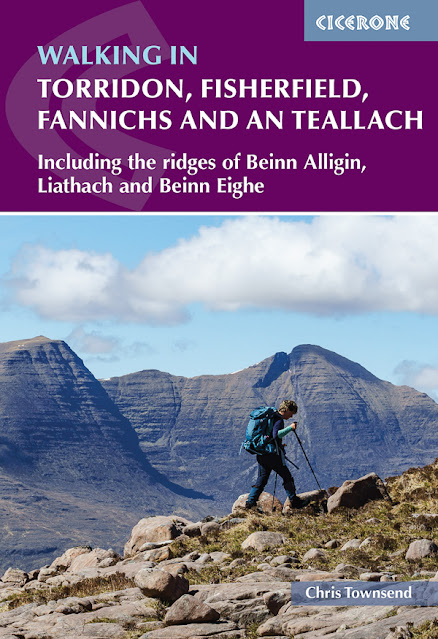
New book with a rather long title out now!

My latest book has just been published, a guide to the huge region of dramatic mountains between Glen Carron and Little Loch Broom in the NW Highlands of Scotland. All the big names are in of course, as shown in the title and subtitle, but the book also includes all the other hills in the area and some of the smaller ones are real gems. There's 50 routes in all. 

The book has over sixty of my photographs, mostly taken over the last two years. Indeed, getting the photographs was more difficult than researching the routes. The latter could still be done on dull or misty days. As book full of cloud-shrouded hidden hills would not be a good idea (there are some pictures like this - I didn't want to give the impression it's always sunny in this region!) I made many visits to take pictures in good conditions. 

Slioch & Lochan Fada

Of course there are many photos I took that don't appear in the book, like the one above. I submitted 150 of the 1400 or so I took. Here are a few more of those that didn't make it into the book.

Ghlas Mheall Liath, An Teallach

Sgorr Ruadh

Beinn Damh & Loch Coire an Ruadh-staic

A'Mhaighdean & Fuar Loch Mor

The book can be ordered direct from the publishers -  https://www.cicerone.co.uk/9781786310286

Friday, 6 May 2022

New book coming soon


My next book will be published July 15th. It's a guide to the huge region of dramatic mountains between Glen Carron and Little Loch Broom in the NW Highlands of Scotland. All the big names are in of course, as shown in the title and subtitle, but the book also includes all the other hills in the area and some of the smaller ones are real gems. There's 50 routes in all. 

The book is also packed with my photographs, mostly taken over the last two years. Indeed, getting the photographs was more difficult than researching the routes. The latter could still be done on dull or misty days. A book full of cloud-shrouded hidden hills would not be a good idea (there are some) so I made many visits to take pictures in good conditions. 

My greatest success was on An Teallach. I'd traversed the mountain several times and visited it many more in the past but not once had it been clear. It seemed that whenever I went near it the clouds descended. With a forecast for clear weather I walked in one evening last July and camped not far from the mountain which was shining gold in the late sun. I didn't want just a long shot of its line of jagged peaks though, I wanted pictures taken on the mountain itself, showing it in all its glory. The next day the mist was down. My heart sank. Maybe this would be another ascent seeing nothing. 

On An Teallach

Then the mists began to clear high above and sink down below the summits. I climbed out of them to a brilliant sunny day, sharp, clear and perfect for photographs. I felt energised - and relieved. I wrote about that trip here.

The book can be ordered direct from the publishers -  https://www.cicerone.co.uk/9781786310286

Thursday, 4 February 2021

Book Review: The Munros by Rab Anderson and Tom Prentice


The latest edition of the Scottish Mountaineering Club’s The Munros is a wonderful book, arguably the best on the Munros yet. Unlike the first three editions this one is much more than a guidebook – though it does that far better than before. It’s also a great book for browsing and daydreaming.

This is a much bigger book than previous editions. The format is a little larger and there are far more pages – 384 compared with 236 for the first edition and 282 for the third (I don’t have the second one). That means more photographs, including double-page spreads for each section, longer descriptions, and larger maps. The Introduction runs to four pages – previously it was one – and has sections on Sir Hugh Munro and on Munro’s Tables. The latter appear at the end of the book for the first time, along with a list of the Munros by height, and an alphabetical index.  Having the Tables in the book is useful as they give a quick reference to the different sections with relevant OS map numbers, grid references, and page numbers.

One big and welcome change is the inclusion of the subsidiary Tops, both in the route descriptions and in the lists. Maybe more people will now include the Tops in their Munro rounds. They are well worthwhile but have been neglected by most guidebooks, including until now the SMCs. When I was planning my 1996 continuous round of the Munros and Tops the only information was in Irvine Butterfield’s The High Mountains of Britain and Ireland and that was scant. I remember plotting the positions of Tops on OS maps, which didn’t name many of them, from the grid references in Munro’s Tables

The design of The Munros is excellent. It looks really good from the clean lines of the cover – no words on the picture – to the double-page spreads introducing each section and the coloured maps, which have more details than in earlier editions.

The route descriptions are more comprehensive with many options described and are more enjoyable to read just for pleasure than previous ones. Long routes over many Munros are described, not just the one or two standard routes (a half-serious joke about the first edition was the suggestion that to avoid crowds on the hill you should read a route description and then take a different one on the hill).

I’m really enjoying looking through this book, admiring the photos, and reliving walks through the words. I already have more than enough books on the Munros. This one is still a welcome addition to my collection. Credit is due to authors Rab Anderson and Tom Prentice and to the SMC for producing it.

The Munros is published by the Scottish Mountaineering Press and costs £30.