Showing posts with label long distance trails. Show all posts

Sunday, 27 July 2025

40 years ago on the Continental Divide Trail, 15 years ago on the Pacific Northwest Trail

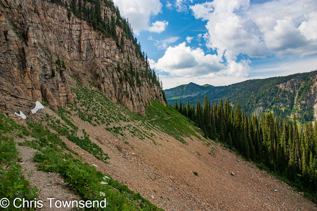
The Highline Trail, Pacific Northwest Trail

On July 27 1985 I reached Macks Inn close to the boundary of Yellowstone National Park and completed the first 815 miles of the Continental Divide Trail. It was day 59 on the trail. I posted a piece on the walk here

On July 27 2010 I camped by Sinclair Creek in the Whitefish Divide region after the first 118 miles of the Pacific Northwest Trail. It was day 8 on the trail. 

Stahl Peak. PNT.

At this point both trails were in the Rocky Mountains but the PNT would soon leave them on its journey east to the Pacific Ocean. The CDT of course stays in the Rockies until they fade away in northern New Mexico.

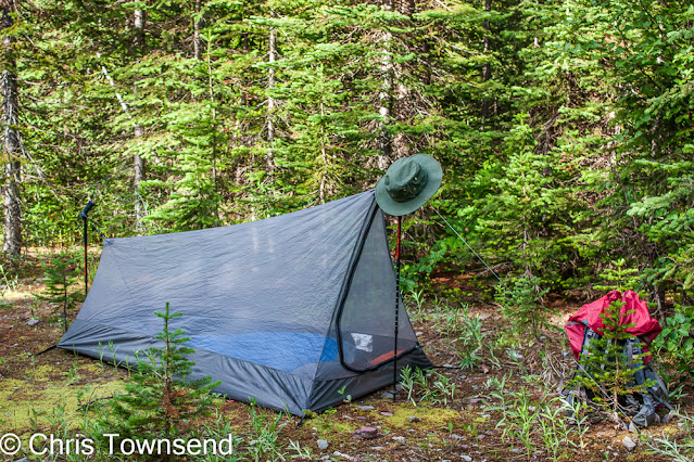
There were mosquitoes! PNT

On the PNT the walking was becoming tougher as I'd left the prepared trails of Glacier National Park behind. It was to become much more difficult, both with the terrain and navigation. On this day I still had trails to follow. It began at a mosquito-infested site where I just slept in the inner mesh tent and finished with thunderstorms and rain. Along the way the scenery was superb and the final section on the Highline Trail wonderful.

There was rain! PNT

On the CDT the walking was already tough, the hardest in fact of the whole walk as there was much bushwhacking and steep rocky slopes and navigation was often just continue south by the easiest way I could find. I wrote in my journal that the ten days I spent in the Beaverhead Mountains were the "toughest walking I've ever done". I did also note that the rewards were "pristine cirques ... no campsites, no trails, no fire rings, no cut trees ... immaculate scenery". 

Immaculate scenery. CDT

On the PNT I was half a day's walk from my first rest stop in the little town of Eureka. On the CDT I hadn't had a break for seventeen days when I reached Macks Inn, a small fishing resort. I needed one! In fact I took two.

Ahead the terrain on the CDT would be much easier though as I crossed Yellowstone National Park with its signed maintained trails and backcountry campsites. 

Whitefish Divide scenery. PNT

A big difference on the walks was my camera gear. 1985 was still film. I haven't yet scanned many of the thousands of images I took. I must do so! 2010 was digital. The images from that walk posted here are ones that didn't appear in my PNT book. All of those with this piece were taken on July 27.

Fire Lookout on 2205m/7235ft Mount Wam. PNT

I 've never written a book about my CDT hike but there is a long chapter about it in my first book The Great Backpacking Adventure (long out of print). The cover of that book is of my friend Scott Steiner who accompanied me on the first 500 miles at a camp below the Chinese Wall in Montana.


Thursday, 24 April 2025

Sixty Years of the Pennine Way


On April 24th 1965 the Pennine Way, the first long-distance path in the UK, was officially opened at Malham Moor. The idea for it came from journalist, walker, and campaigner Tom Stephenson who wrote a newspaper article in 1935 calling for a ‘long green trail’ in England. Thirty years later he was at the opening as secretary of the Ramblers’ Association.

The idea of a long foot path over mountains and moors was a challenging proposal back then as much of the countryside was closed to walkers. It took much campaigning and the passing of the National Parks and Access to the Countryside Act 1949 before the Pennine Way became possible. We have much to thank those who worked for its creation.

The battered copy of Wainwright's guide to the Pennine Way I carried in 1976

The Pennine Way is special to me even though it’s many years since I walked any of it as it was my first ever long-distance walk. This was in April 1976, eleven years after it opened. I encountered bogs, rain, storms, mist, and snow and I relished it all. This what I wanted to do. After I finished I wrote in my journal “this is not the end, this is just the beginning …” and so it has proved.

At the time I was a student, studying for a postgraduate certificate in education. I got the certificate but never used it. The Pennine Way had changed the direction of my life. I didn’t yet know I would make a living writing about the outdoors but I knew I needed to find some way to do many more long-distance walks. Two years later I walked most of the Pennine Way again as part of a Land’s End to John O’Groats walk that became the subject of my first magazine article. I was on my way, on foot and on the page.


Camp below Rakes Rocks, April 7, 1976

When I walked the Pennine Way I was not a photographer and had no thoughts of becoming one. I did want some snaps of my walk though so I took a Kodak Instamatic point-and-shoot camera which used the now long gone 126 film. This produced 26mm square images and I took several rolls on the walk. To describe the results as poor is an understatement! Neither the operator or the camera was up to the dull, dark weather conditions I encountered. But I’m glad I have some pictures from the walk, even if I have to grit my teeth at the quality!

Camp at Top Withens, April 9, 1976

Information on the sixtieth celebrations of the Pennine Way can be found here.

Sunday, 16 June 2024

My Cape Wrath Trail walk

Along the Allt Grannda

My Cape Wrath Trail walk started in sunshine and ended in rain, wind and cold that had me stopping three or four days from the end. There’s no set route. Start in Fort William and walk to Cape Wrath by whichever way you choose. There are suggested routes though, on websites, maps and in a guidebook, all giving various alternatives.

Start in Fort William

From Fort William there are western and eastern options. Having walked much of the western one in Knoydart last year (see this post) I decided to start with the eastern one which initially follows the Great Glen Way. This makes for easy walking and a waymarked path for the first day or so.

Mist rising from Loch Lochy. Early morning at my first camp.

I began at the end of the long hot dry spell in May and was in shorts and t-shirt for the first five days, which took me from Fort William to Morvich and Glen Shiel. After that those garments disappeared into the depths of my pack never to emerge again.

Loch Lochy in the Great Glen

The first section along the Caledonian Canal also provides many places for food and drink and I barely touched my supplies until the evening of the second day. The easy walking continues after the Great Glen Way is left and the route turns west along forest roads above Loch Garry. Once these roads run out at the end of the loch everything changes. An intermittent narrow and hard-to-follow boggy path runs through tussocks and heather. The going is arduous and it took me a while to find anywhere to camp. The landscape improves dramatically however, with a feeling of entering the mountains.

Waterfall on the Allt Grannda

The three days from Glen Garry north over the eastern edge of the Glen Shiel hills to the western end of Glen Affric and then west along the Allt Grannda were a delight with fine views, sunshine, and mostly good paths and tracks. The highlight was the narrow gorge of the Allt Grannda where the path winds across the steep hillside high above the river which crashes down in waterfalls and cascades. This section has been a favourite for many years and I was happy to return after too long away.

The excellent path above the Allt Grannda

At Morvich I ate some fresh food and came down with a stomach bug, which was ironic. I know exactly what it was! I spent a day feeling weak and unwell as the clouds rolled in and rain fell. The dry spell was over.

The Falls of Glomach

I left Morvich for a mostly wet walk to Strathcarron via the Falls of Glomach – as spectacular as ever -, Iron Lodge, Maol Buidhe bothy, and Bendronaig Lodge, a meandering route that would be excellent in good weather. As it was the clouds stayed low on the hills and rain fell frequently.

Much of the time after Morvich was like this

The wet cloudy weather continued as I walked through the Torridon hills and past An Teallach to Inverlael at the head of Loch Broom. However the clouds were often were broken and more interesting visually and there were occasional clearances and bursts of sunshine, especially in the evening. This is an area I know well so I could imagine the big hills that lay hidden all around.

Cloud fill Coire Mhic Fhearchair on Beinn Eighe in Torridon

An Teallach did appear though. An overcast sky made for dull, flat light but the mountain looked as splendid as ever. It was the first hill I’d seen clearly since leaving Morvich.

An Teallach

At Inverlael I had arranged to meet my friend Tony Hobbs who was joining me for the next section to Inchnadamph. I had planned on a day off in Ullapool, which is not far from Inverlael, and Tony had said he’d book somewhere. He had, forty miles away in Lochinver! Everywhere in or near Ullapool was fully booked. So we had a pleasant two nights in the Culag Hotel in Lochinver where we met another CWT walker, also here because everywhere else was booked. In Lochinver we heard the first forecast for the much colder, stormier weather to come.

Waterfall in Glen Douchary

Back on the walk we had good weather for our first camp in Glen Douchary though and for a splendid walk along the lovely gorge in the glen and another camp in the sun by Rappach Water.

Tony Hobbs and his dog Lassie in Glen Douchary

The stormy weather began the next day with heavy showers and an increasingly strong wind as we headed up Glen Oykel. Loch Ailsh was in the mist. The forest was dripping. We did find a small open area in the trees for a sheltered camp. No views, just big Sitka spruce, but we were out of the wind.

Tony and Lassie above the River Traligill after we'd come through the bealach 

Back in the full force of it the next day we continued up the glen and then up to the narrow Bealach Trallgil at just over 500 metres. As we came through the pass the wind was ferocious, blasting right in our faces, which at least meant it was unlikely to knock us off the narrow path into the rocky gorge below. Again that evening we were able to find a sheltered site. Here I began to have doubts about going on. The strong NW wind was meant to continue for many more days, bringing colder air down from the Arctic with snow on the tops.

Walking out to Inchnadamph on the last day

By morning my mind was made up. I didn’t want to struggle into this weather just to reach Cape Wrath. I’d stop at Inchnadamph and come back later for the final few days. I’d walked this section before, indeed I’d walked most of the whole route before, and I am in a position to return at almost any time. If this had been a one-off trip far from home I would have continued despite the weather, as I have done on other long walks. But here, only a few hours from where I live, there was no need.

I enjoyed the Cape Wrath Trail as I always enjoy backpacking, moving on each day, camping each night. It was interesting to do a mostly low level walk through the mountains rather than go over them. I’ll write another piece about my thoughts on the environment along the way soon.

I posted some pictures of my camps on the trail here and some pictures of clouds and mist along the way here.
Saturday, 24 September 2022

40 Years Ago I Finished My Pacific Crest Trail Thru-Hike

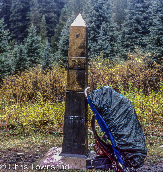
Monument 78, September 24

On the 24th September 1982 I finished my walk along the Pacific Crest Trail at Monument 48 on the USA/Canada border. It was pouring with rain. I didn't mind. I'd just had the greatest adventure of my life. My only regret was that it was ending. 

View from Fire Creek Pass, September 17

The last two weeks of the walk were spectacular as the trail passed through the dramatic alpine mountains of the North Cascades. They were tough weeks too as over and over again the trail climbed to high passes, descended into deep valleys, then climbed straight back up to another high pass. But after over 2000 miles (3200km) of backpacking I was very fit and found the walking easier than back in the much gentler terrain at the start in faraway Southern California. 

Autumn larches at one of my last camps

After the touch of winter at Snoqualmie Pass (see this post) I felt the need to hurry even though I would have liked to draw out these last weeks, stretching every last minute in the mountains and on the trail. But winter was coming. The autumn colours were increasing by the day, the ground a swathe of red. Golden larches shimmering in the forests. Nights were chilly, the ground often white with frost at dawn. Days were hot in the sun but cool in the shade.

Mount Hardy from Methow Pass, September 22

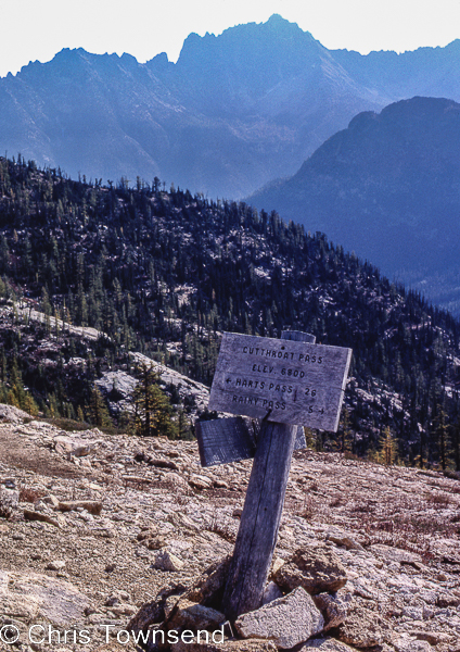
But the weather held until the very last day and the mountains were glorious. This was the most dramatic landscape since the High Sierra. I had wondered if I would be tired of the trail and eager to finish after so many months walking. Not here, not in this magnificent landscape. I felt I could have walked here forever.

Cutthroat Pass, September 22

I couldn't of course. In two days I would be back home. The PCT would live with me forever though and my appreciation and joy in the walk would deepen over the years. 

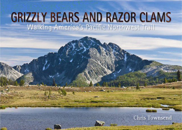
The full story of my PCT hike is told in my book.


Sunday, 12 June 2022

Forty Years Ago On The Pacific Crest Trail: The Thaw Starts

The Tuolumne River

On the 12th June 1982 I arrived in Tuolumne Meadows after a 29 day crossing of the snowbound High Sierra. The first 23 days had taken me and my three companions to Mammoth Lakes, where we sent home our snowshoes, skis and crampons as the snow was softening and the spring thaw starting. After two days in Mammoth Lakes, mostly spent eating, we spent four days walking to Tuolumne Meadows and encountered a taste of what was to come with a thigh-deep ford of Rush Creek.

Soft snow between Reds Meadow and Tuolumne Meadows

At Tuolumne Meadows we found the store had opened two days previously. As no-one in Mammoth Lakes was sure when it would open we'd left with 17 days food so our packs were still heavy despite ditching the snow and ice gear. I was shocked on weighing mine at a store - 92lbs/42kg! How I carried it I now have no idea. It had weighed even more for the 23 days to Mammoth Lakes.

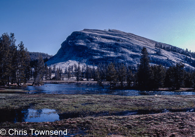
Lembert Dome & the Tuolumne River

Crossing the High Sierra to Mammoth Lakes had been an exciting big adventure. I'd never done anything like it before. Now, I thought, I could start to relax and return to trail hiking. In fact the most dangerous part of the whole walk was about to start. 
I'll tell some tales of the next section soon. The full story is told in my book.


Monday, 9 March 2020

On this day twenty years ago I set out on the Arizona Trail

First camp

On March 9, 2000, I left the Mexican border to hike some 800 miles through the state of Arizona to the border with Utah. I was excited and apprehensive. A desert walk was challenging. I knew from information from the excellent and helpful Arizona Trail Association that the winter had been dry and the always scarce water sources were less reliable than usual. I'd arrived in torrential rain though and spent a day picking up supplies wandering round Tucson in waterproofs as rain crashed off the gutter free buildings. Maybe there would be more water than I expected. There was. And snow.

At the border

The first day was tough, probably the hardest start to a long-distance walk I've ever done. The trail climbed steeply up for 4,880 feet with no water en route and nowhere flat to camp. I had a gallon of water in my pack and I needed it as it was very hot at first. Halfway up I encountered the first snow, which gradually became deeper and deeper until I was wading through a foot of it.
 
Looking back into Mexico

I looked back to dry brown lands stretching into Mexico. Ahead lay 9,466-foot Miller Peak, the highest in the Huachucas Mountains. The first water source was beyond the summit. On the map it said Bathtub Spring. I hadn't expected an actual bathtub though but there it was, sitting surreally in the snow. The water was frozen but a tiny trickle came out of the spout feeding into the bathtub.

Bathtub Spring
My first camp of a desert walk. In the snow. In trees - big magnificent ponderosa pines. As I was to learn the significant timberline here is the lower one, the point at which the desert starts to fade and trees start growing. The mountains aren't high enough to have an upper timberline and the summits are forested.

The walk had begun.


Photographic note: pictures taken with my first digital camera, a 2.3mp Ricoh RDC-5000. I also had two film cameras, an SLR and a compact, and shot over fifty rolls of film. I haven't scanned any of these yet though.

Thursday, 25 July 2019

Thoughts on long-distance hiking and a review of sorts of The Great Alone

Autumn comes to the North Cascades on the Pacific Crest Trail, September 1982

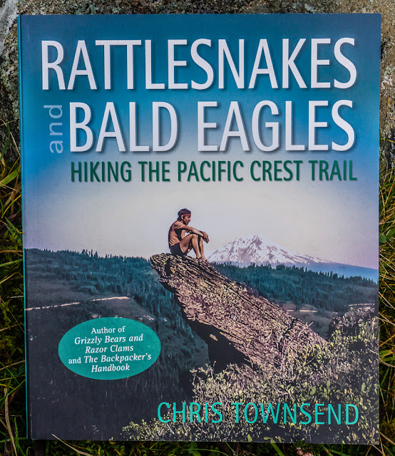
Tim Voors walked the Pacific Crest Trail in 2016. I walked it thirty-four years earlier, in 1982. We’ve both written books about our walks. Tim Voors The Great Alone was published earlier this year. My book, Rattlesnakes and Bald Eagles, in 2014. Both books describe a continuous walk of the trail from Mexico to Canada yet they are very different. Partly this is due to the numbers hiking the trail. 120 thru-hike permits were issued in 1982 and 11 hikers finished the trail. In 2016 3493 thru-hike permits were issued and 753 hikers finished. (See the Pacific Crest Trail Associationwebsite for more information like this). These figures make a huge difference to the trail experience, especially for hikers setting off around the same time, as most do to take advantage of the longest weather window between winters. I often went several days without seeing another person. Voors writes ‘there is always someone who will pass you within a few hours if you need help’.  He also writes ‘the PCT is all about community’. The number of other hikers doesn’t explain the big differences between Voors experiences and mine on its own though, or rather what each of use found the most important experiences.

 
Before I continue I want to make it clear that I enjoyed The Great Alone and think it’s a good book worth reading by anyone interested in long-distance hiking and the effect it has on people. Voors writes well and describes how the trail and the people he met changed him. He also discusses various aspects of PCT life from trail angels to survival skills. Photographs, drawings and paintings by the author conjure up the trail well. The book also stimulated these thoughts, which is what a good book should do.

So this isn’t meant to be a negative review. However, as I read The Great Alone I began to wonder about the title. There are so many people, so many town stops, so little time actually alone with nature. Later in the book it becomes apparent that Voors did feel alone when he only met people at camp and hiked all day by himself. Indeed, he sometimes felt lonely and hurried on to catch people up or reach a road or town. His definition of being alone and mine are very different. I’ve never felt lonely on any long walk. If I meet people during the day and especially if I camp with them I don’t feel alone.  I did hike with others through the snowbound High Sierra on the PCT for security and I did enjoy this but for well over half the trail I was alone and happy to be so. So for me the title of Voors book is a little misleading though maybe others without long-distance hiking experience may well feel the title is right. 

A companion in the High Sierra on the PCT, June, 1982
 
Much of The Great Alone concentrates on roughly the first thousand miles with the last sixteen hundred passed over quite quickly. I wonder if Voors was losing interest by then – or maybe he was just running close to a word limit for the book. Either way the deserts and High Sierra dominate the book with the Cascades rather rushed through.

As I read I also felt an absence. There’s very little about the actual landscapes, little about natural history, geology, conservation, human history. Because I’ve walked the trail I could envisage where Voors was and fill in many of the missing details. I think if I’d never walked the PCT I’d have felt frustrated. I’d want to know about the forests, the desert ecology, conservation designations, the San Andreas Fault, John Muir, strato-volcanoes, the story of the trail itself, the towns along the way. Instead the book is very much about people and about Voors himself. There’s not actually much about the trail or the land it passes through. 

Mount Adams, a 3743 metre stratovolcano. PCT, August 1982
 
There is much in The Great Alone about the toughness of the PCT, about the suffering and endurance involved in a thru-hike. Now a 2600 mile desert and mountain backpacking journey is always going to be strenuous and involve some aches and pains but I never went through the physical and mental injury and anguish that Voors and many of the hikers he met did. Partly this is due to individual natures, but I think a fair amount is due to preparation and experience. Many of today’s PCT hikers seem to have little of either. When I hiked the trail I’d done a fair amount of long-distance walking in Britain, including two 500 miles trips in the Scottish Highlands. I had far worse weather and difficult walking conditions on those trips than anywhere on the PCT. I reckon if you can handle long-distance walking in the Highlands you can manage anywhere! A few years ago one very experienced long-distance hiker did some walking in Scotland and announced the country was unsuitable for long-distance walking due to the lack of decent trails and facilities. Scottish walking is tough! The hikers I teamed up with to go through the High Sierra on the PCT had all hiked the 2,000 mile Appalachian Trail in the eastern USA. 

I don’t think there need be a conflict between a trail being about community and nature or about people and solitude. Some people find a few hours alone quite enough while others, like me, are happy with days or weeks on their own. The longest I’ve been without seeing anybody or even any sign of humanity was ten days on my length of the Yukon Territory walk. I wasn’t even aware I’d be alone that long until I worked it out. I never felt lonely though, there was so much to see and do.
Sharing the experience of a long walk is valuable and creates bonds between people, often people from such different backgrounds and places that they would otherwise never meet. On the trail everyone is equal. This year I took part in the 40th TGO Challenge crossing of the Scottish Highlands (see this post). This was my sixteenth crossing and I was also on the first, 39 years ago. Over the decades I’ve watched the event become more popular and much more people-centred. It’s still possible to take part without meeting many other Challengers – just as I’m sure it’s possible to hike the PCT without being part of the crowd (or moving party as I’ve heard it described, a description that fits some TGO Challengers too). I rarely meet any other Challengers until the finish. Once there I do enjoy meeting others and talking about our crossings. 

'Interesting' weather on this year's TGO Challenge

I walk to experience and be in nature. I am happy to be alone. Others find meeting people and even being part of a group important. Both approaches are valid. There is no right or wrong way to do a long-distance walk. All that matter is to leave little trace of your passing.