Showing posts with label navigation. Show all posts

Friday, 8 April 2022

Thoughts On Smartphone Navigation In The Hills & A Review Of Three Outdoor Phones


The issue of smartphones for navigation in the hills has reared its controversial head again following a BBC website piece with the title "Hillwalkers warned more than a phone needed to navigate mountains" and containing the statement "Some people do not realise phones will just switch off at cold temperatures, leaving them stranded", which is simply untrue. More sensible was the advice from Mountaineering Scotland safety advisor Ben Gibson recommending not just relying on a phone and advising carrying a map and compass as well plus a power bank.

I've written about navigating with phones a few times before but thought I'd expand my thoughts a little here and also post a review of three smartphones designed for outdoor use that recently appeared in The Great Outdoors magazine.

Perhaps the most important point to make is that smartphones, maps, compasses, and GPS units are just tools and to be useful you need to know how to use them and what their limitations are. They're not magic. Map reading is a skill needed whether your map is on a screen or printed.

Now I've been around so long that when I began hillwalking mobile phones and GPS satellites were the stuff of science fiction. Map and compass were the only options. I learnt to use them and couldn't imagine ever not having them. However those much younger have grown up with mobiles and GPS and undoubtedly can't imagine not having them. Suggesting that the tools they are familiar with shouldn't be used or don't work in the hills and they should stick to the old ones is futile and I suspect makes it likely that all the advice of people who say this will be rejected. I know that's what I would have done. If you know someone is wrong about something why trust them on anything else?

That said, having options is wise. Phones can fail or break, though it's never happened to me and I've been using them for navigation for well over a decade. Printed maps can blow away or tear and if paper can get soaked (I prefer ones on plastic). Both have happened to me in the past. Compasses are not infallible either as I discovered many decades ago, long before GPS let alone smartphones, when I walked off the wrong side of Ben More on the island of Mull, following a compass bearing, and discovered that if there are magnetic rocks around compasses can be 180ยบ out. Much more recently I had a compass suffer reverse polarity so the needle pointed south not north, though not accurately enough to use it safely. Whether you use GPS or map and compass as your main navigation tool if you have both you have a backup in case of failure. Or of course two phone. Or two compasses. 


Teaching people how to use a phone for navigation is the way forward, not telling them it won't work. Often problems with using phones for navigation comes down to a lack of skill and knowledge not the failure of the phone. If all you have on the phone is Google maps you'll probably get lost, as you will if all you have is a printed road map. If you're reliant on a preset route, whether downloaded to a phone or in a printed guidebook, and can't map read then you may have problems if you lose the route. Tools have to be the right ones and you need to know how to use them. 

There are many mapping and hiking apps. I currently use OS Maps. Alex Roddie wrote a useful review of apps for The Great Outdoors recently.

"The battery will run out", is often given as a reason for not using a phone for navigation. If you know how to maximise battery life this should not be so (put it in airplane mode most of the time). Carrying a battery charger is wise too. Also, consider a phone with a big battery or one with a replaceable battery (see my reviews below). 

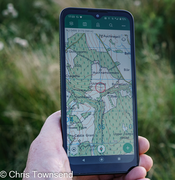
A myth is that phones won't work for navigation without a phone signal. This isn't true as the phone uses GPS satellite signals to show your position not wifi or 4G/5G. You do need to download the maps so they can be used offline - you probably won't be able to do that in the hills.

Whether printed or digital a map for the hills should have contours and other symbols that, when you know how to read them, shows what the terrain is like. In Britain that means the Ordnance Survey or Harvey maps. I do nearly all my navigation with a map. These days it's usually one on my smartphone, though I do carry a printed one as backup and to look at in camp. 

For planning I use a mixture of screen maps and printed maps. On screen I can draw routes and let the software workout distance and ascents. Printed maps I can spread out over the floor and visualise routes over huge areas, a great way to dream. I  love maps. I can spend hours poring over them, studying landscapes and planning routes. 

I still always carry a compass though it may not be used most days. Because I'm so familiar with using one in poor visibility I sometimes get my position on the phone, note the direction I want to take, and then transfer it to the compass as a bearing. I do keep the compass and phone apart though - close together the phone may cause reverse polarity in the compass. Don't carry them in the same pocket!


Summing up: good navigational skills are essential in the hills. And the key one is being able to read a map, whether it’s on paper or on a screen. The latest smartphones are efficient GPS units and with good downloaded maps can be used for navigation. Indeed, being able to pinpoint your position on a map on the screen should make it harder to get lost. A battery pack or spare battery should ensure you don't run out of power. And just in case something does goes wrong, carrying a paper map and a compass or a second phone as a back up is wise..

 
Review of Three Rugged Smartphones
 
From the left: Samsung Galaxy XCover Pro, Land Rover Explore R, Motorola Defy 


Smartphones are generally fairly fragile creatures, needing care, especially when taken into the hills. For years I kept mine in a protective case, handled it carefully, and kept it away from rain, snow, dust and mud. A cracked screen after I dropped my phone on a long walk – not enough to stop it working but I had to baby it the rest of the walk – had me looking at rugged phones designed for construction sites and other outdoor workplaces. I found plenty of big, heavy, chunky, rubberised clumsy-looking phones. They didn’t look very comfortable to carry or use and the specs were minimal. I didn’t think any could replace my phone for all uses.

Then in 2018 Land Rover launched a phone designed for hillwalking and the outdoors. The Explore looked like a slightly bigger standard phone and had all the features of the rugged phones plus much better specs. I took it on the GR5 trail through the Alps and enjoyed having a phone I didn’t have to treat carefully. When I went back to my standard phone I found I resented needing a case so when I replaced it I looked for a rugged phone and was pleased to discover there were now a number of options as well as the Explore.

Having now been using rugged phones for the last year and a half I can’t imagine going back to a standard one. I love having a phone that doesn’t require looking after. I’m now used to ignoring rain, putting my phone down on snow and mud, and slipping it into a pack or jacket pocket knowing it won’t come to harm if I bang it on something. Dropping it isn’t a worry either, though ironically rugged phones are designed to be non-slip. I like not needing a case too. Without one the rugged phones reviewed here are only slightly heavier and barely any bigger than a standard equivalent phone with one. And if the phone gets dirty you can easily wipe it clean.

There are now quite a few rugged smartphones suited to outdoor use. I’ve compared three that I’ve used extensively here. All of them have excellent waterproof, dustproof, and drop specifications. The cameras are all adequate but no more. The other specs are fine for most uses but they’re not as fast as top-end smartphones (or anything like as expensive). However, for the hills they are superb.


Land Rover Explore R    225 grams        £249.      ***1/2


Pros                   customisable dashboard, cost

Cons                  battery life, screen colour

Size                   160 x 76 x11mm

Weight               225 grams

Operating system Android 9/10

Battery              3100mAh

Memory             64GB, micro-SD slot

Cameras            12 MP f1.8 rear, 8MP front

Rather than an update to 2018’s Land Rover Explore this is a new phone with a different design and software. The durability aspects remain though, and it works in temperatures between -30°C and +65°. The screen is protected by Corning Gorilla glass and can be used with gloves or wet fingers. It’s recessed to give extra protection if dropped. The battery is 3,100 mAh, which Land Rover says is enough for 1.5 days with “medium-to-heavy” use.

Although the Explore R is the same size as the Samsung XCover Pro the display is smaller. It also has a slight yellowish colour tinge. However, I soon forgot about this in use. The display is bright and easily visible in sunshine. The screen works with gloves and wet fingers

For mapping the Explore R comes with the OS Maps app and a free 12-month premium subscription.

Like the first Explore the Explore R has a customisable Dashboard page that can give useful information such as sunrise and sunset times, altitude, and compass direction. Some of the information can only be updated with a phone signal though. Other information uses GPS.

I’ve used the Explore R for over a year in every type of weather without any extra protection and it’s always worked fine. There’s a dull finish to the sides and a rough textured back so it can safely be held in one hand.

I think the big drawback of the Explore R is the battery. It will last the 1.5 days claimed, though it’s easy to shorten that if you’re not careful. For a trip longer than a day a battery pack is essential.

https://landroverexplore.co.uk


Motorola Defy         235g   £279      ****1/2        £279       Best Buy

Overall Rating       ****1/2

Likes                       large screen, powerful battery life, cost

Dislikes                   nothing

Size                        170 x 78 x 11mm

Weight                     235 grams

Operating system     Android 10

Battery                    5000 mAh

Memory                   64GB, micro SD slot

Cameras                  48MP f1.8 main, 8MP front

Cost                        £279

The Defy is the biggest phone reviewed yet only weighs a few grams more than the others. The sides and back have a raised, ribbed pattern for a secure grip that’s the best of the three phones. The temperature operating range is -25° to 55°C. The recessed screen is Corning Gorilla glass for protection.

Other than the standard Google apps there’s no preinstalled software so you need to download mapping and other outdoor apps.

The big plus of the Defy is the massive 5000 mAh battery. Using the phone to record my route, check my position on the map occasionally, take a dozen and more photos, send a few texts, and even upload images to social media when there’s a signal the battery lasts two days. With careful use I can make that three.

The Defy arrived for testing at the end of last summer and I’ve used it through the autumn and winter without any problems and without treating it carefully. It’s worked fine in rain and in snow and in temperatures well below freezing. The screen is bright in any light and works with wet fingers and gloves. I like the large size but those with smaller hands may find it a bit more difficult to hold.

The big battery and large screen make this my Best Buy of the three phones, especially as the cost is quite low.

 www.motorolarugged.com


Samsung Galaxy XCover Pro     232g    £469  ****     Recommended


Overall Rating       ****

Likes                       replaceable battery

Dislikes                   quite expensive

Size                        160 x 76 x 10mm

Weight                     232 grams

Operating system     Android 10

Battery                   4050 mAh

Memory                  64GB, micro SD slot

Cameras                 25mp f1.7 wide angle & 8mp ultra-wide angle rear, 13mp front  

The Samsung Galaxy XCover Pro is the most expensive phone reviewed. It does have a better camera than the others and a fairly powerful battery that lasts well. The big plus point though is that the battery is replaceable. This has two advantages. The first is that a spare battery only weighs 76 grams, far less than a battery pack of the same capacity. The second is that if the battery runs out you can just replace it and continue using the phone straight away rather than having to attach it to a battery pack. The battery itself lasts me two days with reasonably careful use.

To change the battery the rear of the phone has to be removed. I was concerned this might be a weak point but after over a year’s use it’s as waterproof and dustproof as ever.

The XCover Pro is designed for construction sites and dusty and dirty workplaces rather than the hills and there are no mapping or other apps and a few features that aren’t really relevant for the outdoors. However, it is very tough and comes with three years guaranteed software and security updates (the other phones have two years).

The phone has a roughened back and matt finish rather than shiny sides to give a secure grip. The size is just right for me to use comfortably in one hand. The screen is only slightly recessed and fills more of the front of the phone than the screens on the other phones. Again, I thought this might be a weak point but so far it’s been fine.

https://www.samsung.com

Wednesday, 24 February 2021

ViewRanger: thoughts, memories, the future

On the GR5 Through the Alps, 2018

ViewRanger, the navigation and mapping app, is changing. In fact eventually the name will disappear as it's integrated into another app, Outdooractive. Recently I asked ViewRanger about the changes and wrote a piece on this for The Great Outdoors online. This elicited a large response. Many people obviously like ViewRanger and don't like the idea of it changing. 

On the Pacific Northwest Trail, 2010

Thinking about ViewRanger I realised that the app has accompanied me on every walk, long or short, for over a decade. No piece of physical equipment has done that. ViewRanger has been on several different phones in that time and has helped me navigate on the Pacific Northwest Trail and the GR5 Through the Alps, and in the High Sierra, Death Valley and, every month, the Scottish Highlands. Sometimes it's made navigation far easier than it would have been with just map and compass. Finding the hidden start of a faint trail in dense forest on the Pacific Northwest Trail, keeping me on the right ridge during a long descent through another forest into Death Valley, crossing the Cairngorm Plateau in a white-out.

ViewRanger in 2009

Having tried ViewRanger for the first time in 2009 I was impressed enough to use it on the Pacific Northwest Trail the next year. Indeed, I bought my first smartphone in order that I could do so. (I was loaned the one for the 2009 trial). After that smartphones came and went but ViewRanger remained. It did just what I wanted it to and it did it reliably.

Death Valley, 2016

Will Outdooractive be as useful and reliable? I hope so but I don't know yet. It's a much bigger app with far more features, most of which I probably won't want. As long as I can ignore them I won't mind that, just as I don't mind the ones that have been added to ViewRanger and which I've never used. My ideal navigation app has good mapping (OS/Harveys in the UK, equivalents elsewhere), gives your position fast and accurately, and can record or follow routes. That's it.

The ViewRanger app will be around for at least a year but it will disappear. I'll be sorry to see it go. It's been part of my outdoor life.


Monday, 4 September 2017

Navigation & Wind on Braeriach

Braeriach from Gleann Einich. My route went up the ridge second from the left.

Clear skies, a moon approaching full, warm weather. That combination tempted me into my first ascent of Braeriach this year. My plan was to photograph sunset and moonrise from a high camp. The last idea was abandoned before I even set out as the forecast was for strong winds increasing overnight and maybe gusting to 60mph by morning. A lower camp and an evening ascent and descent seemed a better ploy.

Braeriach and Rothiemurchus Forest

I approached via Gleann Einich and the north side of the mountain. I love this way to Braeriach, climbing gently through lovely Caledonian pine forest onto open moorland with corrie scalloped Braeriach rising in the distance, huge and brooding. Leaving Gleann Einich I followed the rushing Beanaidh Bheag. There are remnants of an old rough path here but mostly this is tough going through heather, long grass and bogs. At this time of year with the vegetation at its height, hiding rocks and holes, it’s particularly rough. Down here the wind was already strong and I sought a sheltered campsite lower than I’d intended, eventually pitching my tent below a bank some 700 metres below the summit. 

My camp by the Beanaidh Bheag


Setting up camp, having a hot drink, checking the map, repacking my rucksack for the summit, suddenly two hours had gone. Time to set off if I was to make the top for sunset. The going slowly eased as I reached more stony ground with thinner vegetation. Ahead I could see clouds thickening. Loch Coire an Lochain appeared below me, a bright lozenge of shining water. The rocky ridge narrowed. The wind was very strong now though and I needed my poles to stay upright.

The light was going, the cloud sinking, as I reached the summit plateau. Half a kilometre to the cairn. The cloud swept over me. No sunset, no moonrise, no visibility. Just cold damp mist and the roaring wind. A cairn appeared. The summit? Maybe. It would do. Time to turn back before the wind flattened me. I needed to find the top of the ridge I’d ascended – no point going down a longer way – and avoid the very steep craggy corrie walls either side of it. Braeriach’s summit plateau is vast. You could wander in circles here for hours. I looked at the OS map on my phone, the quickest way to check I wasn’t wandering off route too much and much easier than trying to handle a map in this wind, even one in a mapcase. Fifteen minutes later I checked again. Oops. A bit too far west. Head north now. Another look. Should be at top of the ridge now. I continued down, warily. Then a slight gap in the cloud and there to my left was Loch Coire an Lochain, just where it should be. Now I could concentrate on not being blown over or stumbling over rocks.

Loch Coire an Lochain appears during the descent

Eventually the cloud thinned. Soon I was out of it. The sky was clear and bright with stars, except over Braeriach, above which the moon was hidden in the cloud. It didn’t appear until I was almost back at camp. Now on the broad moorland slopes below the northern corries of Braeriach I checked the phone map a few more times just to pick out the most direct way back to camp. High on the mountain the pale granite boulders stood out in the gloom. Lower down the dark vegetation just looked black. Out came my headlamp, the first time I’ve used this for walking since spring.

Back at camp the tent was thrashing in the wind. Several pegs had pulled out of the soft ground. I restored it to stability and crawled in for supper and a night of broken sleep as the wind came in great gusts. 
 
View across Gleann Einich to Sgor Gaoith & Sgoran Dubh Mor
 
By dawn the wind was as strong down here as it had been on the summit. I wobbled back down to Gleann Einich, staggering seemingly drunkenly in the wind. Ahead the great broken rocky wall of Sgor Gaoith and Sgoran Dubh Mor rose impressively into a haze, cloud-streaked sky. The track in the glen was very welcome, as was the shelter of the forest. And finally so was lunch in Aviemore. An exciting trip, though not in the way I’d expected.

Sunday, 9 April 2017

Navigation: Thoughts on Using the Tools

Cloud closing in on Buachaille Etive Mor

The last two decades has seen a recurring outdoor debate about the value of GPS compared to map and compass for navigation. This resurfaced on social media recently so I posted a link to this piece that I wrote back in 2012. Amongst reactions to this was a very interesting one from @tthef who gave a link to a blog post of his own called On the Importance of Being Lost that set me thinking.

tthef makes some good points in this piece, in particular about the need to be able to read the terrain and about situational awareness. I agree that both are very important. However tthef rejects GPS as just a convenience rather than a safety investment and says that using it deprives him of learning opportunities. For him it's 'little more than a way of sharing and following tracks'. Now I think this can be true of GPS but not necessarily so. It all depends on how it's used. Yes, you can programme in routes or just download them and then follow the little arrow. In the same way you can use a guidebook and walk a route with that in hand. In both cases you won't learn how to read the terrain or develop any situational awareness and in both cases if you wander off the route or fail to follow the arrow or route description you could quickly become lost and then have no idea what to do. However GPS doesn't have to be used in this way. Except when I'm testing one I never programme in routes or record tracks.


I taught myself navigation by trial and error long before GPS existed. And I got lost quite often. I only realised one of those expensive compass things might be useful after a wet misty November day on Kinder Scout when I became hopelessly disorientated and ended up descending far from where I wanted to be. Many years later I discovered that compasses aren't infallible when I descended the wrong side of Ben More on Mull - I didn't know the summit rocks were magnetic.

The longest I've been lost was for the best part of a week during my length of the Canadian Rockies walk. A supply box having failed to turn up (the only time that has ever happened) I'd set off with 1:250,000 maps, the only ones I could get locally, that were completely inadequate for wilderness walking. Once I wasn't sure where I was I had no means of finding out. I knew however that if I headed north I would eventually hit a road so I followed my compass until I did. The rugged forested terrain with many deep craggy valleys meant I couldn't walk north in anything like a straight line but had to constantly weave around obstacles.

That weaving around I think of as route finding. To me there are two parts to safe travel in the hills and wild places: navigation, which means knowing how to find the direction I need to go to reach my destination, and route-finding, which means finding a safe way there. This where reading the terrain comes in, something that doesn't require any navigation equipment but does require some skill and experience in understanding the nature of the landscape and how to travel across it. If my terrain reading skills had been better I might not have got lost on Kinder Scout despite not having a compass. In the Canadian Rockies I knew I was east of the main crest and that all streams and rivers would therefore eventually run east out of the mountains so I would have to cross them at some point to continue north. That was reading the terrain on a large scale. Hour to hour it meant finding safe ways down into the canyons and across the rivers and up the other side.

A brief glimpse through the clouds in the Fannichs

When I go to the hills I do so to experience the landscape, the wildlife, and being in the outdoors. I don't want to spend time looking at a map, whether paper or on a screen, or a compass. So I don't spend any more time than necessary on navigation, which can mean hardly any time at all. I do study the map at home and have an idea of the terrain if the place is unfamiliar. On the hill I may glance at the map occasionally, though that's often to identify a feature rather than for navigation. If visibility is poor I'll keep a closer eye on the map and make sure my compass is to hand. As long as I can relate the terrain to the map and to my expectations I don't use the latter though.

And GPS? That comes in as a quick and convenient way of pinpointing my exact position. I've done enough map and compass navigation over the years to welcome something that makes navigation easier. I have no objection to convenience! I think it makes for safer navigation too because I can find where I am so much quicker and often much more accurately than with map and compass. In the middle of somewhere like the vast undulating Moine Mhor plateau in the Cairngorms when the mist closes in it can be very difficult to work out where you are unless you've been keeping a close eye on the map - which I usually haven't been doing. Now the Moine Mhor isn't dangerous in itself as long as you watch your footing but you could easily wander round in circles for many hours and the edges are steep and hazardous in many places. Locating one of the safe ways off is much easier if you know where on the Moine Mhor you are. Yes, you can aim off with your compass (deliberately head to a linear feature such as the edge of the plateau to one side of the spot you want to reach) and then work your way round to the descent route but it's much quicker to head there directly. And that could be safer too as you'll be less tired and maybe won't be caught out after dark.

An opening in the pinyon pine forest on the descent from Telescope Peak

An example of where GPS saved me time and from going the wrong way occurred towards the end of my Yosemite to Death Valley walk last autumn. I had a long cross-country 11,000 foot/ 3350 metre descent from Telescope Peak down a fairly broad winding ridge to do. The initial steep descent down steep scree had no navigational problems - not going too fast and not falling was another matter -but below that I entered a fairly dense pinyon pine forest where the closeness of the trees and lack of views made route-finding quite difficult and sent me off in many different directions. There were spurs leading down into the canyons either side that I needed to avoid but the undulating nature of the terrain made it very hard to know exactly where I was. This is where my GPS came in. Every so often I'd check my position then correct my route so I was heading in the right direction again. I didn't walk with the GPS (my smartphone in fact) in hand - I don't like doing that and it wouldn't have been wise on the rocky, fallen tree strewn ground - but checked it briefly whenever I suspected I was going wrong (which happened quite a few times). I could have got down without GPS but it made it much easier and helped shorten what was any way a very long strenuous day.

Checking my position on the ridge below the pinyon pine forest

So my navigation starts with reading the terrain, followed by occasionally checking the map, and finally using the compass and GPS if I'm really unsure. The last two I do tend to use together - the GPS to find my position and then the compass for a bearing to follow.

Overall I'm in sympathy with tthef. Over-reliance on GPS (or guidebooks) can mean failing to learn about your surroundings. However I do think GPS is a useful tool and it is one I'm glad to have. It shouldn't take over though and doesn't replace basic navigational skills.


Thursday, 6 February 2014

BBC Radio Scotland Out of Doors Compass & Navigation Chat

Following yesterday's rather wild ski tour (see last post) I returned to Coire Cas to be interviewed for BBC Radio Scotland's Out of Doors programme about compass declination and navigation in snowy conditions. This should be broadcast on this weekend's programme - 6.30 a.m. Saturday, 11.05 a.m. Sunday.

Compared with yesterday the weather was much windier, snowier and wilder. The ski resort was closed due to the weather and the snow and wind blasted car park almost empty. We wandered a short distance and found a shallow defile partly out of the wind for the recording. I'll be interested to hear what the weather sounds like!

En route to Coire Cas I had a punctured tyre for the first time in many years. After managing to shuffle into a car park I was pleased to discover there was a jack and a wheel wrench in the boot along with a spare wheel. I hadn't seen any of these for so long I wasn't sure they were there! It took a bit of effort to force the rusty jack to turn and I had to kick the wrench to get the wheel nuts to turn but I did eventually manage to get the old wheel off and the new one on. The car park was in woodland and whilst I wrestled with the wheel two other cars came in with walkers aboard. In both cases the occupants came over and offered help. I didn't need it but it was really good to be asked.

Finally moving again I arrived in Coire Cas forty minutes late. Presenter Euan McIlwraith was still there. My thanks to him for waiting.

The interview over it was off to my local garage to get a new tyre. Two new tyres it turned out when the others were checked. And a sticking brake pad fixed. At a loose end whilst all this was going on I wandered down to the River Spey where there was some wonderful storm light. A short walk and some satisfying photography later I actually felt the burst tyre had been a cloud with a silver lining - and I had pictures of the latter. I'll post some of the photos tomorrow.

Wednesday, 26 September 2012

Controversy 1: Smartphones & GPS in the Hills


Many years ago when the first handheld GPS units appeared I was called a Luddite, old fashioned and out of touch by those keen to boost this new technology because I said that they didn’t replace map and compass. Much more recently I’ve been criticised for promoting smartphones for navigation and for not saying that they weren’t any use and that map and compass was all that was needed. Yet over this time my views haven’t changed much, just adapted to new technology, and I’ve never been as anti or pro any method of navigation as some people thought. Here, in the hope of making it clear, are my views on navigational tools.

Firstly, and most importantly, is that word ‘tools’ for that is all that maps, compasses, GPS units, smartphones and tablets are, tools that can be used for navigation. None of them hold any magic qualities that will navigate for you. If you know how to use them they can all be useful, if you don’t they are all useless. Just carrying a compass or a smartphone won’t help you navigate if you don’t know how to use it. As with any tool you need to know what it can and can’t do.

Maps


The basic tool is a map of course. A map with contours and other symbols that, when you can read them, show what the terrain is like. I love maps. I can spend hours poring over them, studying landscapes and planning routes. I do nearly all my navigation with a map. As long as visibility is good I can quickly locate my rough position on the map and identify surrounding features even if I haven’t been paying much attention for my whereabouts for a while.

Compass


I always carry a compass though it may not be used most days. When visibility is poor it comes into its own, either just giving me a rough direction or the more precise one of a map bearing. In white-outs high in the mountains and in forests where no features are visible I’ve walked for hours with the compass in my hand. I do check the local geology though. Long before GPS came along I was taught that compasses are infallible. Then I walked off the wrong side of Ben More on the island of Mull, following a compass bearing, and discovered that if there are magnetic rocks around compasses can be 180ยบ out. Oops!

GPS


When GPS arrived I could immediately see the usefulness of a device that gave you a grid reference you could plot on a map to see where you were, which was much quicker and easier than the various compass techniques (angle of slope, triangulation and more). You needed to understand grid references of course and not muddle up eastings and northings. And you needed a compass with a roamer scale (or a separate protractor) to plot the grid reference on your map. You could also input a series of waypoints into those early GPS units and then follow this route. I once, as an exercise (not an intentional one – I forgot the map), recorded my route up a hill with the GPS and then used the GPS to retrace it. Doing this I realised an advantage of a GPS over a compass. If you move off the line of a compass bearing due to some obstacle or other you have to take a new bearing as the original one will now be inaccurate. A GPS will point towards the next waypoint from wherever you are.


GPS took a big leap forward when maps could be downloaded onto a unit. Now instead of a grid reference there was your position on the map. Wonderful! In mist and the dark this made navigation much easier. Now if I’m unsure of my whereabouts my first action is to check the GPS map.

Smartphones and Tablets


The latest controversy surrounds the use of smartphones for navigation (and will probably soon include tablets). When small mobile phones first appeared they were criticised because a very few people used them to call for help instead of learning how to navigate. However it soon became apparent that they could be a great boon in calling for rescue when it was genuinely needed and in helping rescue teams locate someone quickly. The controversy died down. Then smartphones arrived. Phones with mapping and GPS receivers. Back came the controversy because again a few people are misusing them and think that they can navigate in the hills with the basic maps provided. You can’t. Or at least no more than you can with a road atlas. But it’s not the device at fault. It’s the operator.

Unfortunately some people are criticising smartphones and giving out myths about them. It was in trying to clear these up that I gave the impression to some people that I was championing phones over map and compass.

One rescue team member was quoted as saying that smartphones were only suitable for urban walking because in the hills they ‘invariably’ fail due to lack of reception and poor battery life. Now the first isn’t true and the second shouldn’t be. Any smartphone with a GPS receiver has as good or better reception than any standalone GPS unit (and the latest models of both are far better than GPS units of just a few years ago). I can’t remember when I last couldn’t get reception, which isn’t surprising as I can get it inside buildings and vehicles, unlike with early GPS units.

As for batteries the answer is simple: carry spares, just as you would for a headlamp or torch (I presume no-one is advising against one of these because of poor battery life). If you have a phone with a non-replaceable battery (a stupid design) then there are various devices that will recharge it. Also, turn off functions you don’t need (I put my smartphone or tablet into airplane mode) and switch off the smartphone when you’re not navigating with it. My current smartphone lasts 6-7 hours like this, which gives several days of use if I don’t keep it switched on. My tablet lasts three times as long and I often leave it switched on to record my route (which has the advantage that if absolutely necessary I could use the tablet to retrace it, though I’ve never done this).

Of course you need to have proper maps on a smartphone for it to be useful for navigation. This isn’t a problem as OS maps are available, visually exactly the same as the paper maps. 


The problem is that anyone who thinks that a smartphone with road maps is adequate for navigation won’t have any navigational skills. Educating people that they need these skills is important. Telling them that smartphones are useless in the hills is unhelpful though and could have a negative effect if accompanied by misinformation. If someone knows they can get a signal but a so-called expert tells them they can’t why they should believe anything else that person tells them?

To conclude: good navigational skills are of course essential in the hills and wild places. And the key one of these is being able to read a map, whether it’s on paper or on a screen. The latest tablets and smartphones are efficient GPS units and with good maps can be used for navigation. Indeed, being able to pinpoint your position on a map on the screen should make it harder to get lost. That said, carrying a paper map and a compass as well as a GPS is wise. Apart from anything else if one fails (and I’ve seen maps shredded by the wind, blown away and dissolved by rain) you still have the other.


Monday, 10 September 2012

Nexus 7 - A Tablet for the Outdoors?


When tablets first came to my notice with the much-hyped launch of the iPad I didn’t take much notice as they didn’t seem to offer anything that made them preferable to the netbook I already owned for general travel while they were too big and heavy for carrying in a pack. Smaller tablets appeared but the few I gave a cursory glance to didn’t seem to offer much. (By the way, I still find using ‘tablet’ this way feels wrong – in my head tablets are bloody great Biblical stones or tiny medicinal pellets – put tablet in a search engine though and the results are all for the computer version).

Then Google launched the Nexus 7, which garnered rave reviews and looked far superior to other small tablets. As it sounded like it had possibilities, in a fit of acquisitiveness I bought one. At first, playing with it at home it seemed just that - a toy. Fun to use but not offering anything that my other collection of electronic devices didn’t already provide. I couldn’t work out just where it fitted and certainly had no thoughts of taking it out in the hills.

Soon though I began to see its potential. The Nexus 7 has a GPS receiver and I noticed that it picked up signals quickly even indoors. Maybe with proper topographic maps it could be useful outdoors? I discovered that the excellent ViewRanger software with Ordnance Survey maps, which has all the capabilities of a standalone GPS and which I already used on my smartphone, was available for the Nexus 7. I loaded it and was immediately delighted by the clarity and the extra area shown by the larger screen compared with the phone – 15 x 9.4cms as opposed to 8 x 5cms.

It was time to take the Nexus 7 for a walk. Some form of protection was needed though. I already had an Aquapac Whanganui waterproof case for my Kindle e-reader and found that this fitted and that I could operate the Nexus 7 and see the screen clearly through it. Turning off the wi-fi, which I had learnt could quickly drain the battery, I put the Nexus 7 in the top of my pack, set ViewRanger to record my route and set off on a six hour walk. Would the battery last was the big question. It did. In fact there was 72% charge left. I was astonished. My smartphone battery just lasts 6-7 hours when recording a route. The Nexus 7 looked like it would last around three times as long. This needed checking so I took it for another walk, this time 61/4 hours long. Charge left: 67%. Now normally I don’t leave my GPS on all day. I just switch it on when I want to check my position, using a paper map the rest of the time. Used like this the Nexus 7 battery could last weeks.

Isn’t it heavy for a GPS though? Not as much as you’d think. It weighs 340 grams. The Satmap Active 10, the best standalone GPS I’ve used, weighs 231 grams but has a screen smaller than the one on my smartphone. The Nexus 7 is much more than a GPS of course and all its other functions can be used anywhere there’s wi-fi (on multi-day journeys the charging cable could be sent ahead or even carried – with travel plug it weighs 84 grams). Compared with the smartphone I’ve found typing on the Nexus 7 easy and web pages look so much better at the larger size. It can be a music player too and an e-reader. Download books and music and the wi-fi can be switched off for these too. The screen isn’t matt like the Kindle though and so is hard to see in bright sunlight.

Compared to my smartphone, netbook and PC the Nexus 7 is very fast. I’m impressed with the Android software, even if it does have the silly name of Jelly Bean, and the Nexus 7 is now my first choice for browsing the web and social networking. Would I take it on a long walk? Probably not. The Kindle is a better e-reader, my smartphone an adequate GPS and their combined weight is 313 grams. But I’ll certainly carry it on day hikes and weekend trips.